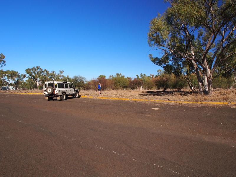
2013 Trip Blog,
June
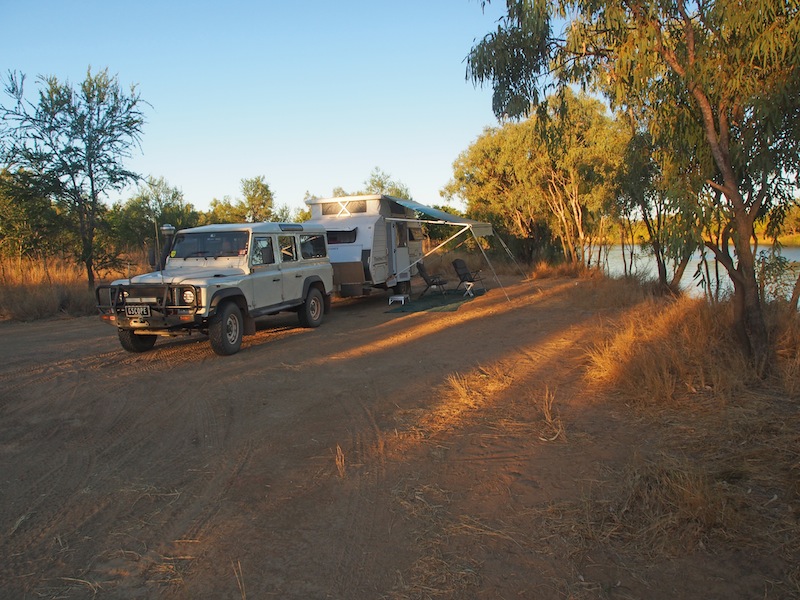
Saturday 1st June, Karumba, QLD
 All the sunshine finally caught up with us today and made us extremely lazy. The most activity
we did this morning was have a shower and do the washing (6 items). But mustering all our
energy we headed back to Karumba Point about 1100 to sit on the rocks and have a wander
along the shore before lunch.
All the sunshine finally caught up with us today and made us extremely lazy. The most activity
we did this morning was have a shower and do the washing (6 items). But mustering all our
energy we headed back to Karumba Point about 1100 to sit on the rocks and have a wander
along the shore before lunch.
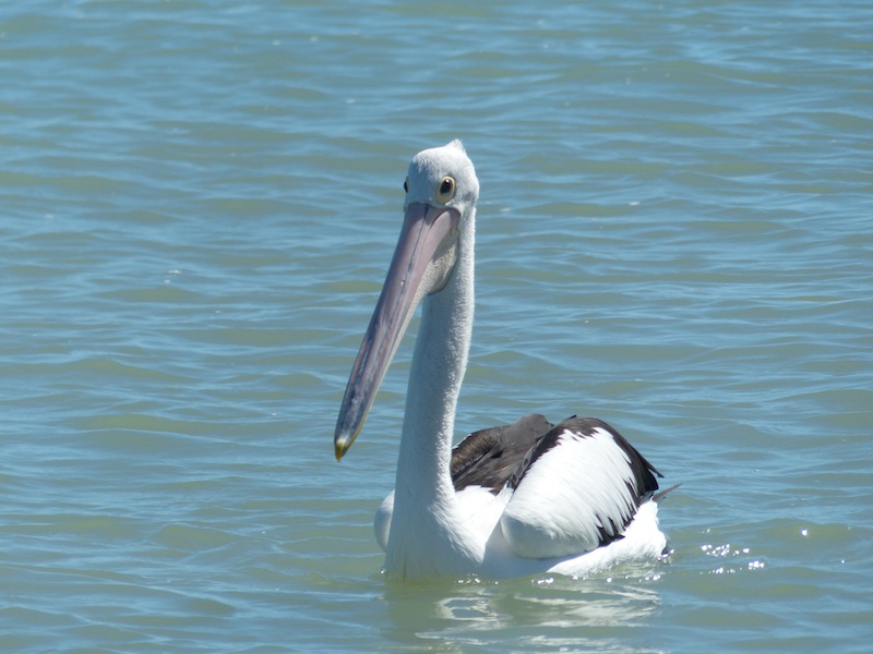
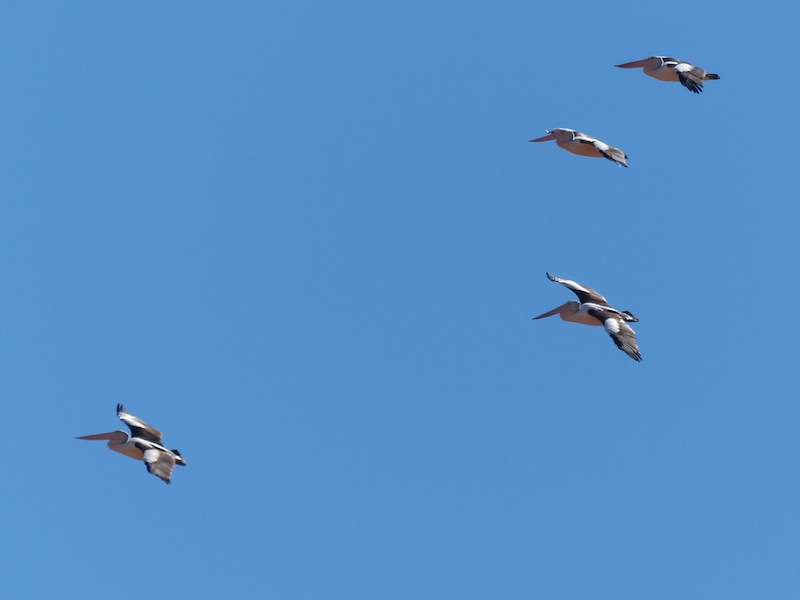
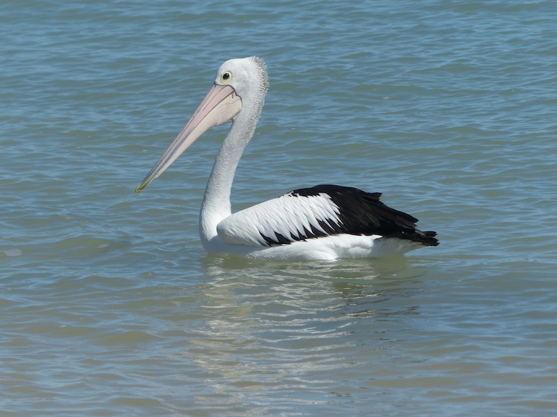 At the risk of being boring, I have included some more Pelican pics. The Pelicans come close
to shore and look amazing against the blue of the water.
At the risk of being boring, I have included some more Pelican pics. The Pelicans come close
to shore and look amazing against the blue of the water.
After lunch, yes more fish, we drove down to the Airport, a few hundred meters away. The gates were closed and with nothing much to photograph we headed back to camp.
You know you haven't got much to do when you spend 15 mins watching a bug hop from the table to the window.

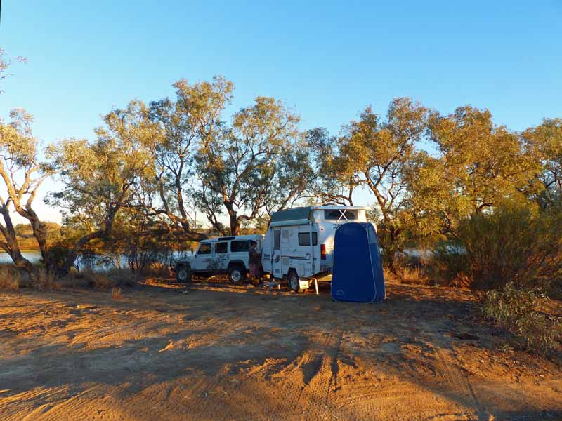
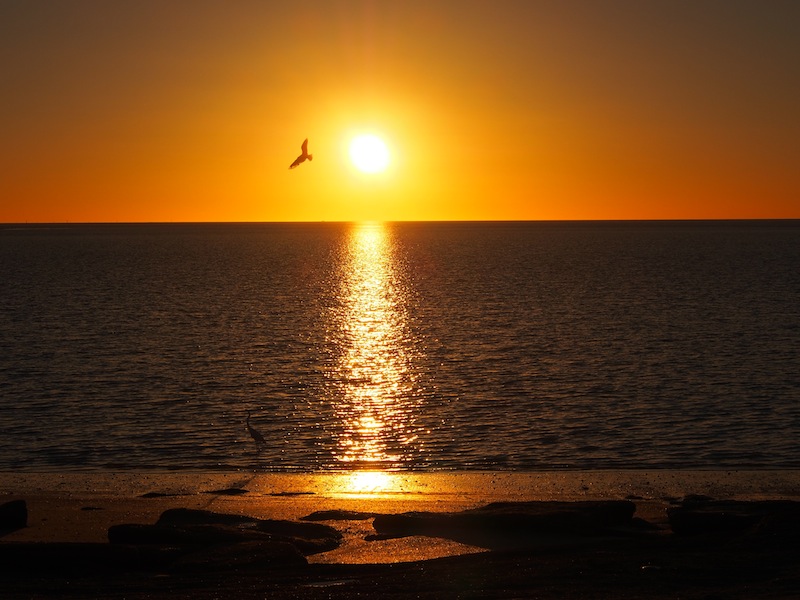
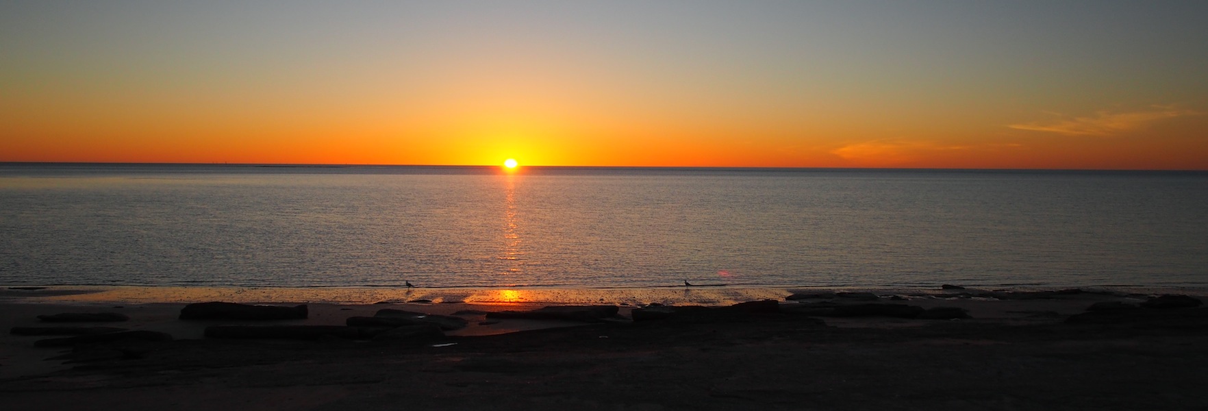
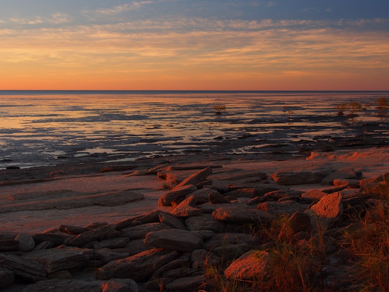
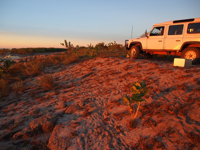
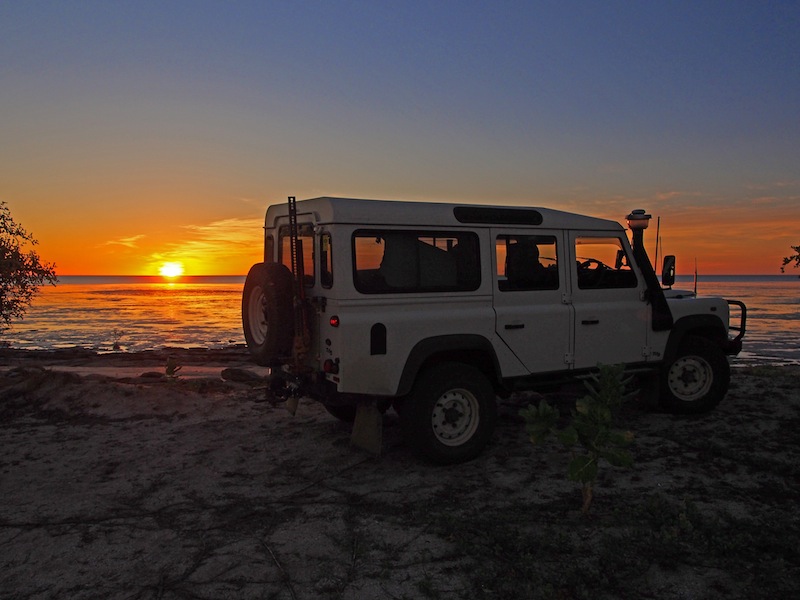
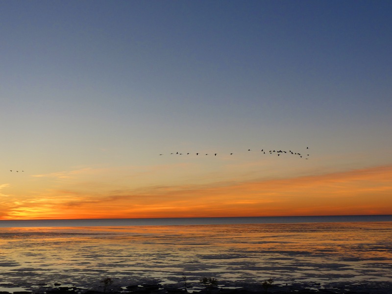
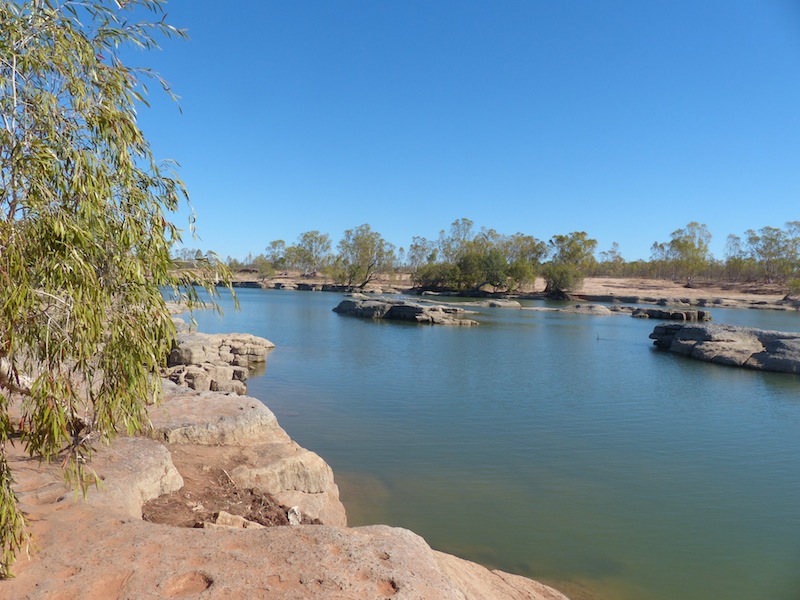
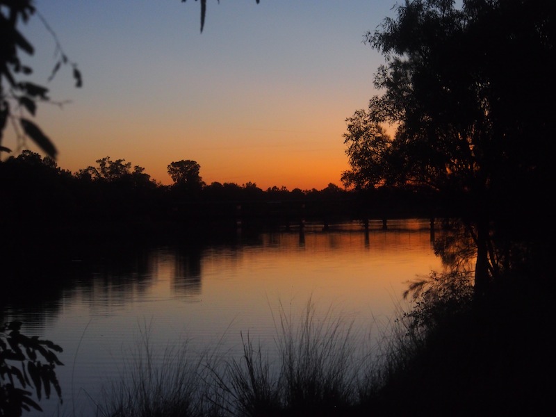
 Capturing the sunset at Karumba Point is a must so we headed around there and sat on the rocks
to wait. The water was very calm and with the tide on the way out the sand islands were now visible.
The Pelican was here again, swimming close to the shore. I've only seen the one Pelican so I'm not
sure if it's the same one every time. He was joined by a Great Egret which waded in the shallows
whilst the Pelican swam only a foot or two away, neither seemed bothered by the other. The Pelican
had swum off and the Egret was wading through the shallows when it was attacked by two Seagulls
who had been walking along the shore. The seagulls kept swooping, diving and squawking but the
Egret weathered the attack and wandered back down to where the Pelican was. Very interesting.
Capturing the sunset at Karumba Point is a must so we headed around there and sat on the rocks
to wait. The water was very calm and with the tide on the way out the sand islands were now visible.
The Pelican was here again, swimming close to the shore. I've only seen the one Pelican so I'm not
sure if it's the same one every time. He was joined by a Great Egret which waded in the shallows
whilst the Pelican swam only a foot or two away, neither seemed bothered by the other. The Pelican
had swum off and the Egret was wading through the shallows when it was attacked by two Seagulls
who had been walking along the shore. The seagulls kept swooping, diving and squawking but the
Egret weathered the attack and wandered back down to where the Pelican was. Very interesting.
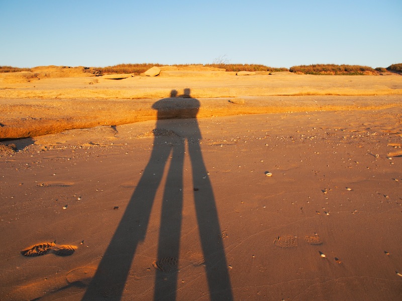
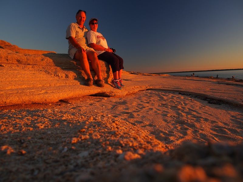 It was a beautiful time of day as we sat on the rocks and waited for the sun to set. There were four
Aboriginal people on the shore fishing, with no rod, just a hand line tossed in and wound around a
stick on the shore. Within 10 minutes the girl was pulling in the line with a large fish
on the end. No gloves on, she just yanked in the line with her bare hands and it was a pretty big fish.
Earlier in the day we had looked at all the gear the fisherman had with them; large rods, big nets, things
to put their rods in on the shore, all the gear we thought we would have to get. Now, after watching how
this Aboriginal girl did it, with her hand line and forked stick, Don might feel a little bit more confident.
Another case of getting back to basics and simplifying the process. Plus it looked like a lot more fun.
It was a beautiful time of day as we sat on the rocks and waited for the sun to set. There were four
Aboriginal people on the shore fishing, with no rod, just a hand line tossed in and wound around a
stick on the shore. Within 10 minutes the girl was pulling in the line with a large fish
on the end. No gloves on, she just yanked in the line with her bare hands and it was a pretty big fish.
Earlier in the day we had looked at all the gear the fisherman had with them; large rods, big nets, things
to put their rods in on the shore, all the gear we thought we would have to get. Now, after watching how
this Aboriginal girl did it, with her hand line and forked stick, Don might feel a little bit more confident.
Another case of getting back to basics and simplifying the process. Plus it looked like a lot more fun.
Sunday 2nd June, Karumba, QLD
 We drove around to Karumba Point about 1000 this morning and found cars everywhere, then we
realised that the Sunday Market was on. I was puzzled that Don seemed so excited to go and look
at the Market. Then he explained………it wasn't the Market he wanted to look at; he figured if everyone
was at the Market there might not be anyone down on the shore fishing.
mmmmm …… sounded logical.
We drove around to Karumba Point about 1000 this morning and found cars everywhere, then we
realised that the Sunday Market was on. I was puzzled that Don seemed so excited to go and look
at the Market. Then he explained………it wasn't the Market he wanted to look at; he figured if everyone
was at the Market there might not be anyone down on the shore fishing.
mmmmm …… sounded logical.We were lucky enough to find a park right above the shoreline where he wanted to fish. With great enthusiasm he got his rod from the back of the car, then seeing a guy selling fishing gear he wandered over and bought 'just the right hook' for catching a fish from this spot. He was full of confidence as he made his way down to the shoreline. As I watched him I wondered whether a bread & butter pudding would make up for his disappointment if he didn't catch anything. He was so keen.
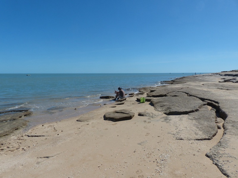 I wandered down and sat on the rock behind him with camera in hand, ready to catch the moment when
he landed his first fish. I was on croc watch. With a fresh prawn on his hook he threw in his line, gave it
a few minutes then wound it in…….no prawn, just the shell. After a short discussion on which way to put
the hook through the prawn, Don cast again. Beautiful cast…..but…..almost in slow motion, he watched
as the prawn flew from the end of the hook and landed about 50ft in front of the line.
I wandered down and sat on the rock behind him with camera in hand, ready to catch the moment when
he landed his first fish. I was on croc watch. With a fresh prawn on his hook he threw in his line, gave it
a few minutes then wound it in…….no prawn, just the shell. After a short discussion on which way to put
the hook through the prawn, Don cast again. Beautiful cast…..but…..almost in slow motion, he watched
as the prawn flew from the end of the hook and landed about 50ft in front of the line.
Undeterred and with only one prawn left, he baited up with a 'plastic thingy', a rubbery fish thing. This didn't seem to have any effect, as he must have waited for at least 5 mins for a bite. So with a determined glance at his last prawn, he threaded it carefully onto the hook, anchored his feet in the wet sand and cast. To add insult to injury, a very large Barramundi leapt out of the water twice, about 30ft directly in front of him. Don was so anxious to cast where he had seen the Barramundi jump that he put a mammoth effort into his cast………..alas, so much of a mammoth effort that his rod went flying into the water as well, luckily not far from shore. With a quick dash in and a quick dash out and a quick glance around to see if anyone had been watching, he resumed his stance and cast again. This time with not so much gusto. "You cast right where that big fish jumped." I said encouragingly.
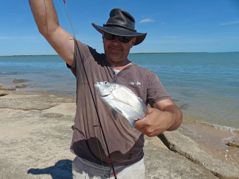
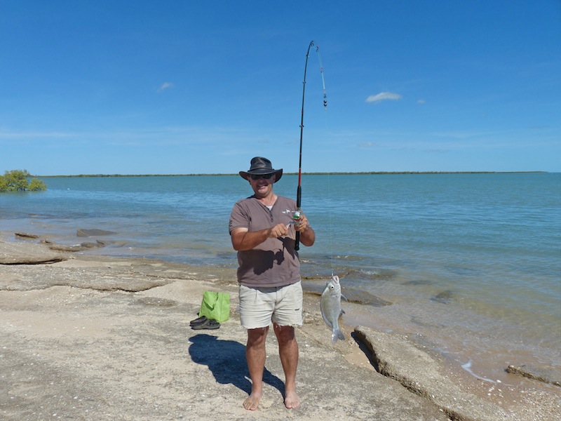 Crossing my fingers, I walked back up to my rock and glanced back at Don as I sat down. I couldn't believe
my eyes……….there was strain on the rod. Was he snagged on something? "Have you got a snag?" I yelled,
but my voice was drowned out by Don's excited shout…."I've got one…I've got one." That fish was out of the
water and on the sand before I could even get up off the rock. Don was excited…I was excited…and I'm sure
everyone within earshot was excited as he proudly held his catch aloft, not quite believing there was an actual
fish on the end of his rod. I clicked away madly but didn't have a lot of time, as the fisherman in Don kicked in.
Like a Pro, he had the hook out of its mouth and the fish in a plastic bag full of sea-water before he had time to
get a really good look at it.
Crossing my fingers, I walked back up to my rock and glanced back at Don as I sat down. I couldn't believe
my eyes……….there was strain on the rod. Was he snagged on something? "Have you got a snag?" I yelled,
but my voice was drowned out by Don's excited shout…."I've got one…I've got one." That fish was out of the
water and on the sand before I could even get up off the rock. Don was excited…I was excited…and I'm sure
everyone within earshot was excited as he proudly held his catch aloft, not quite believing there was an actual
fish on the end of his rod. I clicked away madly but didn't have a lot of time, as the fisherman in Don kicked in.
Like a Pro, he had the hook out of its mouth and the fish in a plastic bag full of sea-water before he had time to
get a really good look at it.
 "Do you think it's under-size? What sort do you think it is?" A couple walking along the shore came up and
asked him if he had just caught a fish. "My first" he replied proudly. I watched him packing his stuff up, rod
under his arm and fish tightly clenched in the other and the smile still on his face.
"Do you think it's under-size? What sort do you think it is?" A couple walking along the shore came up and
asked him if he had just caught a fish. "My first" he replied proudly. I watched him packing his stuff up, rod
under his arm and fish tightly clenched in the other and the smile still on his face.
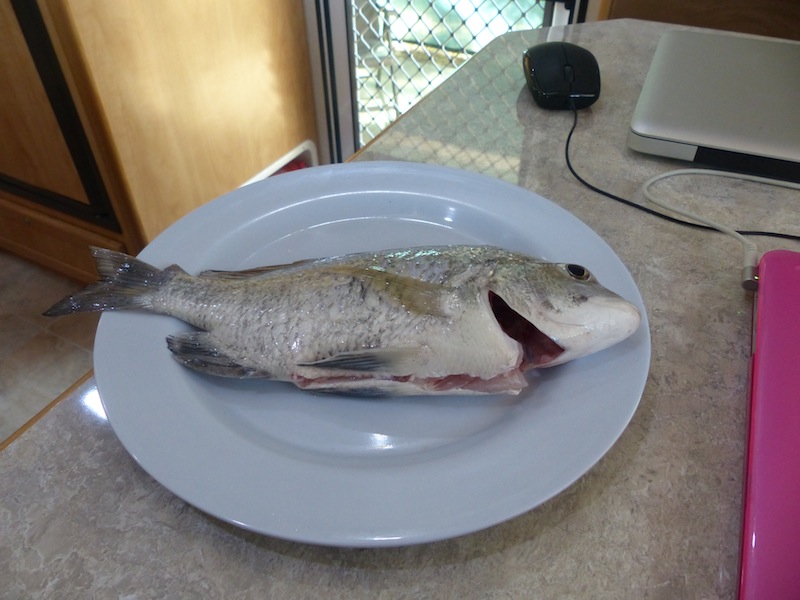
It turned out to be a 28cm Bream.
Thank you Fish Angel.
Monday 3rd June, Karumba, QLD
We had only intended to stay in Karumba two nights but through default ended up being here for five and in hindsight we are glad we made this decision. Two nights would not have been enough time as we have enjoyed it here a lot.
 We had lunch at the local Bakery today and found it excellent. Don loves custard tarts but never buys
them as the pastry is always soggy. Today he was very happy to finally find a custard tart with nice crisp
pastry and firm custard. The Bakery is up for sale, so perhaps next time we come through here it may be
different. After lunch we headed down to the water again at Karumba Point and went for a long stroll along
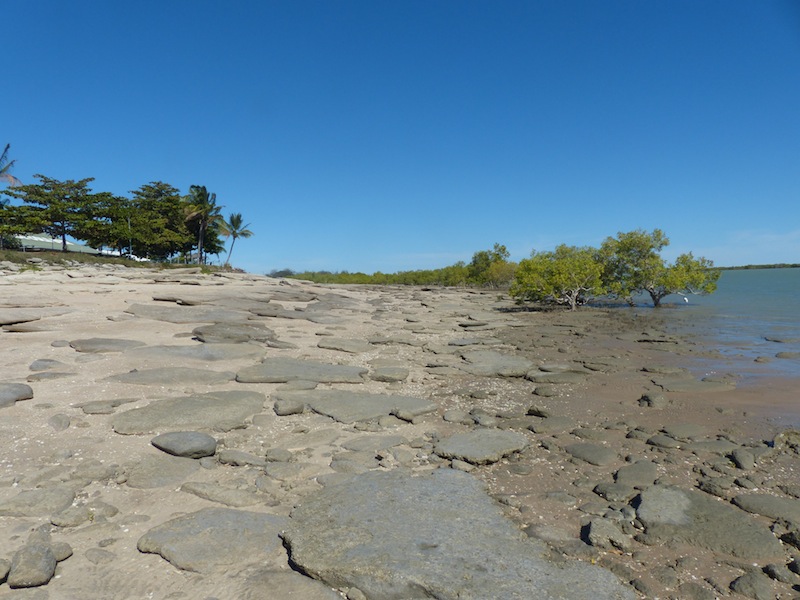
the beach. The tide was out further than we had seen it before, leaving the large shale rocks exposed all the
way into the water. The fish Don caught would have been swimming amongst these very rocks yesterday.
We had lunch at the local Bakery today and found it excellent. Don loves custard tarts but never buys
them as the pastry is always soggy. Today he was very happy to finally find a custard tart with nice crisp
pastry and firm custard. The Bakery is up for sale, so perhaps next time we come through here it may be
different. After lunch we headed down to the water again at Karumba Point and went for a long stroll along
the beach. The tide was out further than we had seen it before, leaving the large shale rocks exposed all the
way into the water. The fish Don caught would have been swimming amongst these very rocks yesterday.
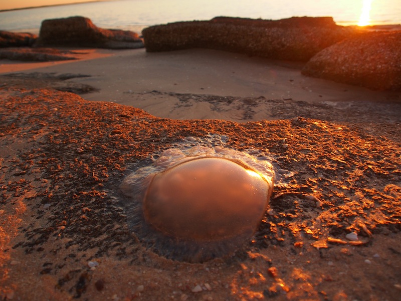
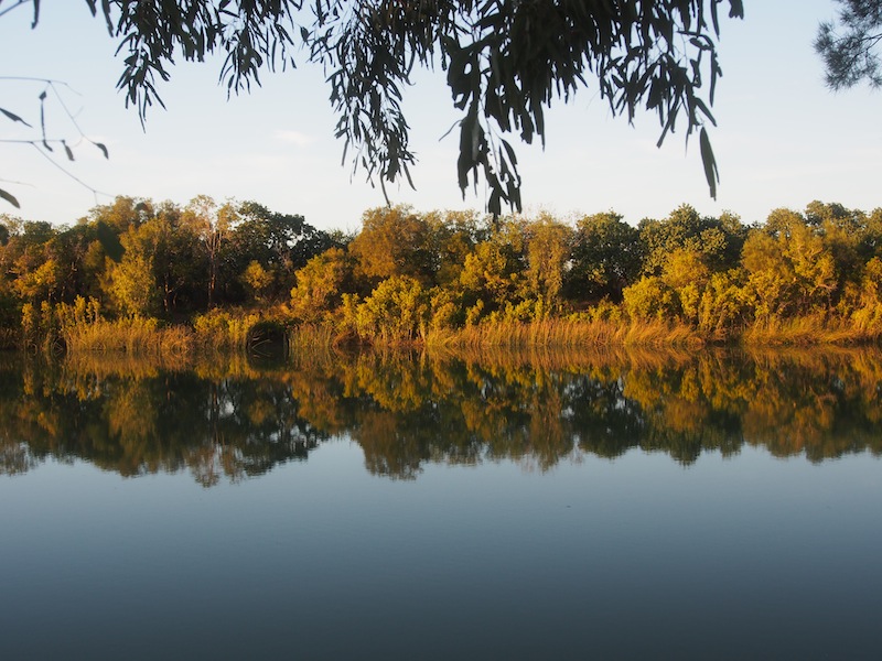
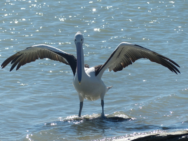 We wandered along the shore looking at all the shells and interesting sea life amongst the rocks. It's amazing
just how many shells there are and how quickly they become encrusted into the sand and form the shale. Once
these shells are embedded there is no dislodging them. The lone Pelican was back again today swimming in the
shallows. Yes, I couldn't resist taking some more photos of it. The shimmer of the sun on the water with the Pelican
highlighted against the blue, his majestic head held high as he glided along just looks so good in the lens.
We wandered along the shore looking at all the shells and interesting sea life amongst the rocks. It's amazing
just how many shells there are and how quickly they become encrusted into the sand and form the shale. Once
these shells are embedded there is no dislodging them. The lone Pelican was back again today swimming in the
shallows. Yes, I couldn't resist taking some more photos of it. The shimmer of the sun on the water with the Pelican
highlighted against the blue, his majestic head held high as he glided along just looks so good in the lens.
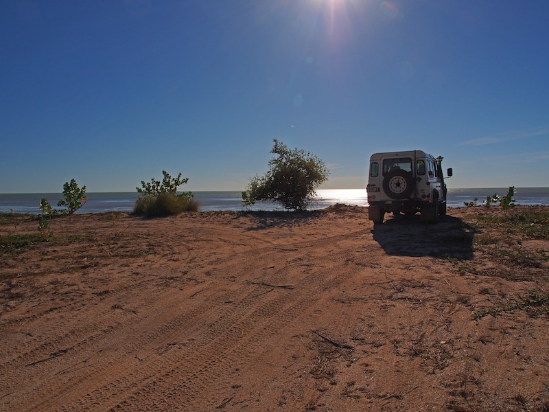
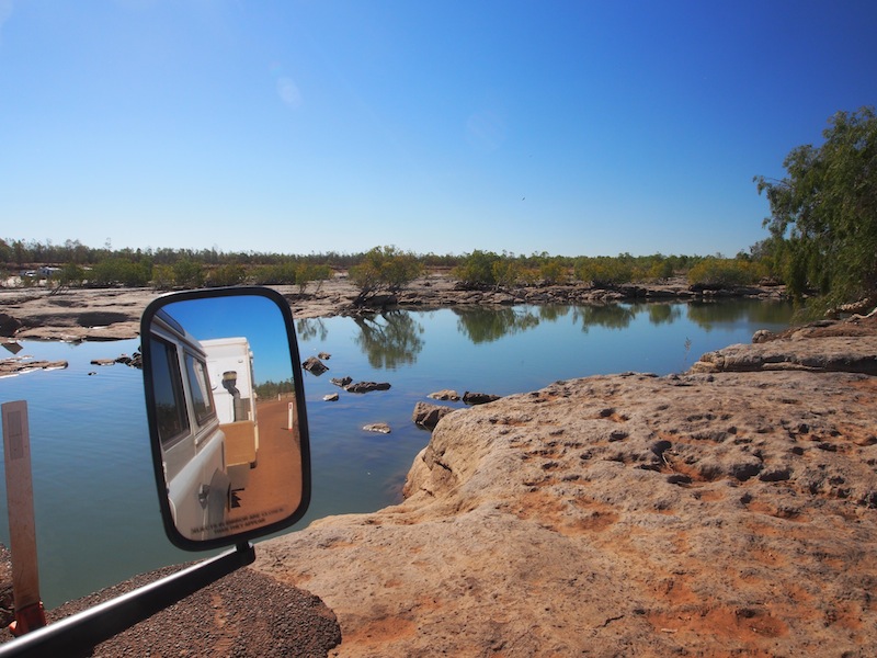
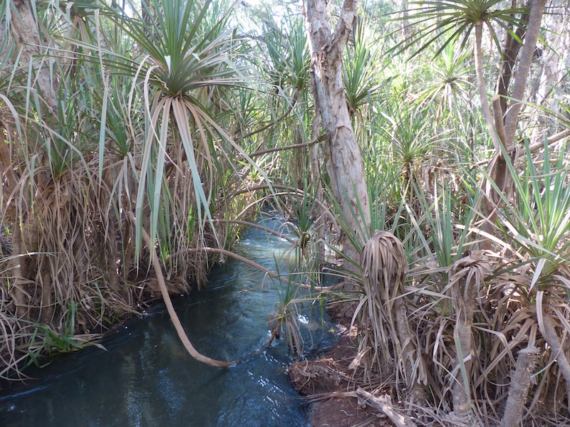
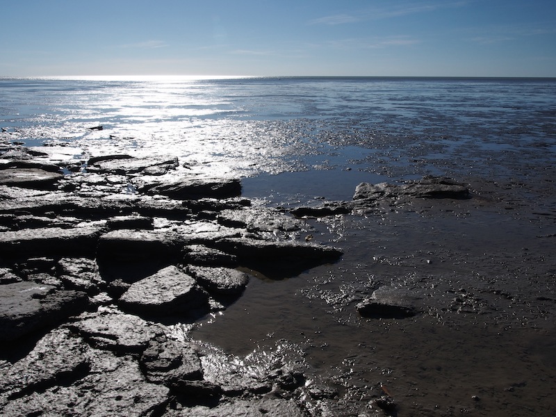 We left Karumba Point and took a track leading in through the swamp……'just to see where it went'. It wound down
behind the Airport and up onto a sandbank over-looking the water. How magic…….we wished we had of discovered
this earlier. The tide was a long way out with large rocks on the shore and new mangrove shrubs sprouting here and
there at the water's edge. There were quite a few birds wading about in the mud flats. Don noticed some crocodile tracks
just over the other side of the sandbank from where we were parked and as there was a bit of a wind today, every time I
heard rustling I got ready to run. We explored the shore a bit then headed back to camp.
We left Karumba Point and took a track leading in through the swamp……'just to see where it went'. It wound down
behind the Airport and up onto a sandbank over-looking the water. How magic…….we wished we had of discovered
this earlier. The tide was a long way out with large rocks on the shore and new mangrove shrubs sprouting here and
there at the water's edge. There were quite a few birds wading about in the mud flats. Don noticed some crocodile tracks
just over the other side of the sandbank from where we were parked and as there was a bit of a wind today, every time I
heard rustling I got ready to run. We explored the shore a bit then headed back to camp.
Tuesday 4th June, Bush Camp, Albert River, QLD (Few kms East of Burketown)
Slow start today as Don discovered his old boss from 20 yrs ago was parked right alongside us. He didn't realise until we were actually hitched up and ready to leave and the guy came over to wish us a safe trip. We headed out the gate about 9.45, stopping off at the Bakery before leaving Karumba to get something to take with us for lunch. We decided to have a coffee whilst we were there and Don purchased a custard tart to have with it. The owner brought the coffee out and recognised Don. She looked down at the custard tart, grabbed the plate and said, "That one won't do. I know how much you love custard tarts" and whipped the plate away, returning with one that had a lot more custard in it. What a nice thing to do.
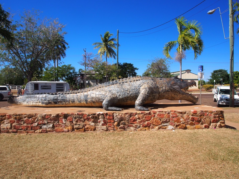
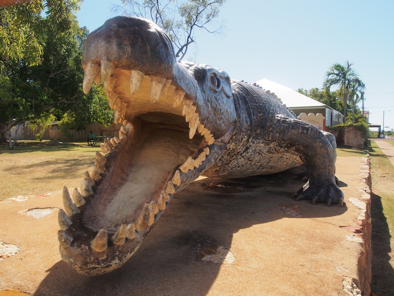 We left Karumba and headed back to Normanton, arriving there about 1115. We took a bit of time to have
a look around but decided to keep on going. The replica of the largest authenticated crocodile ever shot was
interesting being actual size of 8.63m. I think I prefer to see them like this rather than up close in real life. We left Normanton and turned
South but had only gone a short distance when we decided to go West instead and head straight for Burketown
on the Savannah Way.
We left Karumba and headed back to Normanton, arriving there about 1115. We took a bit of time to have
a look around but decided to keep on going. The replica of the largest authenticated crocodile ever shot was
interesting being actual size of 8.63m. I think I prefer to see them like this rather than up close in real life. We left Normanton and turned
South but had only gone a short distance when we decided to go West instead and head straight for Burketown
on the Savannah Way.
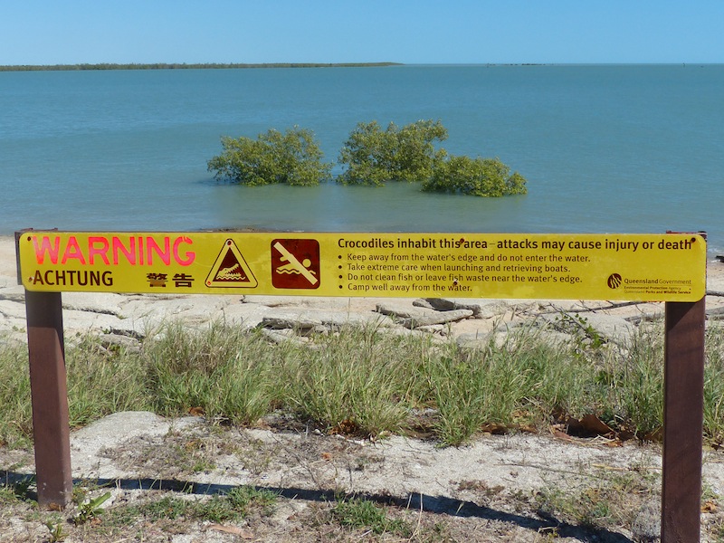
 crossing the Bynoe River then the Flinders River (of which the Bynoe merges with). With
crocodile warning signs at the crossing we kept our meanderings to the bridge.
crossing the Bynoe River then the Flinders River (of which the Bynoe merges with). With
crocodile warning signs at the crossing we kept our meanderings to the bridge.
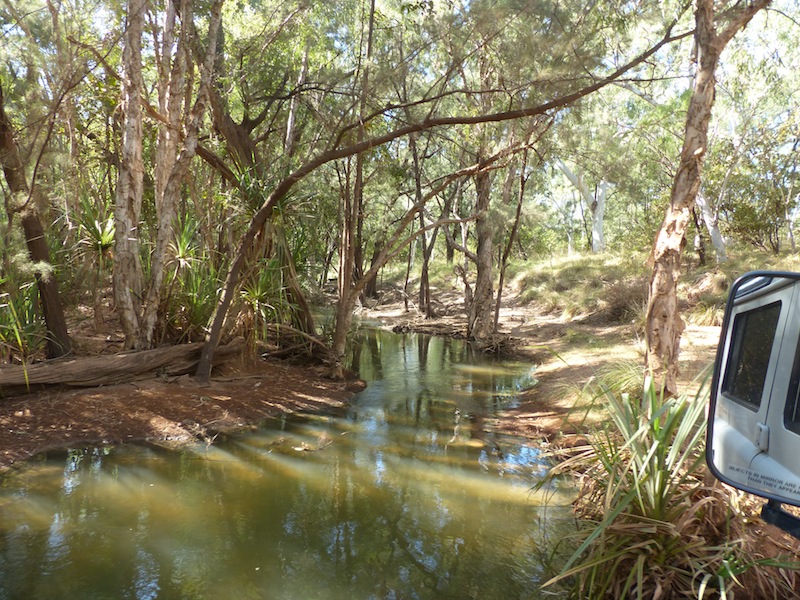
Wednesday 5th June, Camooweal, QLD
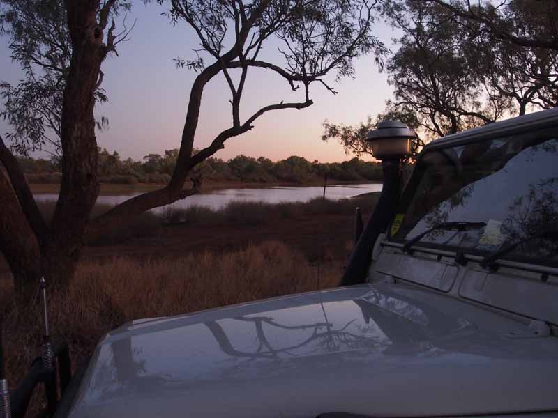
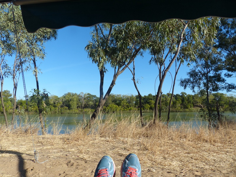
 What a beautiful morning. Such a difference to wake up to complete silence except for the chirping
of the birds. We lay watching the sun rise; gradually the darkness unfolded and the reflections on the
water began to come into focus and the colours sharpen. The water was like a mirror with not a ripple
disturbing the surface. Just for a short time, you could barely tell where the river bank ended and where
the water began, it was a mirror image. Slowly a gentle ripple broke the surface disturbing the illusion.
The bird activity gathered momentum and the ants appeared again along the same trails as yesterday,
their numbers unaffected by the Apostle Birds who had feasted on them the previous evening.
What a beautiful morning. Such a difference to wake up to complete silence except for the chirping
of the birds. We lay watching the sun rise; gradually the darkness unfolded and the reflections on the
water began to come into focus and the colours sharpen. The water was like a mirror with not a ripple
disturbing the surface. Just for a short time, you could barely tell where the river bank ended and where
the water began, it was a mirror image. Slowly a gentle ripple broke the surface disturbing the illusion.
The bird activity gathered momentum and the ants appeared again along the same trails as yesterday,
their numbers unaffected by the Apostle Birds who had feasted on them the previous evening.
 We packed up reluctantly and headed for Burketown where we fuelled up then took a look around the town;
five minutes later we were back at the Fuel Depot. Burketown is not very large. We took a few photos then
stopped at the Bakery to get some 'morning tea', it was only through fast-talking that I managed to avoid a trip
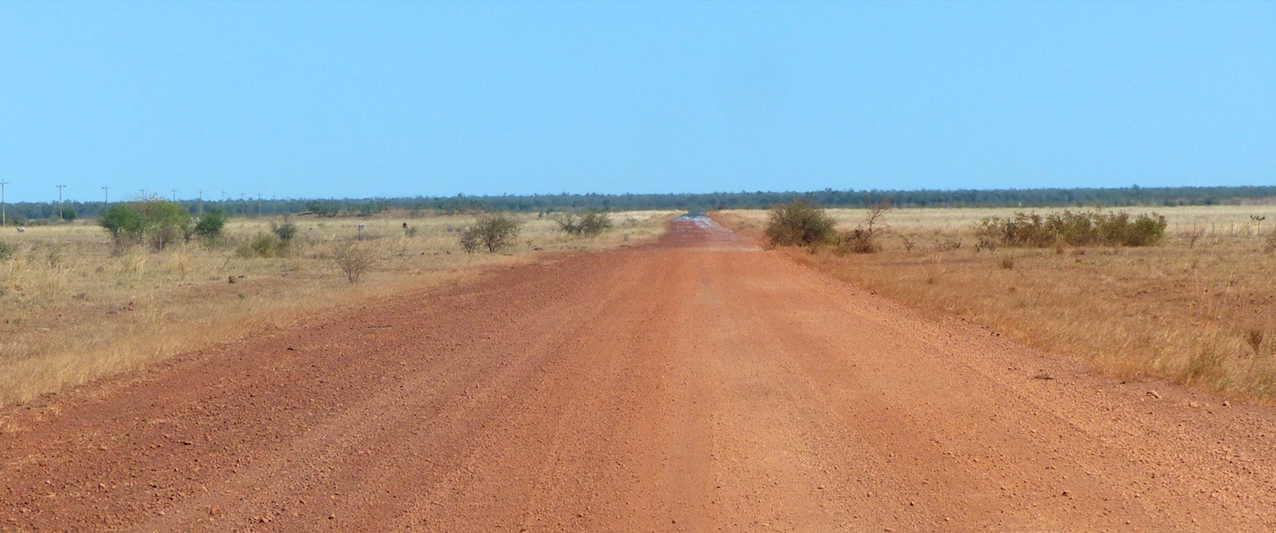
to the Tip which was visible as we left Burketown. We headed W on the Savannah Way for 37kms before turning
SW on a dirt road to Gregory Downs. There was a lot of road-work being carried out along this route, some sealing
in progress but still wet.
We packed up reluctantly and headed for Burketown where we fuelled up then took a look around the town;
five minutes later we were back at the Fuel Depot. Burketown is not very large. We took a few photos then
stopped at the Bakery to get some 'morning tea', it was only through fast-talking that I managed to avoid a trip
to the Tip which was visible as we left Burketown. We headed W on the Savannah Way for 37kms before turning
SW on a dirt road to Gregory Downs. There was a lot of road-work being carried out along this route, some sealing
in progress but still wet. 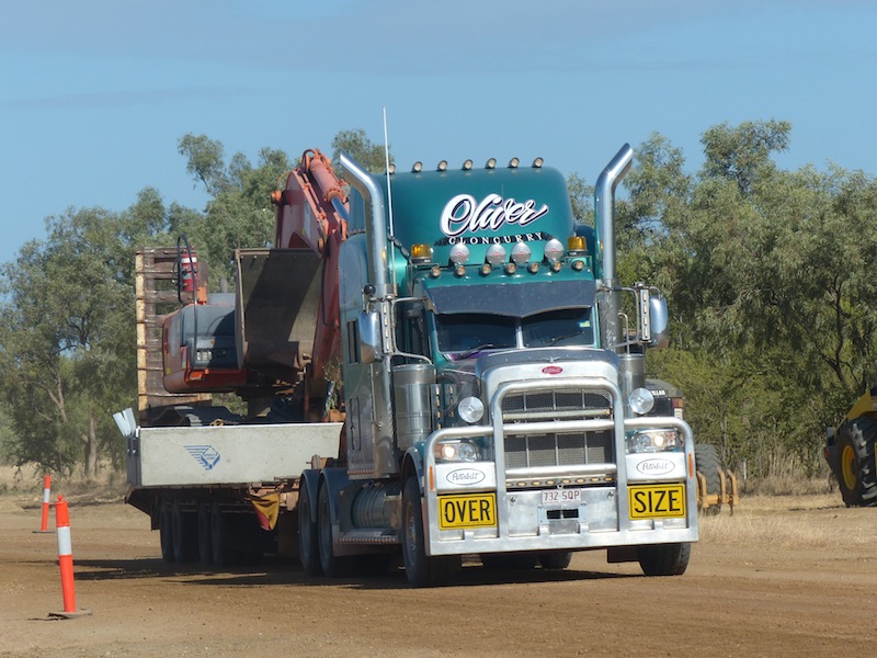
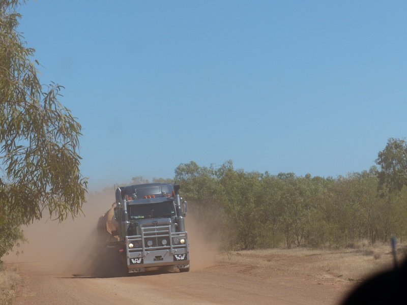
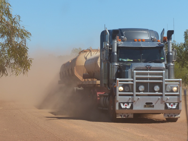
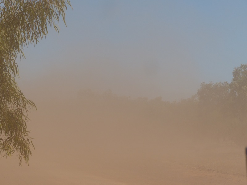
 The dust was incredible as the large 3 truck road-trains delivering the crushed rock came by
constantly. Most of these drivers were courteous as the road conditions were not ideal but there was one ignorant DH
who bored down into a gully at full speed, onto a narrow bridge and up through the loose dirt on the side honking his
horn as he went. Three other trucks went by at the same time, waved, smiled and managed to pass without showering
stones, dust and other fragments all over us. I hope that ignorant driver bites is tongue when he's eating his dinner.
The dust was incredible as the large 3 truck road-trains delivering the crushed rock came by
constantly. Most of these drivers were courteous as the road conditions were not ideal but there was one ignorant DH
who bored down into a gully at full speed, onto a narrow bridge and up through the loose dirt on the side honking his
horn as he went. Three other trucks went by at the same time, waved, smiled and managed to pass without showering
stones, dust and other fragments all over us. I hope that ignorant driver bites is tongue when he's eating his dinner.
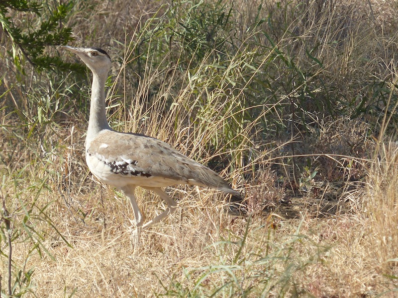
 Not much wildlife at all along this route, only some Brolgas and some Bustards, both of which we never tire of seeing.
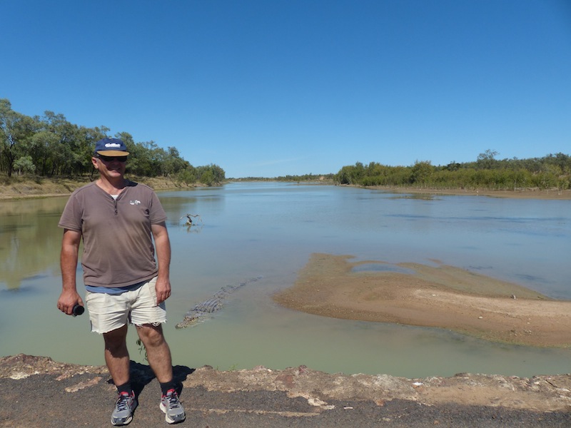
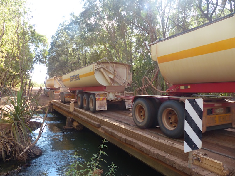
We came to Beames Creek, a narrow section of road dipping down into a gully and were just amazed when we crossed
over the wooden bridge and saw a wonderful oasis. There was room to pull over on the other side of the creek and we
spent about half an hour here. There was a small campsite available up the track a bit but the noise and dust from the
passing trucks would make it very unpleasant until the road-works are completed.
Not much wildlife at all along this route, only some Brolgas and some Bustards, both of which we never tire of seeing.
We came to Beames Creek, a narrow section of road dipping down into a gully and were just amazed when we crossed
over the wooden bridge and saw a wonderful oasis. There was room to pull over on the other side of the creek and we
spent about half an hour here. There was a small campsite available up the track a bit but the noise and dust from the
passing trucks would make it very unpleasant until the road-works are completed.
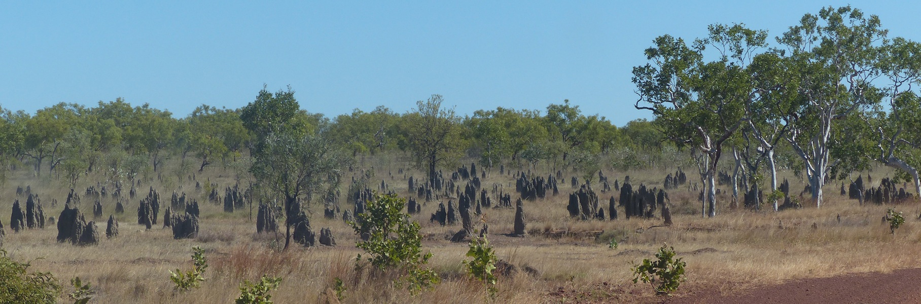
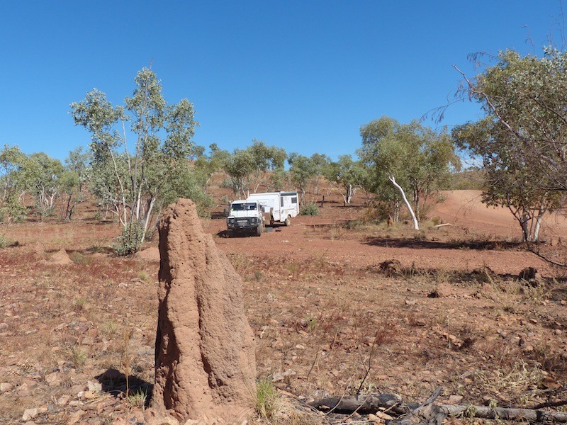
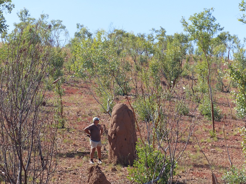
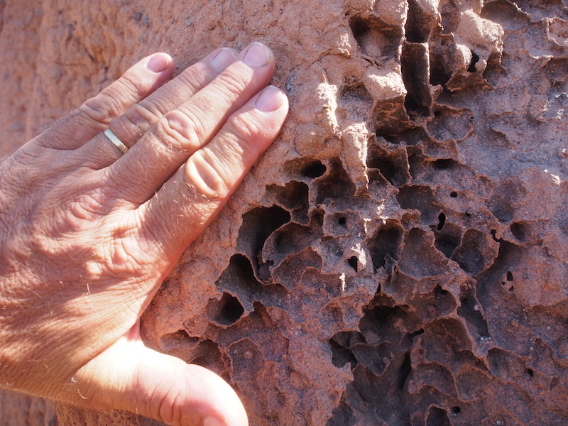
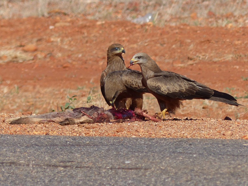
We pulled into Gregory Downs just on Noon. There is very little here except for the Pub, which is a rather uninviting place on the outside and not a lot going for it on the inside as far as personality and service goes but we may have caught them on a bad day. We had a quick lunch here then pushed on South, still undecided as to whether to go to Boodjamulla NP or not. The only high-light on this leg were some Wedged-tail Eagles we saw claiming a kangaroo carcass. The road was very rough with corrugations and bull dust. The ant hills were numerous and very large. It was quite interesting to see the different colours of the soil in the ant-hills, not only in different areas but within a short distance.
 We hadn't seen another vehicle on this road other than the road-trains so it was a bit of a surprise when rounding a corner we
saw a trailer blocking the left side of the track and a guy kneeling down beside it. As we neared, it was apparent that he had broken
the axle U Bolts which had caused the wheel to jolt backwards, jamming in the mudguard and tearing the hub off. He was a young,
fit guy and was not too perturbed as his mate had gone off to Mt. Isa (about 2.5 hrs away) to get some parts. We offered whatever help
we could and called his mate on our satellite phone (no other service out here). Being reasonably comfortable that he was OK, we
headed off and promised to keep a look-out for his mate.
We hadn't seen another vehicle on this road other than the road-trains so it was a bit of a surprise when rounding a corner we
saw a trailer blocking the left side of the track and a guy kneeling down beside it. As we neared, it was apparent that he had broken
the axle U Bolts which had caused the wheel to jolt backwards, jamming in the mudguard and tearing the hub off. He was a young,
fit guy and was not too perturbed as his mate had gone off to Mt. Isa (about 2.5 hrs away) to get some parts. We offered whatever help
we could and called his mate on our satellite phone (no other service out here). Being reasonably comfortable that he was OK, we
headed off and promised to keep a look-out for his mate.
 We stopped for a coffee about half an hour later whilst we made the final decision about whether to turn E to the NP or continue on S
to Camooweal. It took the full half hour to chew through the Anzac Biscuit that Don had purchased at the Burketown Bakery but they
were yummy. Don was a bit annoyed he only got a couple. Still feeling a bit uneasy about the guy with the trailer, we decided to continue
on to Camooweal in the hope of making sure his mate was on the way. We were relieved to see him coming towards us about half an hour
later. After we passed the road to Mt. Isa, the road became worse. The only consolation was traveling through the Smiths Range, very similar
to the Flinders Ranges. The road conditions did not get any better all the way to Camooweal. The only respite was a couple of photo stops for
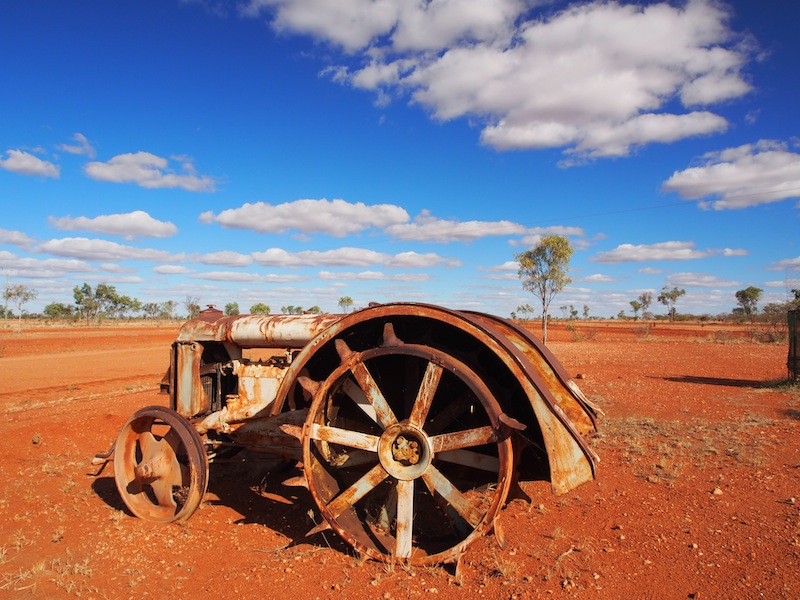
some wild goats and an old rusted car propping up a tree. We arrived in Camooweal quite tired and glad to be off the road for the day.
We stopped for a coffee about half an hour later whilst we made the final decision about whether to turn E to the NP or continue on S
to Camooweal. It took the full half hour to chew through the Anzac Biscuit that Don had purchased at the Burketown Bakery but they
were yummy. Don was a bit annoyed he only got a couple. Still feeling a bit uneasy about the guy with the trailer, we decided to continue
on to Camooweal in the hope of making sure his mate was on the way. We were relieved to see him coming towards us about half an hour
later. After we passed the road to Mt. Isa, the road became worse. The only consolation was traveling through the Smiths Range, very similar
to the Flinders Ranges. The road conditions did not get any better all the way to Camooweal. The only respite was a couple of photo stops for
some wild goats and an old rusted car propping up a tree. We arrived in Camooweal quite tired and glad to be off the road for the day.
Thursday 6th June, Mt. Isa, QLD
 We left later this morning than intended, as when we arrived in Camooweal yesterday afternoon we were
both too tired to do the blog. We finished it before heading off this morning, as it takes a bit of time and too
much to do two days together. We ended up parked on the side of the road just inside the town boundary
to upload it as there was no signal once outside the town area.
We left later this morning than intended, as when we arrived in Camooweal yesterday afternoon we were
both too tired to do the blog. We finished it before heading off this morning, as it takes a bit of time and too
much to do two days together. We ended up parked on the side of the road just inside the town boundary
to upload it as there was no signal once outside the town area.
 We finally got going around 1030 and headed East on the Barkly Highway. All the traffic that passed us
was heading West towards NT. Camooweal is situated just inside the border of NT/QLD. The Barkly Highway
is the only sealed road that links QLD with the NT so we were expecting to see a bit of traffic on this route. It was
a bit of a change from the amount of dirt we swallowed yesterday. We had been travelling about an hour when
a red 80 Series Toyota flew past heading East. It had only just passed us and was still on the RHS when the
surfboard on top of his vehicle took to wind surfing and flew off, breaking in two as it did so. It was obviously not
tied down well enough for the speed he was doing. We were quite lucky not to collect the surf board through the
windscreen. He jammed on his brakes and pulled over, we could smell his rubber for about a km. I must praise
Don for his driving, which was impeccable in the situation.
We finally got going around 1030 and headed East on the Barkly Highway. All the traffic that passed us
was heading West towards NT. Camooweal is situated just inside the border of NT/QLD. The Barkly Highway
is the only sealed road that links QLD with the NT so we were expecting to see a bit of traffic on this route. It was
a bit of a change from the amount of dirt we swallowed yesterday. We had been travelling about an hour when
a red 80 Series Toyota flew past heading East. It had only just passed us and was still on the RHS when the
surfboard on top of his vehicle took to wind surfing and flew off, breaking in two as it did so. It was obviously not
tied down well enough for the speed he was doing. We were quite lucky not to collect the surf board through the
windscreen. He jammed on his brakes and pulled over, we could smell his rubber for about a km. I must praise
Don for his driving, which was impeccable in the situation.
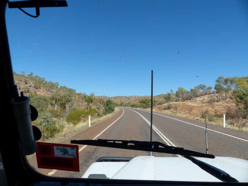
The road was fairly average in things of interest until we hit the Waggaboonyah Range which was really picturesque. It was about this time that the 80 Series flew past us again, not quite as fast and minus the surfboard on top, obviously laying back on the road somewhere in at least two pieces.

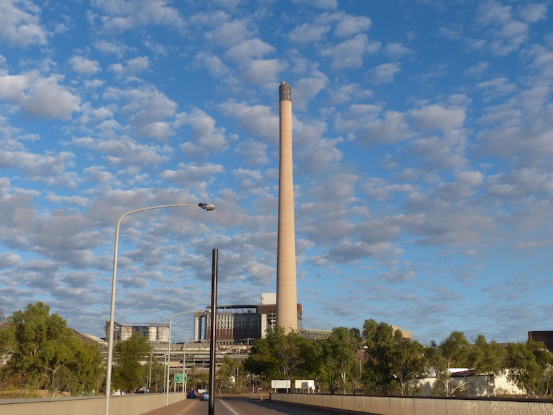
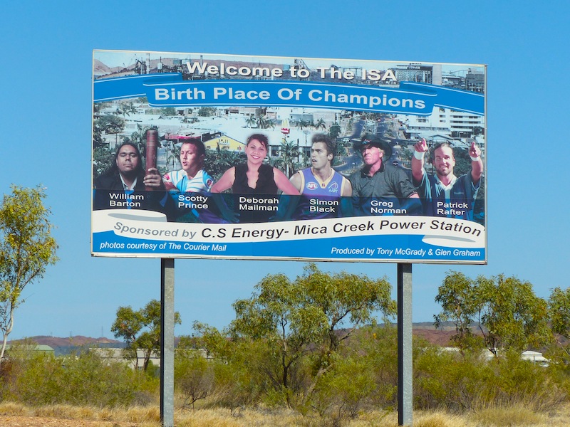 We arrived in Mt. Isa around 1230. We knew it was going to be large but after the small places we've been through it was
a bit of a shock to suddenly hit a City in the middle of the Outback. It is much more than a mining or outback town, It is huge,
with no less than 8 minerals being independently mined within the region. Mount Isa has certainly grown from its humble
beginnings as a 'mine in the middle of nowhere' to a thriving outback city. It celebrated 90 years of existence in February this
year; hard to believe they have been mining here for that long. We have a large, shaded campsite under the trees which will
be really good if we decide to stay here for awhile. There is a lot to see in this region.
We arrived in Mt. Isa around 1230. We knew it was going to be large but after the small places we've been through it was
a bit of a shock to suddenly hit a City in the middle of the Outback. It is much more than a mining or outback town, It is huge,
with no less than 8 minerals being independently mined within the region. Mount Isa has certainly grown from its humble
beginnings as a 'mine in the middle of nowhere' to a thriving outback city. It celebrated 90 years of existence in February this
year; hard to believe they have been mining here for that long. We have a large, shaded campsite under the trees which will
be really good if we decide to stay here for awhile. There is a lot to see in this region.
Friday 7th June, Mt. isa, QLD
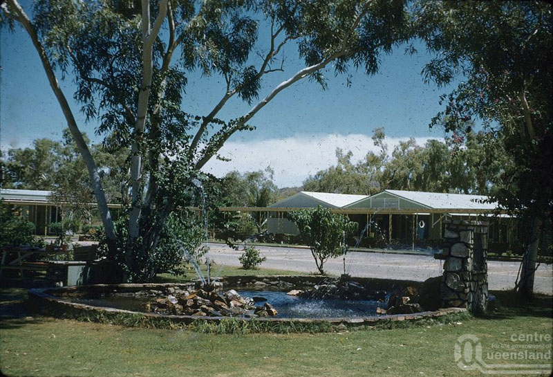
We've decided to stay in Mt. Isa for a week or two and take the opportunity to do a few things to the Landy and the Van whilst we are near the necessary shops. We were surprised to find there is very little choice in the way of shops in Mt. isa, despite its size and its declaration as a City but there seems to be at least one shop for whatever you need.I had made an appointment yesterday at a Hair Salon Don spotted whilst we were driving around looking for SuperCheap Autos and once again was lucky with the choice. When I went in there today, all the talk was about the headlines in the local paper announcing the closure of the Copper Mine as early as 2019; this has a lot of people very nervous about the future of Mt. Isa. I recall reading an article about people being extremely concerned, that with more and more horses on the street, how on earth were they going to manage all that horse-shit. Then the motor car was invented. I'm sure Mt. Isa will survive just fine.
We had a quick look around town today and had lunch at a very nice Cafe, I got my hair cut and Don got the parts he needed to grease the bearings on the Van, so not much time for anything else today, so no pics.
I will precede this next bit by reiterating what a private person Don is and how he shuns any sort of notoriety for himself. So, (looking on the funny side, sorry Don), there he was, minding his own business, blending in with the shelves, looking for some globes when a guy came up to him and said, "Landy?". "Yeah", said Don "do I have something on me that gave that away?" "No", said the guy "I've asked everyone else". With that he tells Don that he has just spent half an hour outside looking at his Landy. "You didn't answer the question on the head-lights" he said. Don looked at him amazed. "It's Don Incoll isn't it?" he asked. Don was too stunned to reply. "Yeah", he continued "I recognised the head-lights from the Landy Forum." Poor Donald, I'm afraid your anonymity has been compromised. Where are you going to hide now?
Saturday 8th June, Mt. Isa, QLD
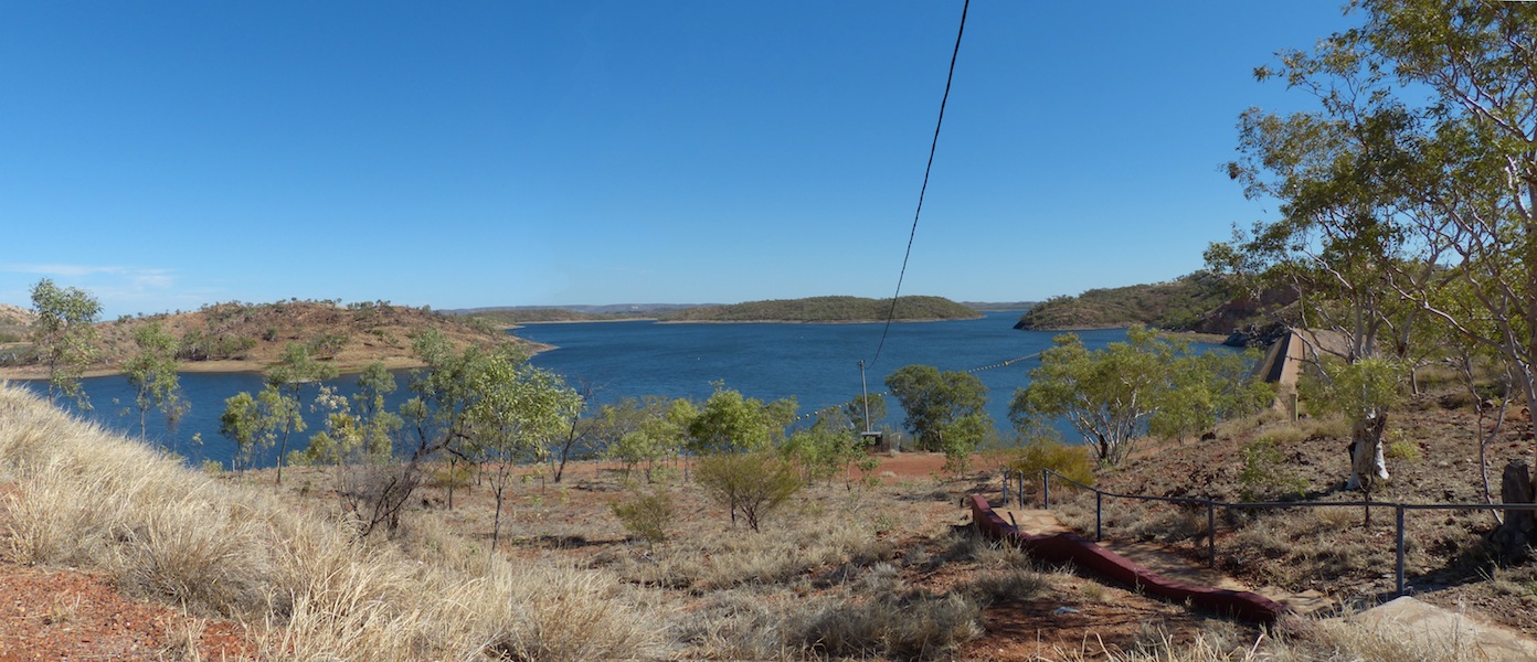 A beautiful day again today, just perfect for a picnic. We boiled up a couple of eggs, made up a salad,
packed the cooler bag and off we went to Lake Moondarra, an artificial lake on the Leichardt River, 20km
North of Mt. Isa. The lake provides water for the township as well as the mines. Originally built for Mt. Isa
Mines, started in 1956 and completed in 1958, it was at that time the largest water scheme in Australia
financed by private enterprise. Leichardt Dam officially became Lake Moondarra in 1961 after a local boy
won a competition to name the Lake. Moondarra is an Aboriginal name meaning…'plenty of rain also thunder'.
A beautiful day again today, just perfect for a picnic. We boiled up a couple of eggs, made up a salad,
packed the cooler bag and off we went to Lake Moondarra, an artificial lake on the Leichardt River, 20km
North of Mt. Isa. The lake provides water for the township as well as the mines. Originally built for Mt. Isa
Mines, started in 1956 and completed in 1958, it was at that time the largest water scheme in Australia
financed by private enterprise. Leichardt Dam officially became Lake Moondarra in 1961 after a local boy
won a competition to name the Lake. Moondarra is an Aboriginal name meaning…'plenty of rain also thunder'.
 It was a nice drive out to the Lake on a sealed road, through the Waggaboonyah Range. Arriving at the Lake
was a really pleasant surprise. Not only the amazingly beautiful bright blue of the water but the well maintained
grassy areas all along the shore. Gazebos were well spaced across this area with clean well designed picnic
tables inside on concrete floors. Free BBQs were provided as well as a Toilet / Shower Block. The picnic area
was quite extensive with ample room for many people to enjoy the facilities.
It was a nice drive out to the Lake on a sealed road, through the Waggaboonyah Range. Arriving at the Lake
was a really pleasant surprise. Not only the amazingly beautiful bright blue of the water but the well maintained
grassy areas all along the shore. Gazebos were well spaced across this area with clean well designed picnic
tables inside on concrete floors. Free BBQs were provided as well as a Toilet / Shower Block. The picnic area
was quite extensive with ample room for many people to enjoy the facilities.
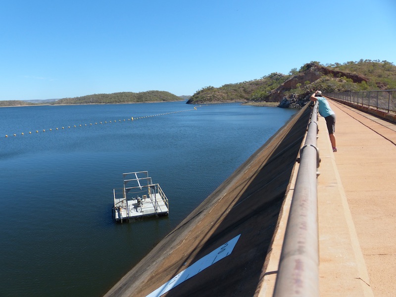
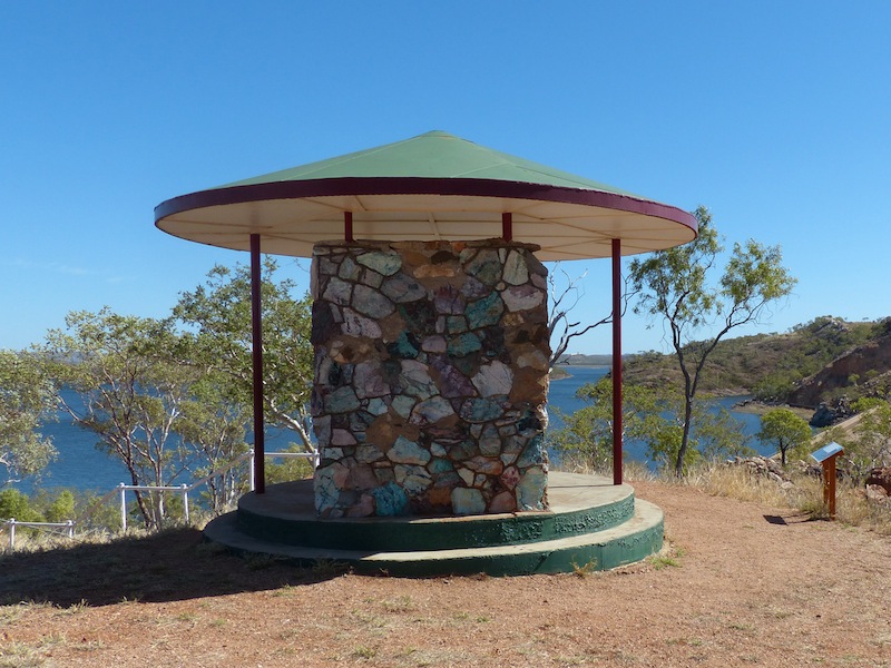 We headed up to the Lookout first and took a walk across the wall and back; plenty of photo opportunities here.
The surrounding scenery is beautiful with the colours of the Australian bush complimenting the bright blue of the
Lake. We walked up to the top Lookout, once again amazing views. The wall of the Gazebo here was made from
local stone,
We headed up to the Lookout first and took a walk across the wall and back; plenty of photo opportunities here.
The surrounding scenery is beautiful with the colours of the Australian bush complimenting the bright blue of the
Lake. We walked up to the top Lookout, once again amazing views. The wall of the Gazebo here was made from
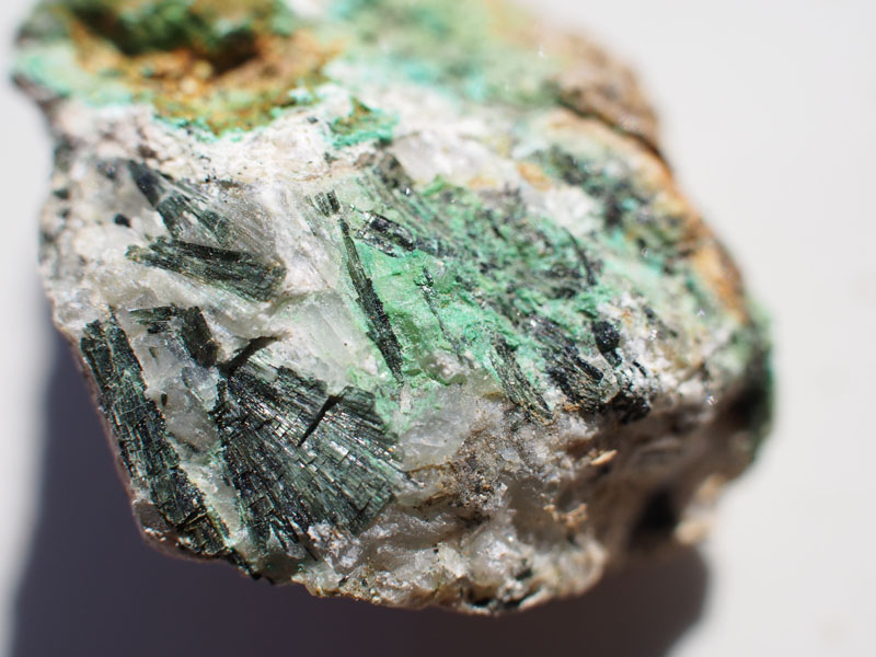
local stone,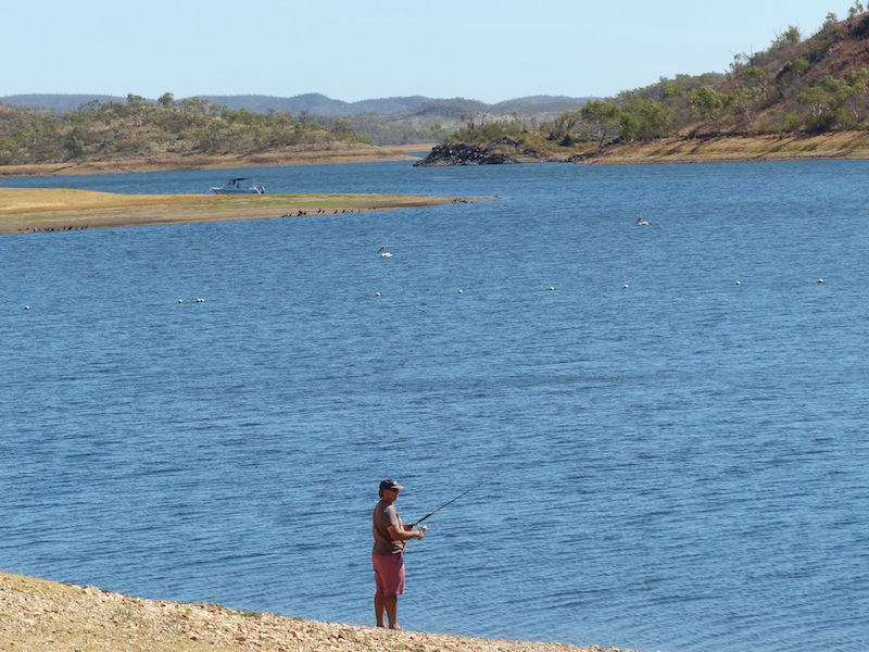 a lot of which were encrusted with Malachite, typically associated with copper deposits.
We headed back to the Landy and drove back down to the picnic area to have lunch. The Apostle Birds soon arrived to pick up the crumbs as well as a Yellow-throated Miner Bird. There were many birds along the shoreline, pelicans, egrets, herons, ducks and many others. Where these birds are there are usually fish, so Don threw his line in for about 10 mins but wasn't really in the mood for fishing so gave the Barramundi another day to enjoy the Lake.
 Heading back to Mt. Isa we noticed quite a few tracks going off into the scrub that we might explore over the next week.
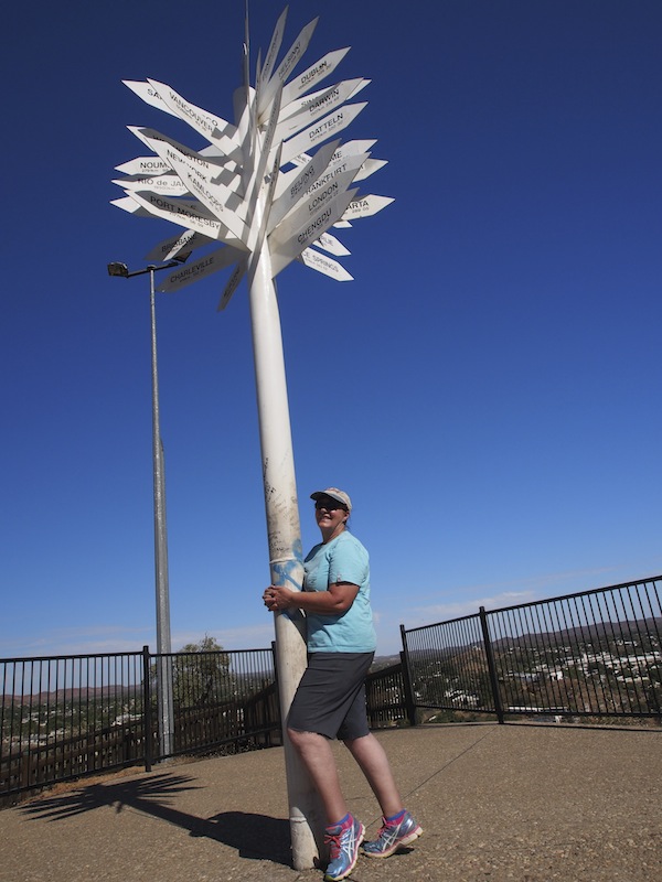
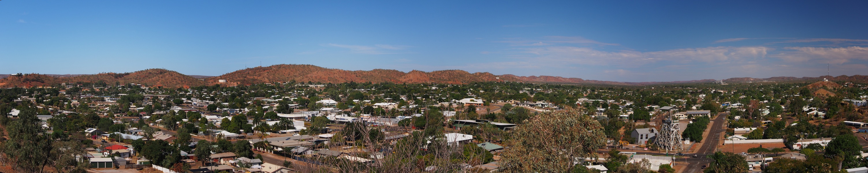
We arrived back in Mt. Isa and headed up to the local Lookout over-looking the town for a few more photos. It's hard to
imagine just how big Mt. Isa is but this Lookout provides a 360° view of the township and surrounding hills as well as the
Mine area, which are situated right within the town. The global sign-post at the top of the Lookout is a well-known landmark.
From this vantage point it is easier to understand the vastness of the town, with almost 23,000 residents and 9,000 dwellings
and growing. It is the largest and most populous city in Queensland's vast western interior and one of the largest centres in
Outback Australia. The Leichardt River divides the city into areas known as 'mineside' and 'townside'. Xstrata, the Power
Station and the Airport are on the 'mineside' with the majority of the city including the CBD and Base Hospital on the 'townside'.
Heading back to Mt. Isa we noticed quite a few tracks going off into the scrub that we might explore over the next week.
We arrived back in Mt. Isa and headed up to the local Lookout over-looking the town for a few more photos. It's hard to
imagine just how big Mt. Isa is but this Lookout provides a 360° view of the township and surrounding hills as well as the
Mine area, which are situated right within the town. The global sign-post at the top of the Lookout is a well-known landmark.
From this vantage point it is easier to understand the vastness of the town, with almost 23,000 residents and 9,000 dwellings
and growing. It is the largest and most populous city in Queensland's vast western interior and one of the largest centres in
Outback Australia. The Leichardt River divides the city into areas known as 'mineside' and 'townside'. Xstrata, the Power
Station and the Airport are on the 'mineside' with the majority of the city including the CBD and Base Hospital on the 'townside'.
Sunday 9th June, Mt. Isa, QLD
 Stayed in camp today, did some chores, and just relaxed. It was interesting watching a little Grey-fronted
Honeyeater trying to 'get friendly' with his reflection in a side mirror. He would definitely get a prize for
persistence, trying unsuccessfully for about an hour.
Stayed in camp today, did some chores, and just relaxed. It was interesting watching a little Grey-fronted
Honeyeater trying to 'get friendly' with his reflection in a side mirror. He would definitely get a prize for
persistence, trying unsuccessfully for about an hour. Don decided today was the day to pull out the drawers in the back of the Landy and do a 'clean up'. I glanced at the large array of 'things' laid out under the annex and decided I would keep out of the way until Don wanted me to sort through anything he thought wasn't necessary. I was surprised to see it all put back together without any discussion.
"How's it going?" I asked "looks like you've got a bit more room there, did you throw out anything?" "No, just put it all back and re-organised it a bit" Don replied. "Gee, you did a good job" I said, looking in at the now much tidier back. It wasn't until later, when I went to put a bag of rubbish in the bin, that I noticed a whole box of 'excess things' that had been quietly dumped. Somehow I think I might be given a bit more leeway next time I want a new pen or two.
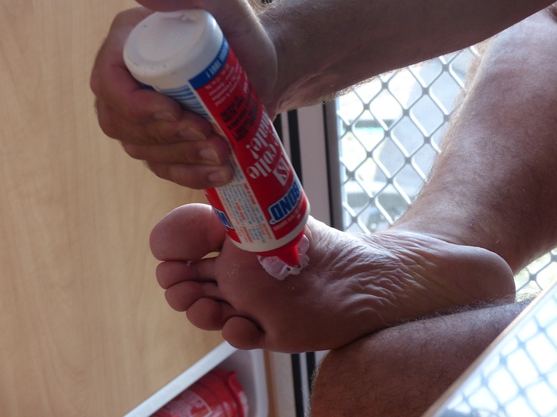 After the big 'clean out' of the Landy and contrary to his experience with prickles, Don was walking around without
shoes again and, what a surprise, he got another prickle in his foot. This time I caught his 'treatment' on camera.
He smeared his toe with 'Weldbond Glue', waited for it to dry, then pealed it off taking the prickle with it.
After the big 'clean out' of the Landy and contrary to his experience with prickles, Don was walking around without
shoes again and, what a surprise, he got another prickle in his foot. This time I caught his 'treatment' on camera.
He smeared his toe with 'Weldbond Glue', waited for it to dry, then pealed it off taking the prickle with it.
He was pretty smug about his success but I notice he is wearing his sandals again.
Monday 10th June, Mt. Isa, QLD
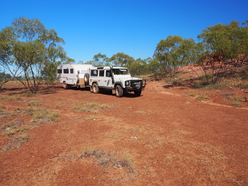
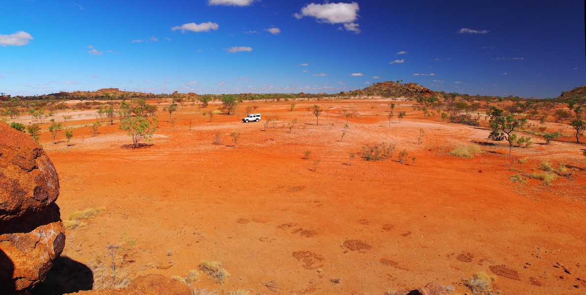
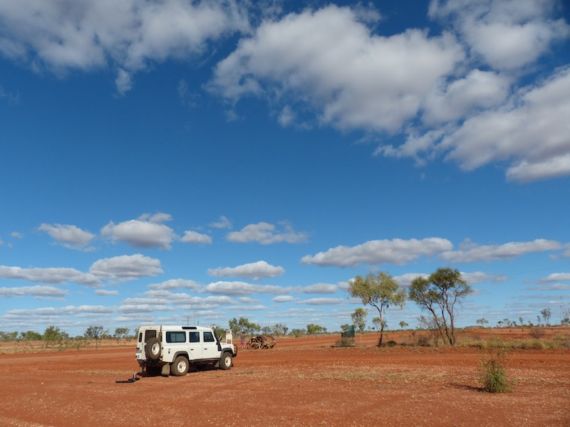
What a great day! After having spent yesterday in camp we were well rested to do the 350 km round trip down to Dajarra and return. The most tackling part of this trip today was actually getting out of Mt. Isa with fuel. Traffic was no problem as it was a Public Holiday but finding the fuel station was. As we are still finding our way around Mt. Isa and were having trouble locating the Service Station Don thought he would do it the 'quick' way with the GPS. Confidently he followed the directions, continue on, turn right, continue on, turn right again. Bingo! We were back where we started. So much for the GPS. We turned it off and did it the old fashion way, fuelled up and headed off SW down the Diamantina Developmental Road.
 This was a good road although narrow and one lane most of the way, but with very few cars on this road we
had a good run. About 75kms down we turned West onto a dirt track and headed for some Ruins we had seen
marked on the map. This was a really interesting track and about 7kms in, just over the dry river bed, we came
to the Ruins. We presumed it was an old homestead. Nothing much of it remained but it still had a story to tell.
We went for a walk around, took some photos then boiled the billy before heading back onto the Diamantina Road
South.
This was a good road although narrow and one lane most of the way, but with very few cars on this road we
had a good run. About 75kms down we turned West onto a dirt track and headed for some Ruins we had seen
marked on the map. This was a really interesting track and about 7kms in, just over the dry river bed, we came
to the Ruins. We presumed it was an old homestead. Nothing much of it remained but it still had a story to tell.
We went for a walk around, took some photos then boiled the billy before heading back onto the Diamantina Road
South.
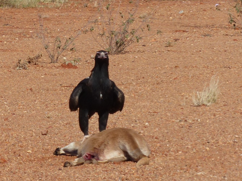
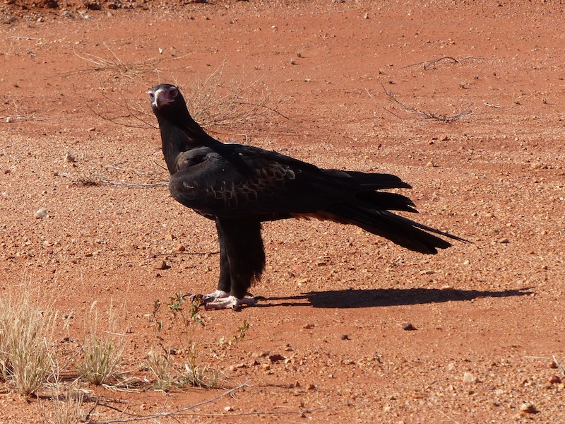
 It wasn't long before we spotted a large Wedge-tailed Eagle on top of a kangaroo carcass on the road. As we approached
slowly, he didn't move from the carcass. It was only when we came to a full stop right beside him that he hopped back about
6ft but didn't fly away. This Eagle was darker and larger than the ones we had seen previously. We were to see another two
more as we continued South.
It wasn't long before we spotted a large Wedge-tailed Eagle on top of a kangaroo carcass on the road. As we approached
slowly, he didn't move from the carcass. It was only when we came to a full stop right beside him that he hopped back about
6ft but didn't fly away. This Eagle was darker and larger than the ones we had seen previously. We were to see another two
more as we continued South.
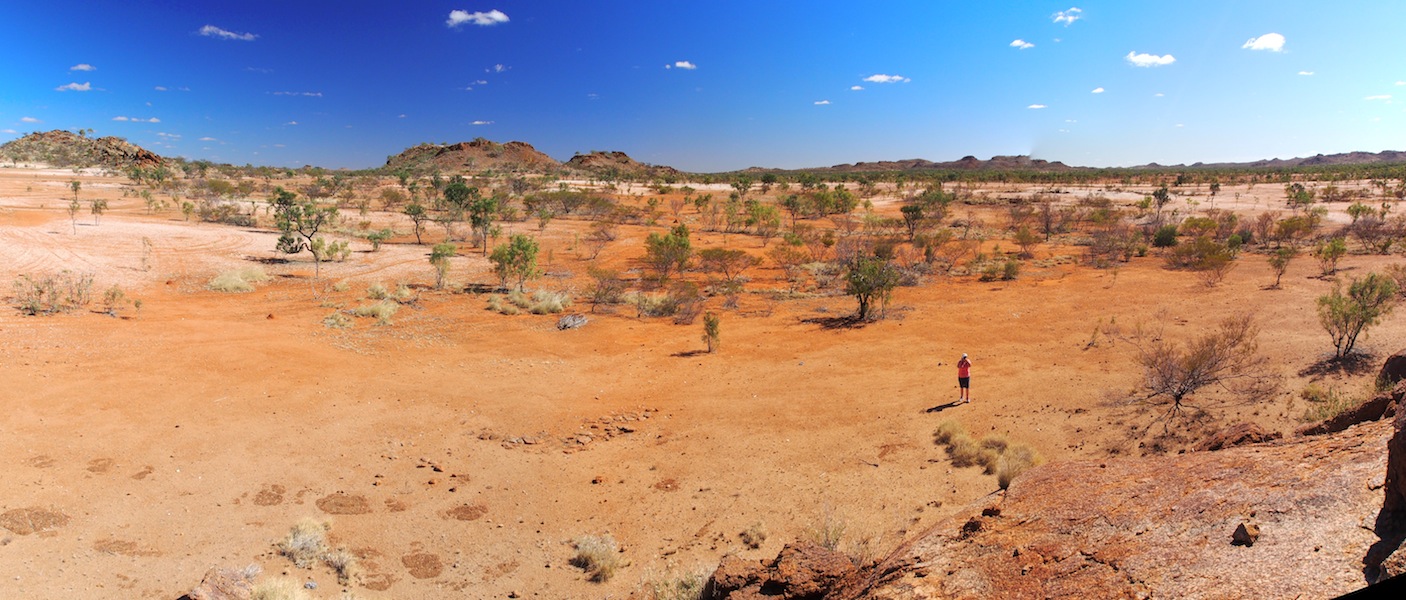
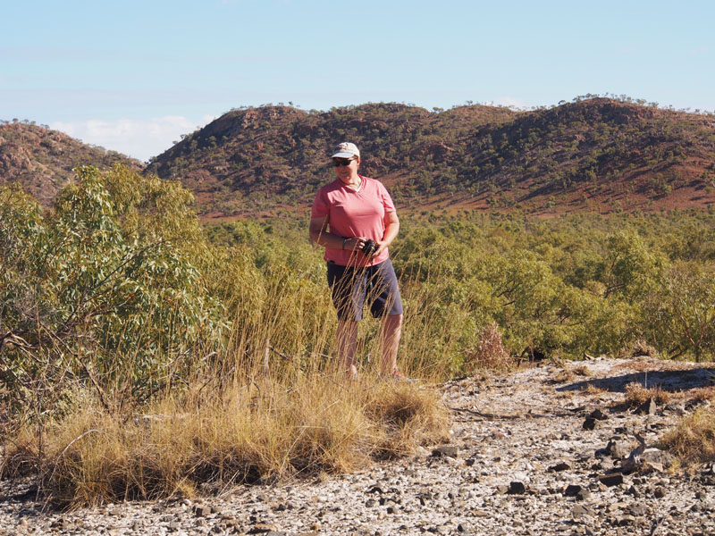
 The scenery was just beautiful…..the real Australian Outback at its best. The rocky outcrops were extremely interesting with
huge boulders piled high on top of each other as if placed there by hand. We stopped at one particularly interesting pile of
boulders with Don climbing to the top. (He's such a show-off). I am still having a bit of trouble with my ankle so rock climbing
is still off limits for me at this stage. We made a mental note of this place as it would make a great place to camp if we come
back up this way.
The scenery was just beautiful…..the real Australian Outback at its best. The rocky outcrops were extremely interesting with
huge boulders piled high on top of each other as if placed there by hand. We stopped at one particularly interesting pile of
boulders with Don climbing to the top. (He's such a show-off). I am still having a bit of trouble with my ankle so rock climbing
is still off limits for me at this stage. We made a mental note of this place as it would make a great place to camp if we come
back up this way.
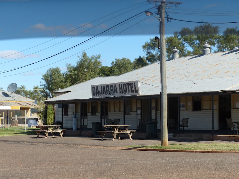 We arrived at Dajarra, a tiny community with a Pub, a Roadhouse and not much more. We stopped in at the Pub, but being
Monday the cook wasn't working. We had a beer and a chat with the very nice Swedish Girl behind the bar, here on a Work
Visa. It seems QLD is the place the Swedish girls come to. We left the Pub and stopped next at the Roadhouse and had a
sandwich and coffee before heading back North on the dirt track to Mt. Isa.
We arrived at Dajarra, a tiny community with a Pub, a Roadhouse and not much more. We stopped in at the Pub, but being
Monday the cook wasn't working. We had a beer and a chat with the very nice Swedish Girl behind the bar, here on a Work
Visa. It seems QLD is the place the Swedish girls come to. We left the Pub and stopped next at the Roadhouse and had a
sandwich and coffee before heading back North on the dirt track to Mt. Isa.
 The road was good most of the way. We reached the fork to turn NW to Mt. Isa but detoured 7kms NE to Duchess, once a Mine
but now abandoned but still with one solitary little Pub still operating. You would miss it if you drove past in a cloud of dust. The
place looked really interesting but we didn't have enough time to explore, with only enough daylight left to get back to Mt. Isa
before dark.
The road was good most of the way. We reached the fork to turn NW to Mt. Isa but detoured 7kms NE to Duchess, once a Mine
but now abandoned but still with one solitary little Pub still operating. You would miss it if you drove past in a cloud of dust. The
place looked really interesting but we didn't have enough time to explore, with only enough daylight left to get back to Mt. Isa
before dark. 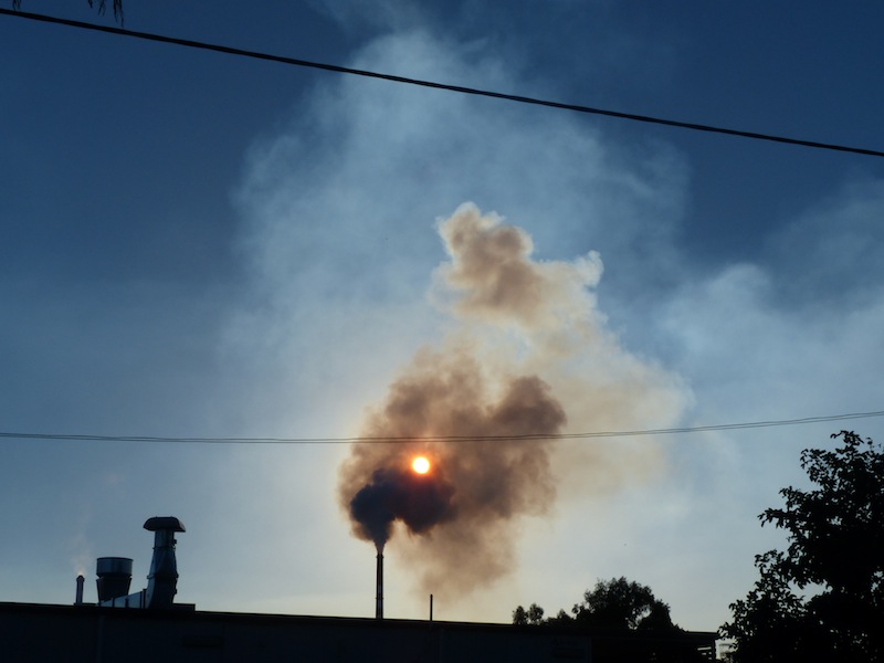 This will only be a short detour when we head back down this way after we go to Cloncurry so will make a stop off
then to explore this area further. It was hard to drive off when the place looked so interesting but we headed back to the fork and
turned NW for Mt. Isa.
This will only be a short detour when we head back down this way after we go to Cloncurry so will make a stop off
then to explore this area further. It was hard to drive off when the place looked so interesting but we headed back to the fork and
turned NW for Mt. Isa.
A good run back with lots of great scenery to keep us interested, arriving back in Mt. Isa before the sun went down and catching a great shot of the sun obscured by the smoke of the huge Chimney at the Mine.
Wednesday 12th June, Mt. Isa, QLD
 We were up early this morning and down at the Bureau of Meteorology by 0800 which is located on the mine-side
just south of the Airport. We thought we might spot a few flights going across before we went in but
things were quiet.
We were up early this morning and down at the Bureau of Meteorology by 0800 which is located on the mine-side
just south of the Airport. We thought we might spot a few flights going across before we went in but
things were quiet. We were looking forward to doing the tour of the Bureau of Meteorology as we had missed doing it in Longreach. At 0830, Scott, the weatherman appeared and greeted us. Dressed in casual shorts, Tee and Sandals and a wide grin on his face, he explained that he was a bit 'second-hand' this morning so he may not be as amusing as usual. He was wrong. He was not only amusing but extremely interesting. He started off slow but within 10 mins he had hit his stride.
First, we went into the office whilst he explained a few of the details of the working of the Weather Station. He explained the many changes in the reporting procedures to when he first started 25 yrs ago. With the advances in computer technology and the many avenues now available with which to collect the necessary data, Weather Station personnel have been reduced in most areas. This particular Weather Station at Mt. Isa now having a staff of just one, that being Scott. The amount of data used to predict the weather patterns was amazing and gives a better understanding of why the Bureau is able to predict the weather with a reasonable degree of accuracy.
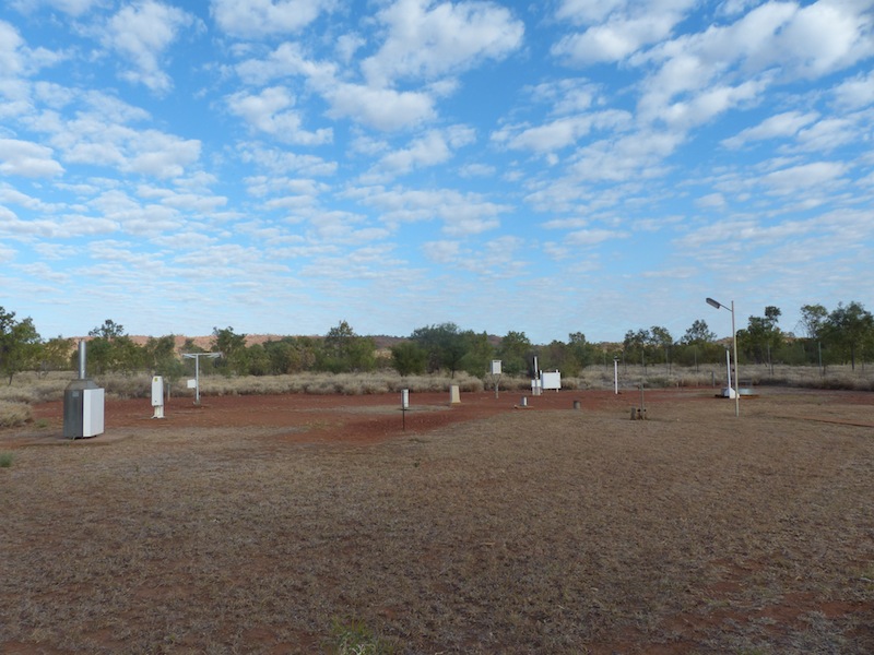 With all the technological information under our belt, Scott then hurried us outside with the explanation that he
he needed to do his 'readings' before the release of the Weather Balloon at 0915. He pointed to a long, narrow
concrete path in the yard and said, "Just head up that way". We walked single file along the path with great
anticipation as to what was at the end of it. We cleared the few sparse trees along the path and came to an open
clearing………O.K…….this looks interesting. There placed strategically in an area of about 60ft diameter were
some 'objects'.
With all the technological information under our belt, Scott then hurried us outside with the explanation that he
he needed to do his 'readings' before the release of the Weather Balloon at 0915. He pointed to a long, narrow
concrete path in the yard and said, "Just head up that way". We walked single file along the path with great
anticipation as to what was at the end of it. We cleared the few sparse trees along the path and came to an open
clearing………O.K…….this looks interesting. There placed strategically in an area of about 60ft diameter were
some 'objects'.
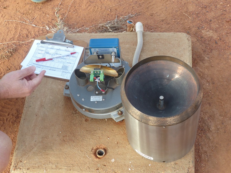
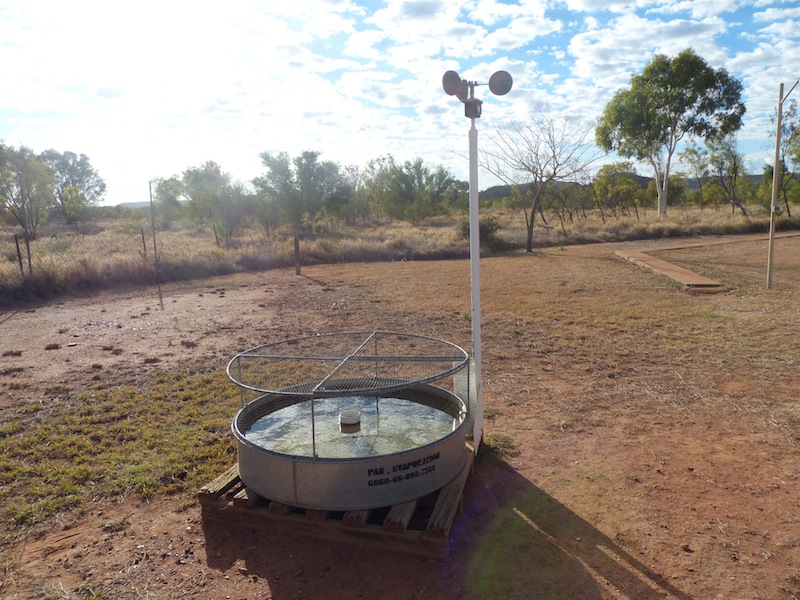 Scott headed to the first 'instrument', a galvanised tub about 3ft in diameter and explained that this was the 'evaporation pan', used to measure the amount of evaporation that had occurred. With that, he headed off and came back with a
tall glass container about 5" in diameter, with measurements marked down the side and filled with water. With that
he poured the contents into the tub, then repeated the procedure, taking note of the amount of water he needed to
top up the tub. Now, this was really interesting. After all the high tech stuff we had seen and heard about in the office
it was totally unexpected to see such an important measurement done 'by hand'.
Scott headed to the first 'instrument', a galvanised tub about 3ft in diameter and explained that this was the 'evaporation pan', used to measure the amount of evaporation that had occurred. With that, he headed off and came back with a
tall glass container about 5" in diameter, with measurements marked down the side and filled with water. With that
he poured the contents into the tub, then repeated the procedure, taking note of the amount of water he needed to
top up the tub. Now, this was really interesting. After all the high tech stuff we had seen and heard about in the office
it was totally unexpected to see such an important measurement done 'by hand'.
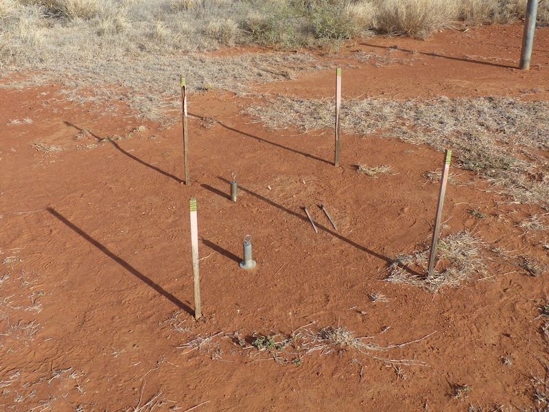
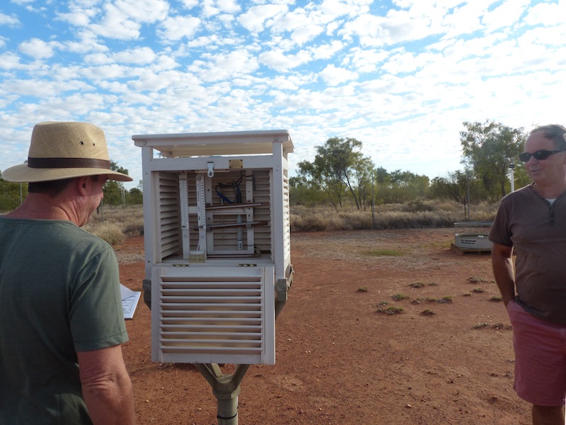 We went through each of the 'instruments' in the circle, a steel cone about 12' high (AKA rain gauge), a white box (Stevenson Screen) that measured
the temperature and the humidity, a piece of ground about 3ft square denoted by the four wooden stakes that marked the
corners, with two 12" long thermometers lying horizontal along the ground, one embedded 10cm, one embedded 20cm, then
another two going straight down, 50cm and 100cm. These were to measure the temperature of the ground at various depths.
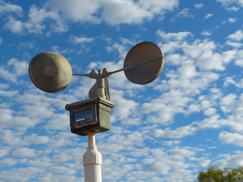
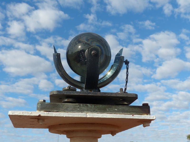
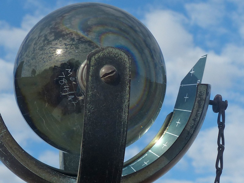
There was an anemometer which measured the amount of wind that passed during the day and a really interesting instrument
that measured the amount of sunlight that occurred during the day. The Campbell Stokes sunshine recorder was a really fascinating instrument. A slim card was
inserted underneath a magnifying ball that refracted the sun as it traversed across the sky. This then burnt a line along
the card during sunshine. This part of the tour was really fascinating.
We went through each of the 'instruments' in the circle, a steel cone about 12' high (AKA rain gauge), a white box (Stevenson Screen) that measured
the temperature and the humidity, a piece of ground about 3ft square denoted by the four wooden stakes that marked the
corners, with two 12" long thermometers lying horizontal along the ground, one embedded 10cm, one embedded 20cm, then
another two going straight down, 50cm and 100cm. These were to measure the temperature of the ground at various depths.
There was an anemometer which measured the amount of wind that passed during the day and a really interesting instrument
that measured the amount of sunlight that occurred during the day. The Campbell Stokes sunshine recorder was a really fascinating instrument. A slim card was
inserted underneath a magnifying ball that refracted the sun as it traversed across the sky. This then burnt a line along
the card during sunshine. This part of the tour was really fascinating.
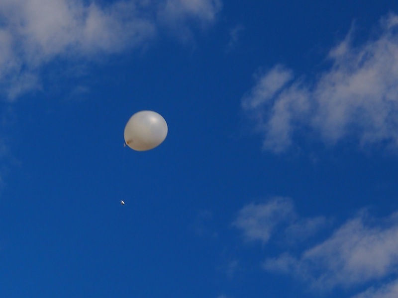
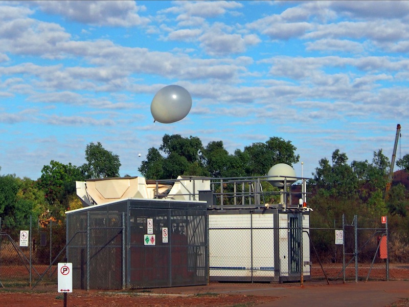 Back into the office for a brief explanation of the actual Weather Balloon that was to be released at 0915 then out again to see
the launch. With a bit of a wind today, the balloon was launched and rising before you could blink. It was fascinating to watch
it gain altitude, its data box trailing below on a string that unwinds to 60m as it rises 300m per minute, up to around 30km where
it will burst, falling to earth aided by a small plastic parachute inserted inside.
Back into the office for a brief explanation of the actual Weather Balloon that was to be released at 0915 then out again to see
the launch. With a bit of a wind today, the balloon was launched and rising before you could blink. It was fascinating to watch
it gain altitude, its data box trailing below on a string that unwinds to 60m as it rises 300m per minute, up to around 30km where
it will burst, falling to earth aided by a small plastic parachute inserted inside.Back in the office again with a few more questions, a few more explanations and a lot of information. Thank you Scott, if you were feeling second-hand today, we'd love to catch you on a 'good' day, that hour and a half was most interesting and informative.
Thursday 13th June, Mt. Isa, QLD
We took things easy today and did a bit of local sight-seeing in Mt. Isa. Taking in the Tent House, the Underground Hospital & Museum and the Outback at Isa, an informative Centre showing the history of Mt Isa.
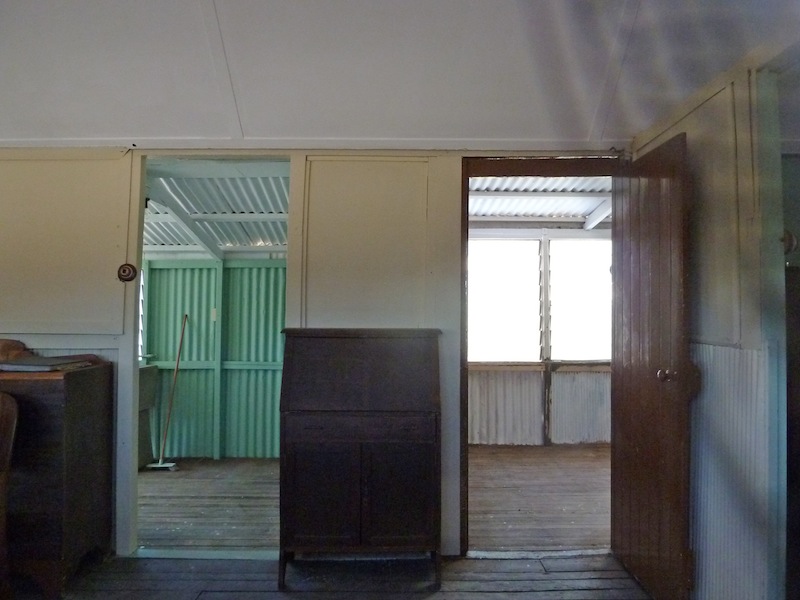
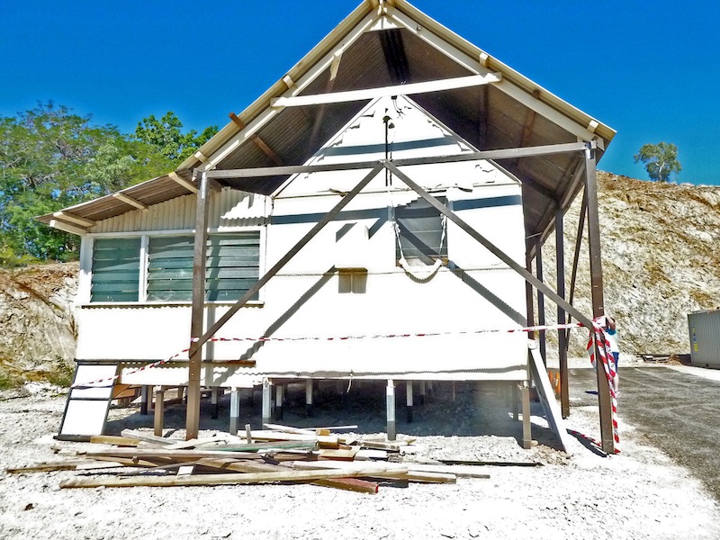 The Tent House is the last remaining example of the 'quick fix' housing used in the Mt. Isa area for the miners
and their families. At one time there were 300 of these houses but these have since been demolished. Many
locals born and raised in Mt. Isa would have lived in one of these Tent Houses up until the early sixties. These
houses had canvas walls, tin roofs and mostly dirt floors. They were cheap, easy to build and quick to relocate.
The Tent House is the last remaining example of the 'quick fix' housing used in the Mt. Isa area for the miners
and their families. At one time there were 300 of these houses but these have since been demolished. Many
locals born and raised in Mt. Isa would have lived in one of these Tent Houses up until the early sixties. These
houses had canvas walls, tin roofs and mostly dirt floors. They were cheap, easy to build and quick to relocate.
The Underground Hospital was built in 1942 following the bombing of Darwin. There was concern that Mt. Isa may be a target if the Japanese pushed their raids further inland. The Underground Hospital is tunnelled into the side of the hill behind the Mount Isa Base Hospital. There is a large collection of antique medical equipment, old iron hospital beds and even a real skeleton on display along the verandahs of the Museum.
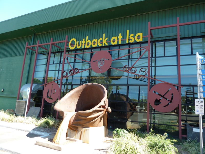
 The Outback at Isa Centre was extremely informative with a great DVD presentation of the early history of Mt. Isa.
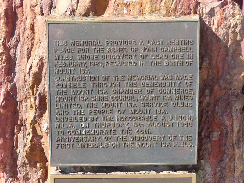
The large bucket outside depicting the molten copper pour is really impressive. Lead Ore was first discovered in
Mt. Isa in 1923 and after the Mines were established, continued to mine Lead until 1943 when they switched over
to Copper mining to meet the demands of World War 2. This was switched back again in 1946 but both Lead and
Copper were produced in parallel from1953. There is too much historical data to write here but anyone interested
in the story of Mt. Isa would not be disappointed if they took the trouble to look it up.
The Outback at Isa Centre was extremely informative with a great DVD presentation of the early history of Mt. Isa.
The large bucket outside depicting the molten copper pour is really impressive. Lead Ore was first discovered in
Mt. Isa in 1923 and after the Mines were established, continued to mine Lead until 1943 when they switched over
to Copper mining to meet the demands of World War 2. This was switched back again in 1946 but both Lead and
Copper were produced in parallel from1953. There is too much historical data to write here but anyone interested
in the story of Mt. Isa would not be disappointed if they took the trouble to look it up.
Friday 14th, Mt. Isa, QLD
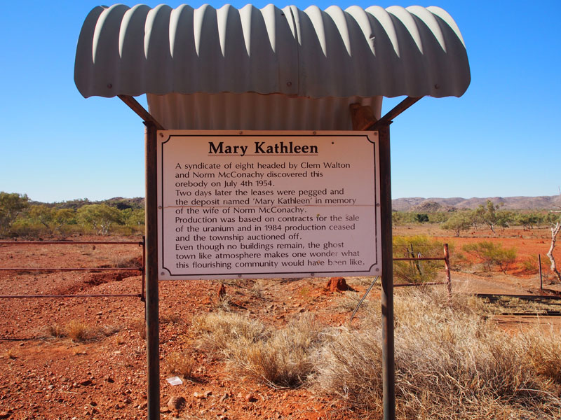
 An early start today as we headed East along the Barkly Highway towards Cloncurry about 58kms
enroute to the Mary Kathleen Uranium Mine (now abandoned). The scenery along the way was great, I believe
it is still part of the Waggaboonyah Range. We turned North onto the road leading into the site of the
original township of Mary Kathleen.
An early start today as we headed East along the Barkly Highway towards Cloncurry about 58kms
enroute to the Mary Kathleen Uranium Mine (now abandoned). The scenery along the way was great, I believe
it is still part of the Waggaboonyah Range. We turned North onto the road leading into the site of the
original township of Mary Kathleen.
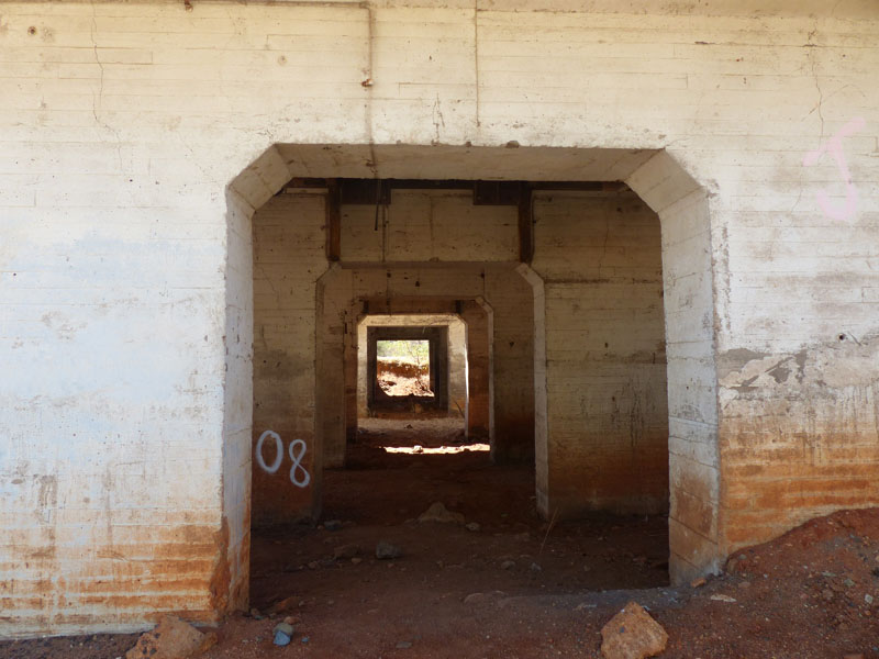
 This road, once sealed, is now in a very bad state of disrepair, with
large holes in the bitumen where it has broken or been washed away. The site of the township is only
about 2km off the main Highway with a stone entranceway that must have looked quite grand when the
township existed. Just inside this entranceway is a large circular garden bed about 3ft high, no longer
welcoming and full of colour but over-grown and tangled with weeds.
This road, once sealed, is now in a very bad state of disrepair, with
large holes in the bitumen where it has broken or been washed away. The site of the township is only
about 2km off the main Highway with a stone entranceway that must have looked quite grand when the
township existed. Just inside this entranceway is a large circular garden bed about 3ft high, no longer
welcoming and full of colour but over-grown and tangled with weeds.
 We had an aerial map of the original township and also a mud map with which to identify where the various
buildings originally stood. We drove through the entrance and turned left towards the site where the Police
Station was once housed. The roads were sealed and as yet, not overgrown with weeds so it was rather an
eerie feeling to drive along the streets of a once thriving town with only the concrete bases to give testament
to the once proud buildings that had stood on them.
We had an aerial map of the original township and also a mud map with which to identify where the various
buildings originally stood. We drove through the entrance and turned left towards the site where the Police
Station was once housed. The roads were sealed and as yet, not overgrown with weeds so it was rather an
eerie feeling to drive along the streets of a once thriving town with only the concrete bases to give testament
to the once proud buildings that had stood on them.
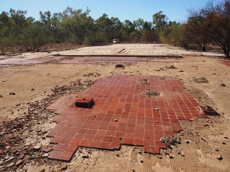 We pulled into the kerb in front of where the large Cafeteria used to be (parking correctly, habits are entrenched)
then got out to explore. We walked around, what would have been a lovely shaded square, and across the foundations
of the General Store, General Shops, Recreation Room, Library, Hotel, ANZ Bank, Town Office, Post Office, Medical Centre,
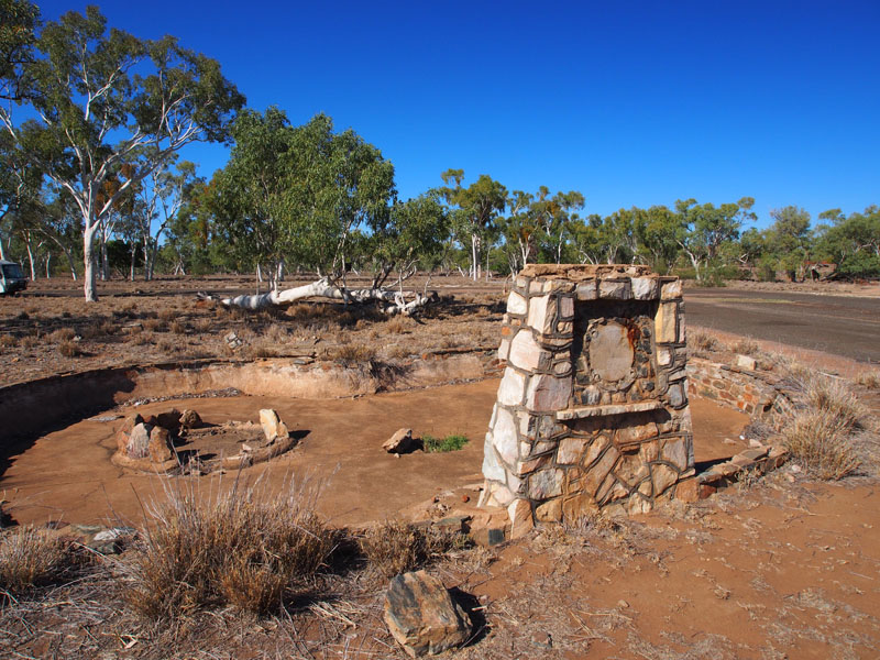
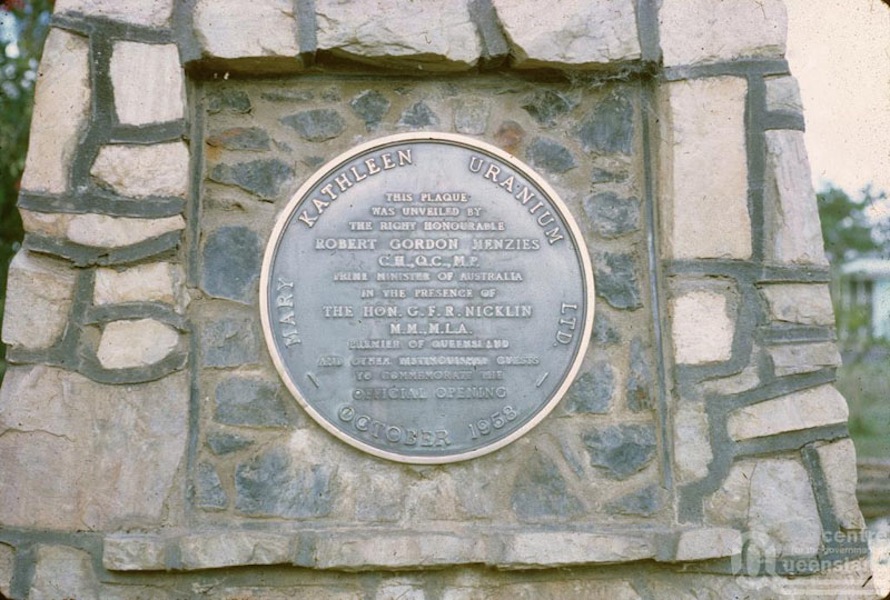
Town Hall and Pottery Club. At the corner of the Square was a large stone obelisk, its centre piece removed; just a circular
scar remained where the plaque denoting the opening of the town of Mary Kathleen in 1958 by Sir Robert Menzies (then Prime
Minister) had once taken pride of place. This stood in front of what would have been a pond with two stone garden surrounds
within. I'm sure this would have looked extremely attractive when the town was here.
We pulled into the kerb in front of where the large Cafeteria used to be (parking correctly, habits are entrenched)
then got out to explore. We walked around, what would have been a lovely shaded square, and across the foundations
of the General Store, General Shops, Recreation Room, Library, Hotel, ANZ Bank, Town Office, Post Office, Medical Centre,
Town Hall and Pottery Club. At the corner of the Square was a large stone obelisk, its centre piece removed; just a circular
scar remained where the plaque denoting the opening of the town of Mary Kathleen in 1958 by Sir Robert Menzies (then Prime
Minister) had once taken pride of place. This stood in front of what would have been a pond with two stone garden surrounds
within. I'm sure this would have looked extremely attractive when the town was here.
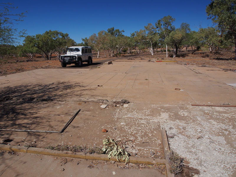
Now Then Now Then
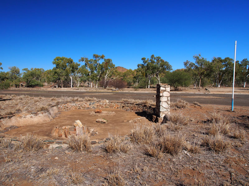
We next walked across to where the Fire Station was housed then up through the residential area to the Police Station. It was quite a strange feeling, walking across the foundations where other people had once called home; where they had done their shopping, chatted with each other in the street and bustled around the various shops. Children would have laughed and played as they rode their bikes around the Square. Now all that remained were some concrete foundations, broken floor tiles and a few pathways with the odd plumbing evidence to remind you of the infrastructure that would have been needed for a town of this size and population. As I stood there in reverie, I recalled when I came home on leave from the Army and visited the site of the old house I had grown up in. I stood on the gravel road and just stared at the now empty acres in front of me; piles of dirt heaped up where the old house used to stand. The trees I used to climb, still standing but looking small and insignificant without all the surroundings that had made this my home. I cried as I gazed at my childhood of past, now obliterated by progress. Would these children that once played here, in Mary Kathleen, feel the same if they revisited this site?
ANZ Bank Plumbing Telecom OJ (behind post office) Parking Bays
 We ambled back to the car and continued the drive clockwise, across the Corella River (dry) around past another residential area,
Apex Hall, BMX Track and up to the site of the Cinema and Lawn Bowling Club. Next we located the sites of the Swimming Pool,
School, Tennis Courts, Basketball area and the Sports Oval. These latter being on the South side of the Corella River. Crossing the
River again and past the residential area on the North side, we arrived back at the entrance to the town. This had been an extremely
thought provoking journey through this now abandoned township. Life moves on.
We ambled back to the car and continued the drive clockwise, across the Corella River (dry) around past another residential area,
Apex Hall, BMX Track and up to the site of the Cinema and Lawn Bowling Club. Next we located the sites of the Swimming Pool,
School, Tennis Courts, Basketball area and the Sports Oval. These latter being on the South side of the Corella River. Crossing the
River again and past the residential area on the North side, we arrived back at the entrance to the town. This had been an extremely
thought provoking journey through this now abandoned township. Life moves on.
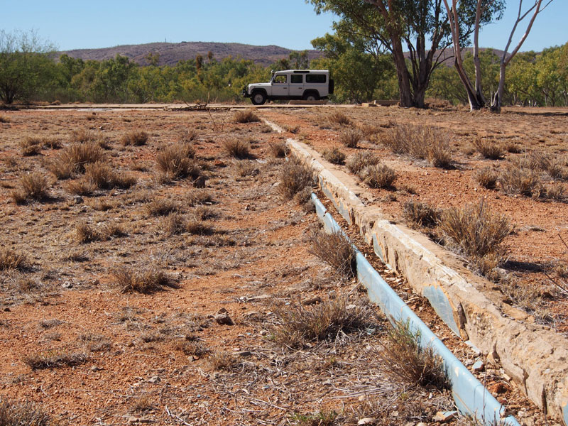
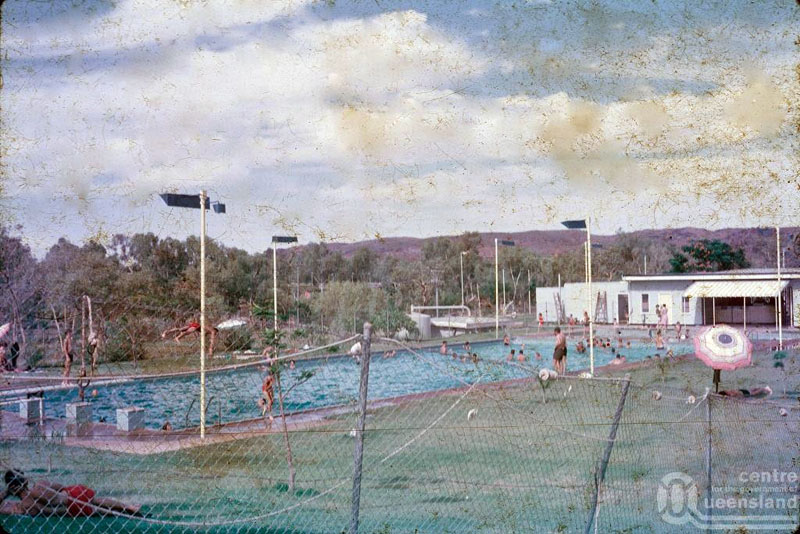
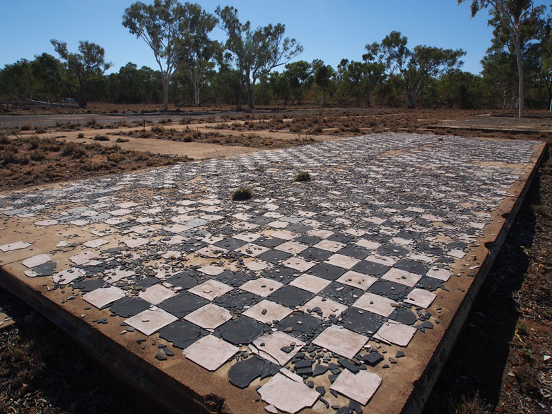
Pool Change Rooms Pool edge Swimming Pool …now and in its heyday
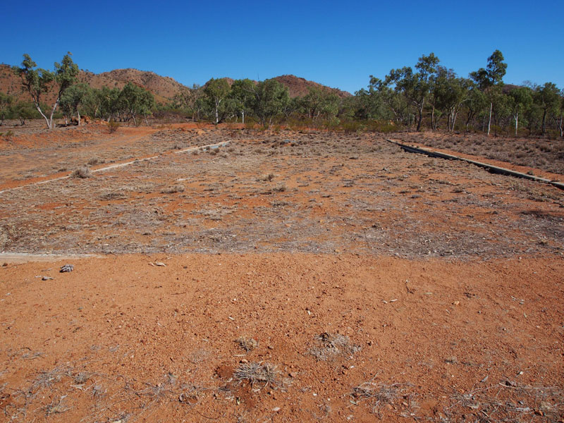
Some brief facts….the Uranium deposit was discovered by Clem Walton and Norm McConarchy in 1954. Mary Kathleen was named after McConarchy's wife. The town enjoyed prosperity between 1956 and 1963 until it was placed in mothballs. It was re-opened in 1974 until 1983 when it was closed due to the Federal Government's three mine policy. Mary Kathleen was closed and the entire town including houses, went to public auction in 1983. It is now privately owned and access allowed by the generosity of the owners. In 1961 the population was around 1,000 and by 1981 there were over 2,000 residents.
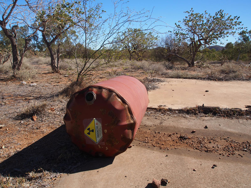
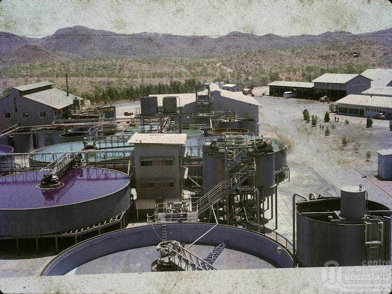
Remnants of Uranium Ore Processing Plant how it was then (compare background hills)
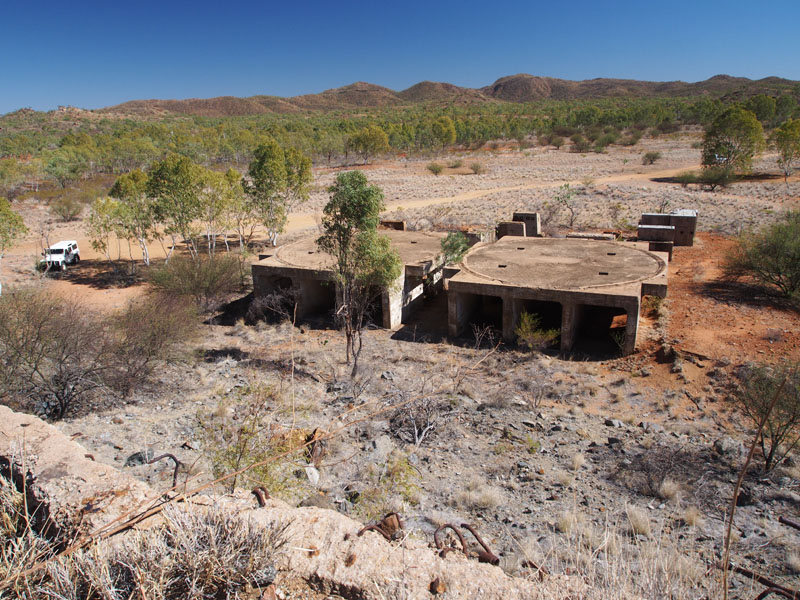
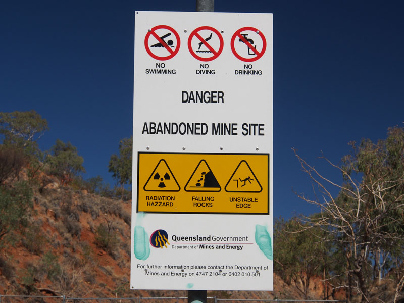
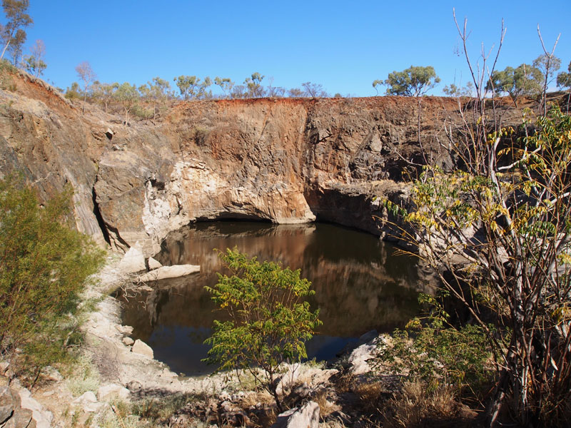
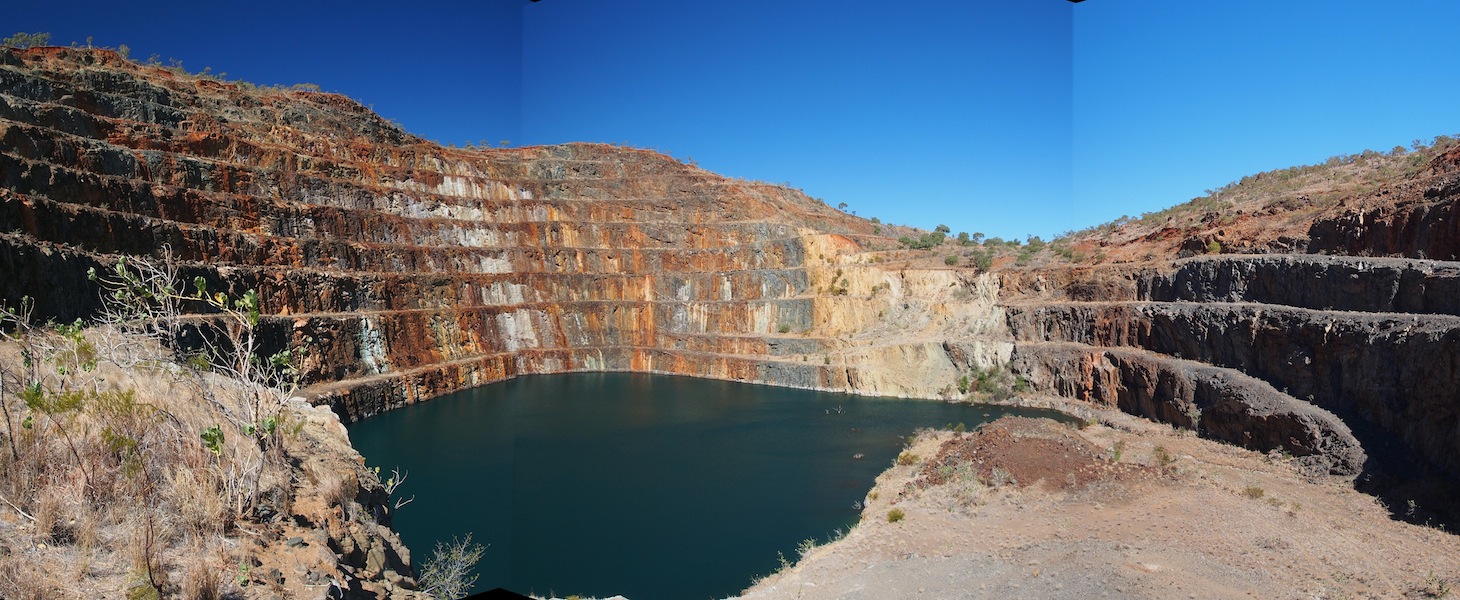 Back down the hill, we parked at the fence, wriggled around the side of it and began the long trek to the Open Cut. The walk to the Mine Pit
was about 1.5kms (3km round trip), which wasn't difficult. Once at the top, there were a few rock barriers to climb over to get a good view. It is
not the biggest Open Cut we have seen but it was definitely interesting and significant because it is a Uranium Mine. Back down the hill again,
around the fence and back in the Landy, we headed back to the highway and West to Mt. Isa.
Back down the hill, we parked at the fence, wriggled around the side of it and began the long trek to the Open Cut. The walk to the Mine Pit
was about 1.5kms (3km round trip), which wasn't difficult. Once at the top, there were a few rock barriers to climb over to get a good view. It is
not the biggest Open Cut we have seen but it was definitely interesting and significant because it is a Uranium Mine. Back down the hill again,
around the fence and back in the Landy, we headed back to the highway and West to Mt. Isa.
Sundy 16th, Mt. Isa, QLD
 What a super day……..we headed East again along the Barkly Highway for about 50kms, then turned
South onto a dirt track that looked very promising on the mud map we had. Although the track was listed
as 4WD only and 'Extreme', my faith in Don's capability is unshakable, so I was looking forward to the
seeing what lay ahead.
What a super day……..we headed East again along the Barkly Highway for about 50kms, then turned
South onto a dirt track that looked very promising on the mud map we had. Although the track was listed
as 4WD only and 'Extreme', my faith in Don's capability is unshakable, so I was looking forward to the
seeing what lay ahead.
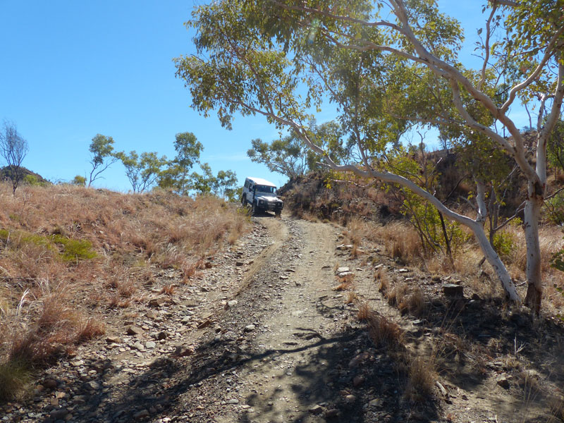
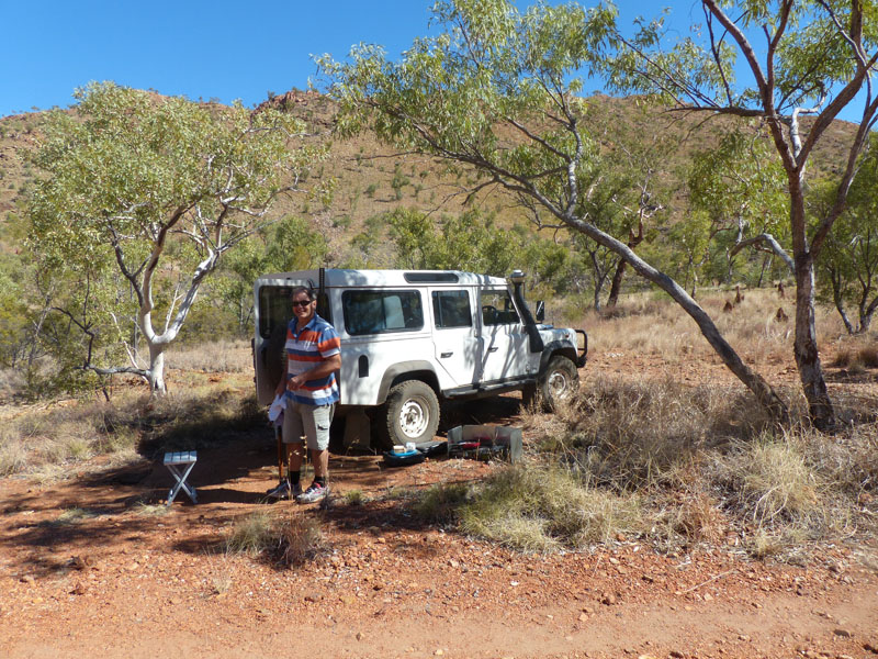
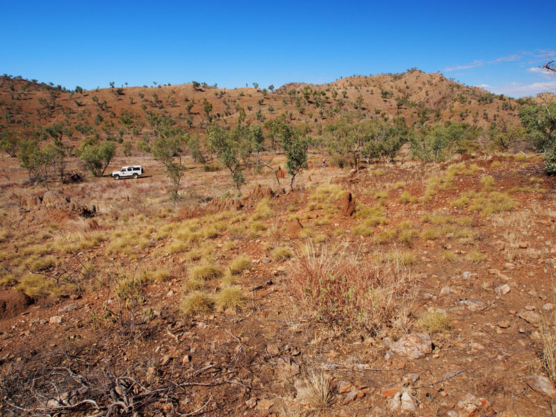
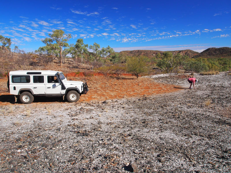
 As we traversed the track, it was understandable why it was listed as 'Extreme' if you weren't used to this
sort of off-road trekking. There were deep ruts, large boulders, steep hills and very rough and uneven surfaces
from large rocks that protruded from the ground but a 4WD enthusiast would have no difficulty. We followed the
track as it wound around the hills and through the gorges; the scenery alone was well worth coming down this
track. Everything was so interesting, so much to see. We stopped often to get out and have a bit of a fossick around.
We reached the turnoff to Rigby Falls to the right or Corella Creek to the left and decided to stop there for lunch.
As we traversed the track, it was understandable why it was listed as 'Extreme' if you weren't used to this
sort of off-road trekking. There were deep ruts, large boulders, steep hills and very rough and uneven surfaces
from large rocks that protruded from the ground but a 4WD enthusiast would have no difficulty. We followed the
track as it wound around the hills and through the gorges; the scenery alone was well worth coming down this
track. Everything was so interesting, so much to see. We stopped often to get out and have a bit of a fossick around.
We reached the turnoff to Rigby Falls to the right or Corella Creek to the left and decided to stop there for lunch.
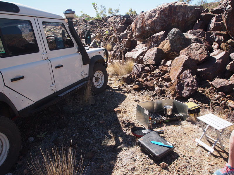
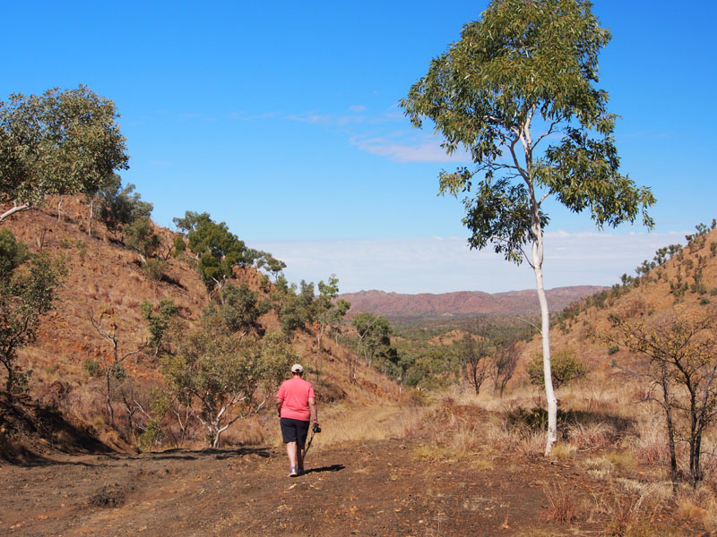
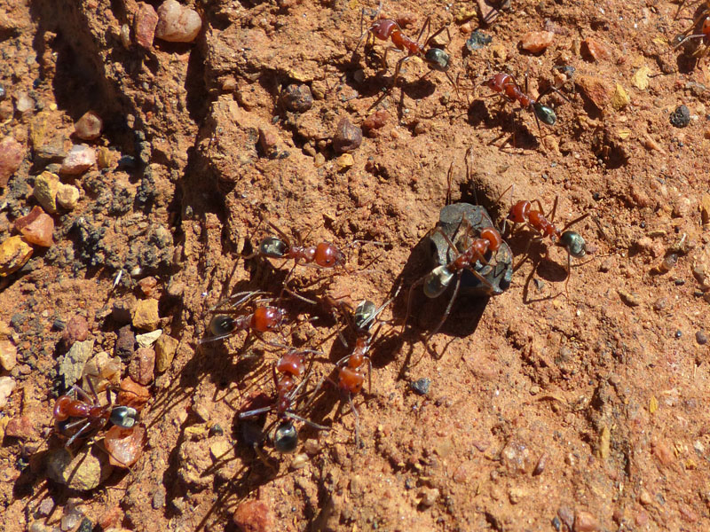
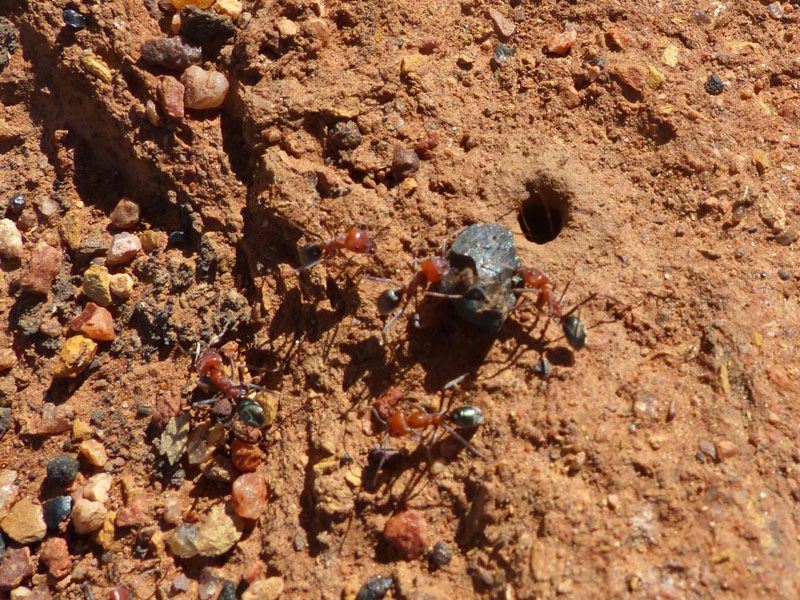
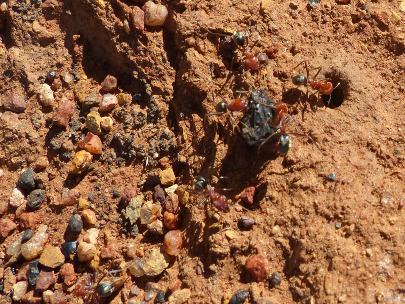
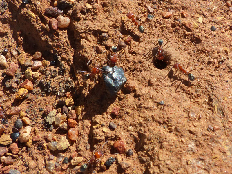
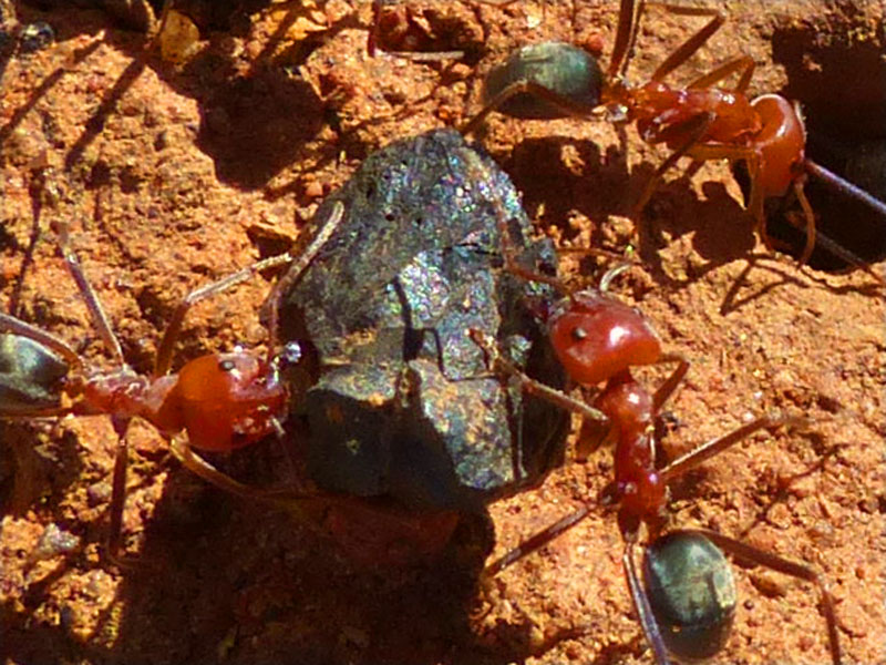
 It was just beautiful sitting there in the bush, hardly any flies at all and no artificial noises interrupting the silence. How
amazing, to be able to take the time to look at all the little things that usually go by unnoticed as you hurry about the
important 'job' of living. As we sat there enjoying our coffee, some very small black ants caught our attention as they
scurried about beneath our feet. They were quite tiny. Don squeezed the last bit of condensed milk out of the tube and
dropped it in their path; they went crazy. Just a few, suddenly became a multitude as they scurried around the milk and
darted backwards and forwards to the nest; a small hole near my foot. I picked up the small piece of meat that had been
dropped when making our lunch, and dropped it in their path also, this also created a great flurry of movement to and from
the nest, with more little ants rushing to the meat.
It was just beautiful sitting there in the bush, hardly any flies at all and no artificial noises interrupting the silence. How
amazing, to be able to take the time to look at all the little things that usually go by unnoticed as you hurry about the
important 'job' of living. As we sat there enjoying our coffee, some very small black ants caught our attention as they
scurried about beneath our feet. They were quite tiny. Don squeezed the last bit of condensed milk out of the tube and
dropped it in their path; they went crazy. Just a few, suddenly became a multitude as they scurried around the milk and
darted backwards and forwards to the nest; a small hole near my foot. I picked up the small piece of meat that had been
dropped when making our lunch, and dropped it in their path also, this also created a great flurry of movement to and from
the nest, with more little ants rushing to the meat. 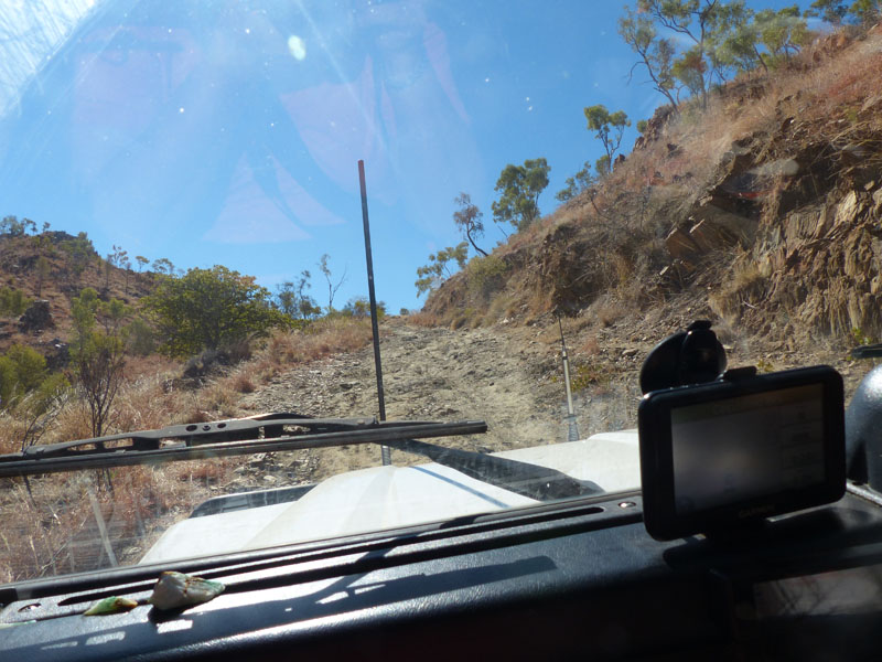 But the strange thing was, that when Don rinsed his cup out and emptied
the small amount of water onto the ground, the ants went into another flurry and rushed over to this spot. Such fascinating
little insects. Thank goodness they are so small or none of us would have a chance. If only we could harness their amazing
productivity; but then again, all these little workers are blind, sterile females.
But the strange thing was, that when Don rinsed his cup out and emptied
the small amount of water onto the ground, the ants went into another flurry and rushed over to this spot. Such fascinating
little insects. Thank goodness they are so small or none of us would have a chance. If only we could harness their amazing
productivity; but then again, all these little workers are blind, sterile females.
 We enjoyed lunch, then decided not to continue on the other 10kms we had intended to as we had spent so much time
stopping along the way and wanted to check out another abandoned Mine on the way back, so we retraced our route.
We enjoyed lunch, then decided not to continue on the other 10kms we had intended to as we had spent so much time
stopping along the way and wanted to check out another abandoned Mine on the way back, so we retraced our route.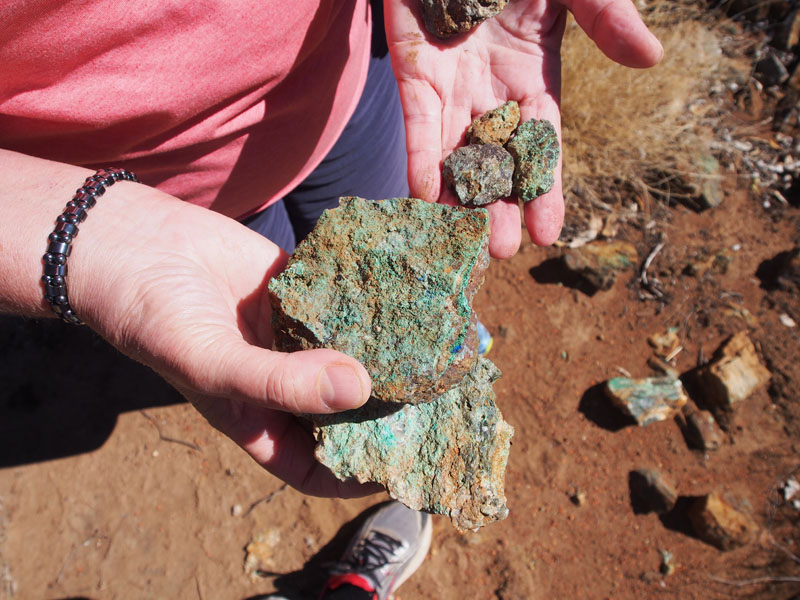 We had
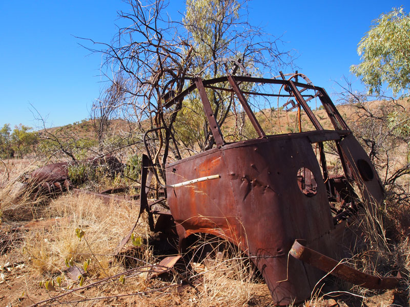
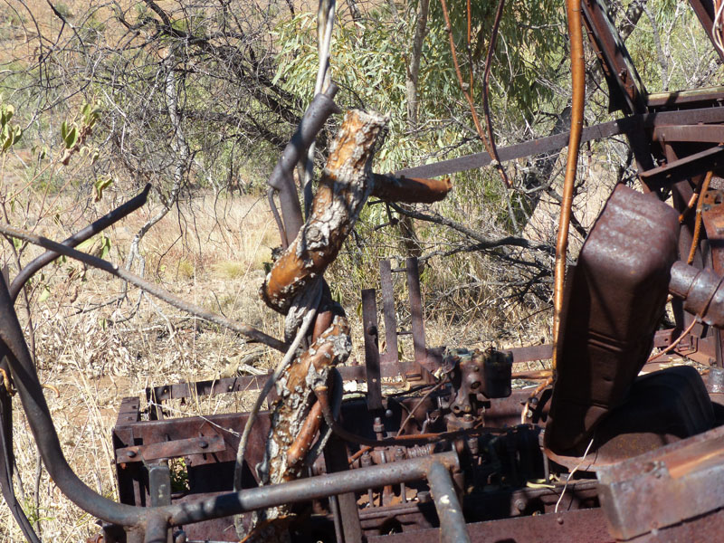
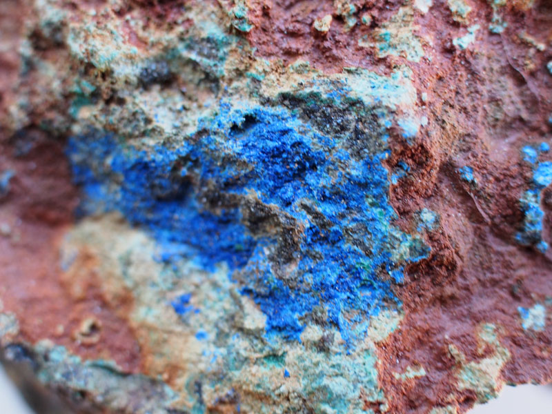
seen an interesting bit of rusty 'something' from the track on the way down, so when we came to it again we went in to investigate.
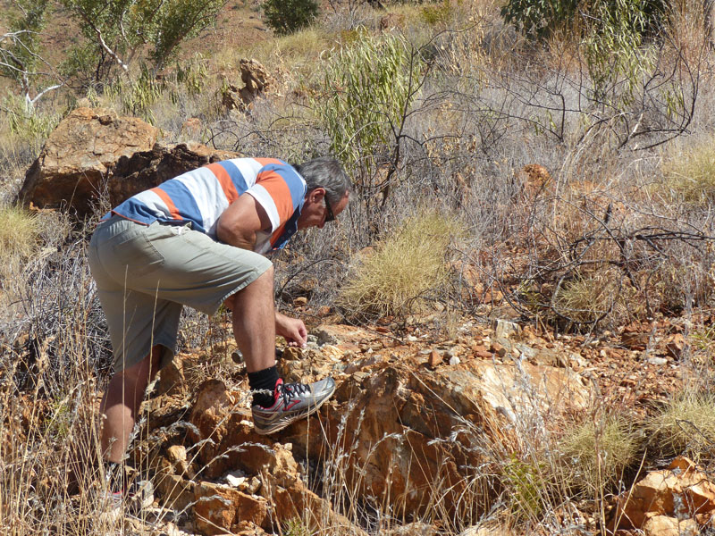
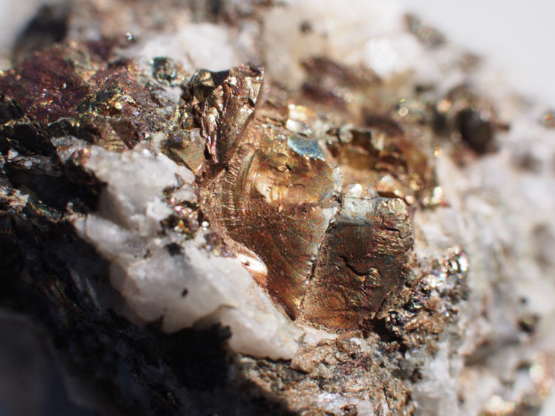
It turned out to be a rusted out old bus and from the things scattered about, it looked like someone had been camped here at one
stage doing some hand mining. This was an extremely interesting stop. We fossicked about for nearly an hour here. A very bad
place for a mad keen 'rock enthusiast' with strict orders that 'there is NO room for rocks' to stop. It was like a chocoholic being left
inside the Cadbury factory with instructions to 'look only'. BUT…luckily….Don is almost as addicted as me and as I secreted a few
little samples into my pocket I noticed him also picking up a few here and there and walking back to the Landy with them, studying
them closely. Oh Yes…….all is good.
We had
seen an interesting bit of rusty 'something' from the track on the way down, so when we came to it again we went in to investigate.
It turned out to be a rusted out old bus and from the things scattered about, it looked like someone had been camped here at one
stage doing some hand mining. This was an extremely interesting stop. We fossicked about for nearly an hour here. A very bad
place for a mad keen 'rock enthusiast' with strict orders that 'there is NO room for rocks' to stop. It was like a chocoholic being left
inside the Cadbury factory with instructions to 'look only'. BUT…luckily….Don is almost as addicted as me and as I secreted a few
little samples into my pocket I noticed him also picking up a few here and there and walking back to the Landy with them, studying
them closely. Oh Yes…….all is good.
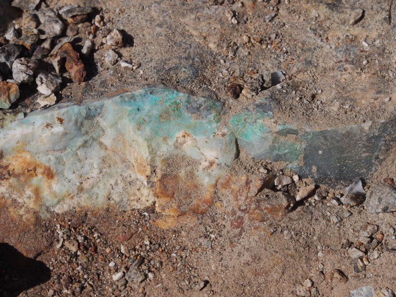
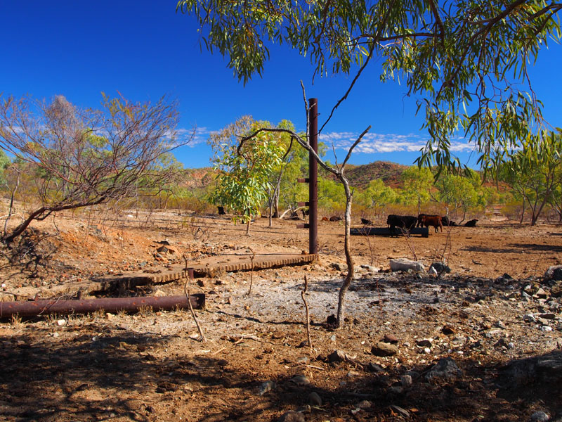
 We left this interesting site and continued back up the track to the Mount Frosty turnoff. This was the site of an abandoned Gypsum
Mine. WoW!! What a beautiful sight, as we rounded a bend the whole hill-top in front of us glistened white as the sun danced off
the quartz crystals that lay on the ground. These were not quartz rocks, which themselves are quite stunning, but quartz crystals
which lay scattered across the ground. We resisted the temptation to stop immediately and go and explore this area and continued
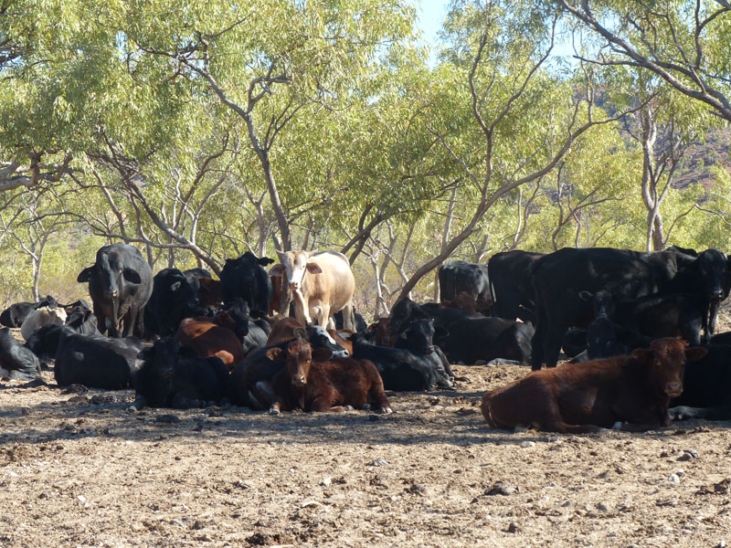
on around the bend to the abandoned Mine Pit. There was a large herd of cattle laying under the trees just below where we stopped.
We drove slowly so as not to disturb them, they have enough trouble trying to locate feed. No use wasting their energy.
We left this interesting site and continued back up the track to the Mount Frosty turnoff. This was the site of an abandoned Gypsum
Mine. WoW!! What a beautiful sight, as we rounded a bend the whole hill-top in front of us glistened white as the sun danced off
the quartz crystals that lay on the ground. These were not quartz rocks, which themselves are quite stunning, but quartz crystals
which lay scattered across the ground. We resisted the temptation to stop immediately and go and explore this area and continued
on around the bend to the abandoned Mine Pit. There was a large herd of cattle laying under the trees just below where we stopped.
We drove slowly so as not to disturb them, they have enough trouble trying to locate feed. No use wasting their energy.
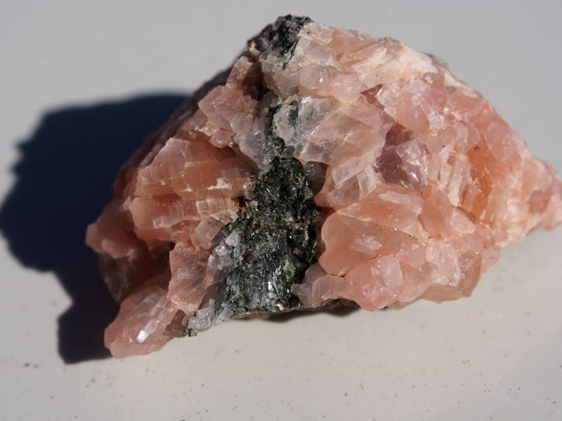
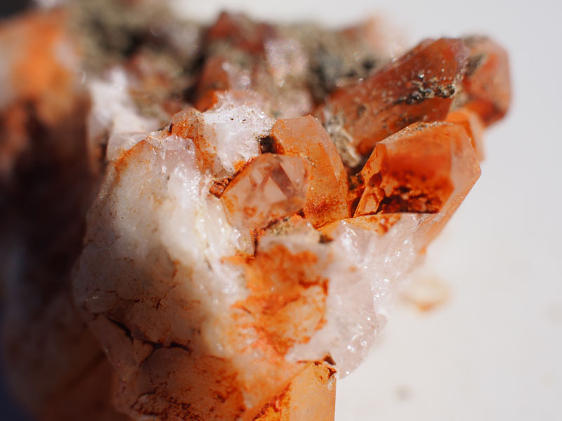
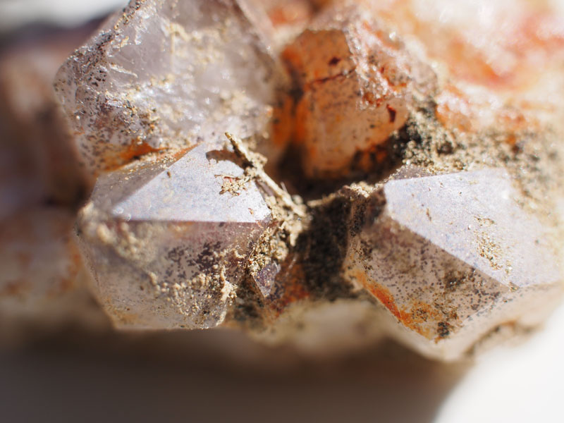
 We fossicked about here for over an hour then reluctantly left and headed back up to the hill to where the quartz crystals lay on the ground.
Just too amazing. It looked like snow through the camera. We fossicked about here for another half hour then headed back to the Highway,
more because it was just too tempting with all those beautiful stones and crystals laying about than because we needed to go. Much better
to leave them there for other people to enjoy their splendour. (Get thee behind me Satan).
We fossicked about here for over an hour then reluctantly left and headed back up to the hill to where the quartz crystals lay on the ground.
Just too amazing. It looked like snow through the camera. We fossicked about here for another half hour then headed back to the Highway,
more because it was just too tempting with all those beautiful stones and crystals laying about than because we needed to go. Much better
to leave them there for other people to enjoy their splendour. (Get thee behind me Satan).
Wednesday 19th June, Mt. Isa, QLD
No blog for the last two days (I got a bit carried away with birthday celebrations). Thank you to my family and friends for making it so special. In fact we didn't really do anything that was newsworthy or of interest to other people nor took any photos. Just enjoyed a couple of days together without any 'responsibilities'.
 Today, was our last day in Mt. Isa before we head East tomorrow for Cloncurry (or maybe somewhere
in between if we find the right campsite), so we took the opportunity to have another look around
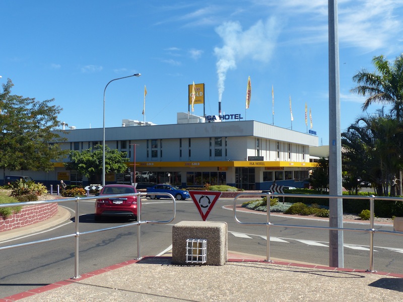
Mt. Isa before we leave. We had lunch at the Isa Hotel, a really nice venue; reasonably priced food and
excellent service. Nice open lounge area with large open windows along the street side and plenty of
good seating, roomy booths or a table, whichever you prefer.
Today, was our last day in Mt. Isa before we head East tomorrow for Cloncurry (or maybe somewhere
in between if we find the right campsite), so we took the opportunity to have another look around
Mt. Isa before we leave. We had lunch at the Isa Hotel, a really nice venue; reasonably priced food and
excellent service. Nice open lounge area with large open windows along the street side and plenty of
good seating, roomy booths or a table, whichever you prefer.
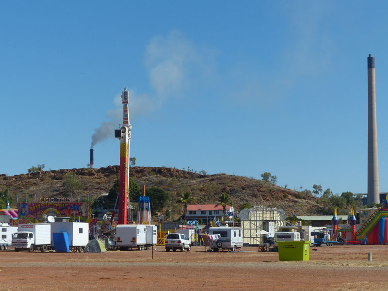
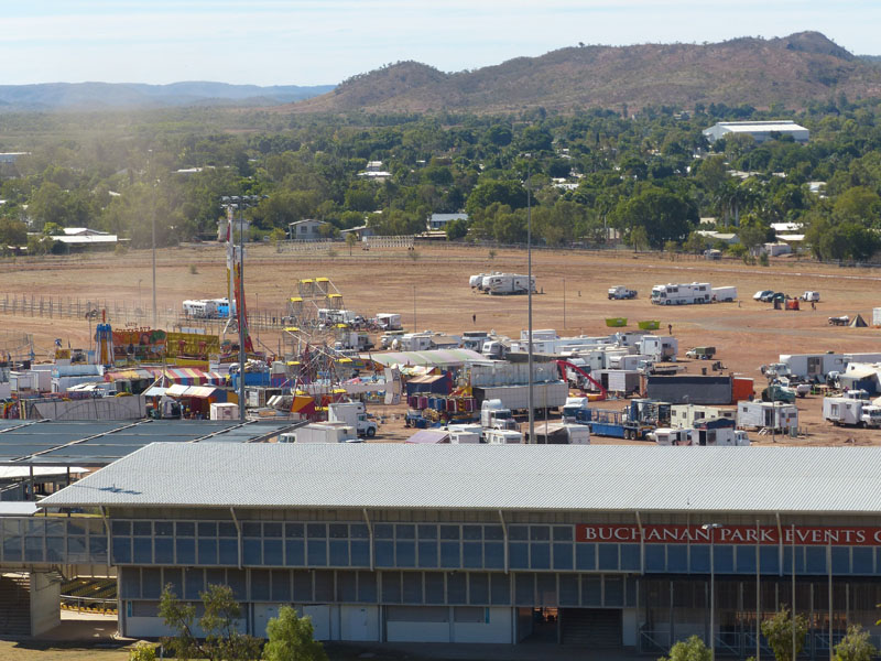 After lunch, we drove to Buchanan Park (Show Grounds / Horse Racing Track / Rodeo Venue). The Mt. Isa
Show is on this Friday and Saturday. Friday is a Public Holiday in Mt. Isa (Show Day). It was really interesting
to see all the caravans, large trucks, tents and equipment of the Show People as they busily prepared for the
Show. The preparations were a lot more advanced than yesterday when we drove through, with the Ferris Wheel
already assembled and other rides in various states of assembly. Caravans, tents, washing on string lines and
cooking equipment on small portable stoves all provided an atmosphere and reality of the nomadic life of the 'Show
People'. This reality is rarely thought of when you pay your entrance fee and step into the excitement and razzle
dazzle of the local Shows so it was really interesting to take in the pre-show atmosphere.
After lunch, we drove to Buchanan Park (Show Grounds / Horse Racing Track / Rodeo Venue). The Mt. Isa
Show is on this Friday and Saturday. Friday is a Public Holiday in Mt. Isa (Show Day). It was really interesting
to see all the caravans, large trucks, tents and equipment of the Show People as they busily prepared for the
Show. The preparations were a lot more advanced than yesterday when we drove through, with the Ferris Wheel
already assembled and other rides in various states of assembly. Caravans, tents, washing on string lines and
cooking equipment on small portable stoves all provided an atmosphere and reality of the nomadic life of the 'Show
People'. This reality is rarely thought of when you pay your entrance fee and step into the excitement and razzle
dazzle of the local Shows so it was really interesting to take in the pre-show atmosphere.
 Call us mean……but we dropped a small stone near the top entrance to see what the ants would do.
Within a second or two, a couple of ants started to push it away from the entrance and then left it up to one, who carried
it back down the mound.
Call us mean……but we dropped a small stone near the top entrance to see what the ants would do.
Within a second or two, a couple of ants started to push it away from the entrance and then left it up to one, who carried
it back down the mound.
(EDIT by Don…. IRONY = upon looking at the ant photos closer we noticed the rock looked a little special,
That Rock is a Nice specimen of Peacock Ore,
…. looks like the Ants have the last laugh)
Next we visited the Royal Flying Doctor Service Office. The first aircraft, a DeHavilland 50, 'G-AUER' was supplied by Qantas and was specially modified to carry a stretcher. The first pilot, Capt Arthur Affleck, was also from Qantas. This first flight on 17 May 1928 to Julia Creek, to attend an injured stockman was to highlight the necessity of an Aerial Medical Service and so began the unique medical scheme to ensure there was a mantle of safety over the inland'. This service is still regarded as an essential and much valued part of living in the Outback areas of Australia.
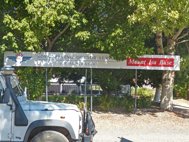
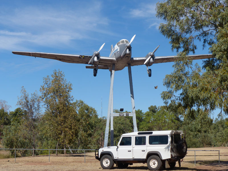
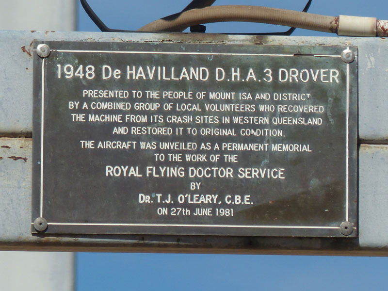
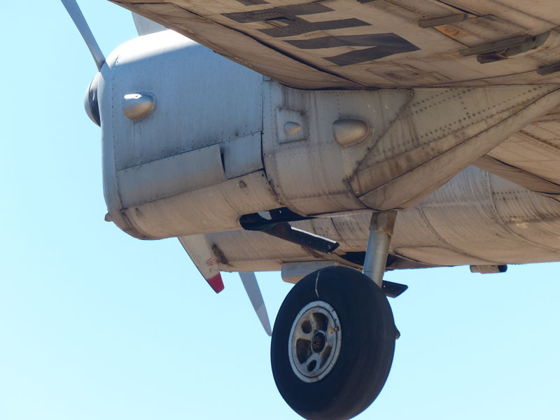
Thursday 20th June, Bush Camp, Maronan Station, QLD
With rain expected in Mt. Isa today and the temperature dropping to 23o it was a good time to move on. We've enjoyed our stay in Mt. isa, despite the dust that you can smell in the air. Watching the smoke pour out of the Stacks at the Mine, it crosses your mind that this might not be the healthiest place to stay long term, but then again, a lot of people have.
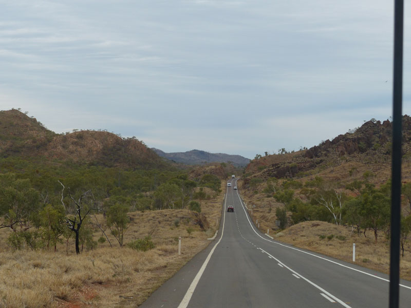 We packed up and headed East down the Barkly Highway towards Cloncurry. After two weeks in a Caravan Park
we were both anxious to find a nice little quiet spot to camp. Our first attempt was about 65kms East of Mt. Isa. We
turned off the Highway and down to the gate at the start of the track to Corella Dam, constructed on the Corella
River in the 1960's to supply water to the Mary Kathleen township and Mine. The water was pumped from the Dam
to Mary Kathleen by way of an underground steel pipeline crossing under the Barkly Highway. The pipeline is still
there today. From our information, it would have been a really good place to camp but this was not to be, unfortunately
the gate at the start of the track was locked. (A sign stated the gate would be locked if the water level was too high).
We packed up and headed East down the Barkly Highway towards Cloncurry. After two weeks in a Caravan Park
we were both anxious to find a nice little quiet spot to camp. Our first attempt was about 65kms East of Mt. Isa. We
turned off the Highway and down to the gate at the start of the track to Corella Dam, constructed on the Corella
River in the 1960's to supply water to the Mary Kathleen township and Mine. The water was pumped from the Dam
to Mary Kathleen by way of an underground steel pipeline crossing under the Barkly Highway. The pipeline is still
there today. From our information, it would have been a really good place to camp but this was not to be, unfortunately
the gate at the start of the track was locked. (A sign stated the gate would be locked if the water level was too high).
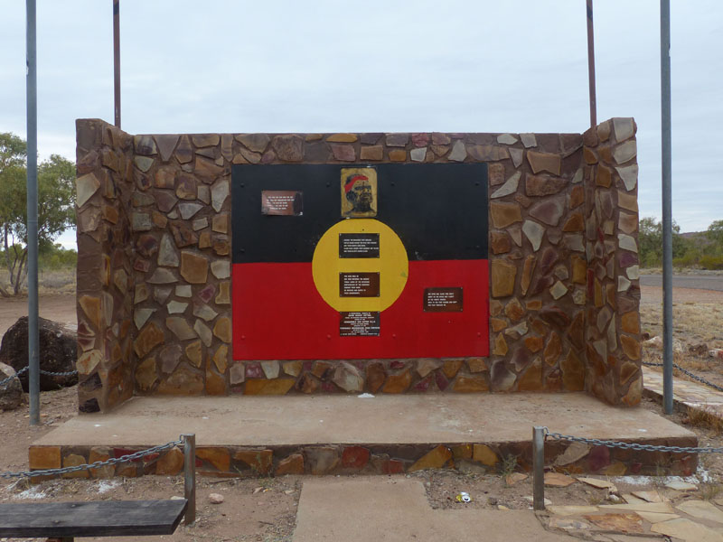 Oh Well, on to Plan B…………Well, we hadn't really formulated a Plan B yet but we worked on it as we drove towards
Cloncurry. The Barkly Highway winds its way through the beautiful Selwyn Ranges so it was hard to keep my eyes on
the map instead of gazing out the window.
Oh Well, on to Plan B…………Well, we hadn't really formulated a Plan B yet but we worked on it as we drove towards
Cloncurry. The Barkly Highway winds its way through the beautiful Selwyn Ranges so it was hard to keep my eyes on
the map instead of gazing out the window.
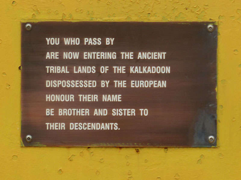 We stopped at an Historical Site just off the Highway, dedicated to the plight
of the Aboriginal tribes native to this area. The Plaque was large, double sided and set in a stone wall, with very poignant
verses set around it. Anyone taking the time to read the verses couldn't help but be touched by the soulful sentiments they
portrayed.
We stopped at an Historical Site just off the Highway, dedicated to the plight
of the Aboriginal tribes native to this area. The Plaque was large, double sided and set in a stone wall, with very poignant
verses set around it. Anyone taking the time to read the verses couldn't help but be touched by the soulful sentiments they
portrayed.
We continued on and arrived in Cloncurry around Noon, still not quite decided on what we were going to do. Cloncurry
looked quite interesting and we had planned to spend about two days here but Don really had cabin fever (or Caravan Park
fever) and needed a gum tree, so I madly devised an alternative route. We continued East through Cloncurry for about 10kms
then turned off onto the Landsborough Highway towards McKinley for about a further 50kms before turning South at the Fullarton
River onto a dirt track. 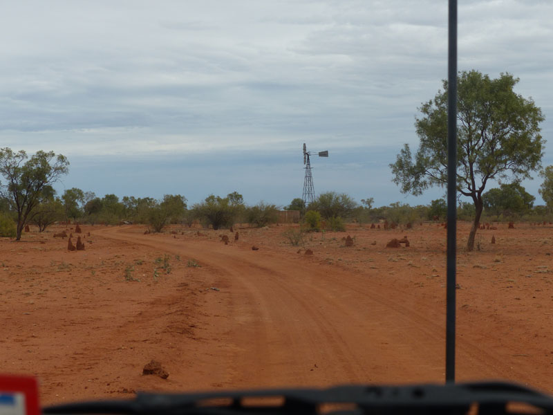 This track runs through the Maronan Station, a privately owned property that runs along the Fullarton River.
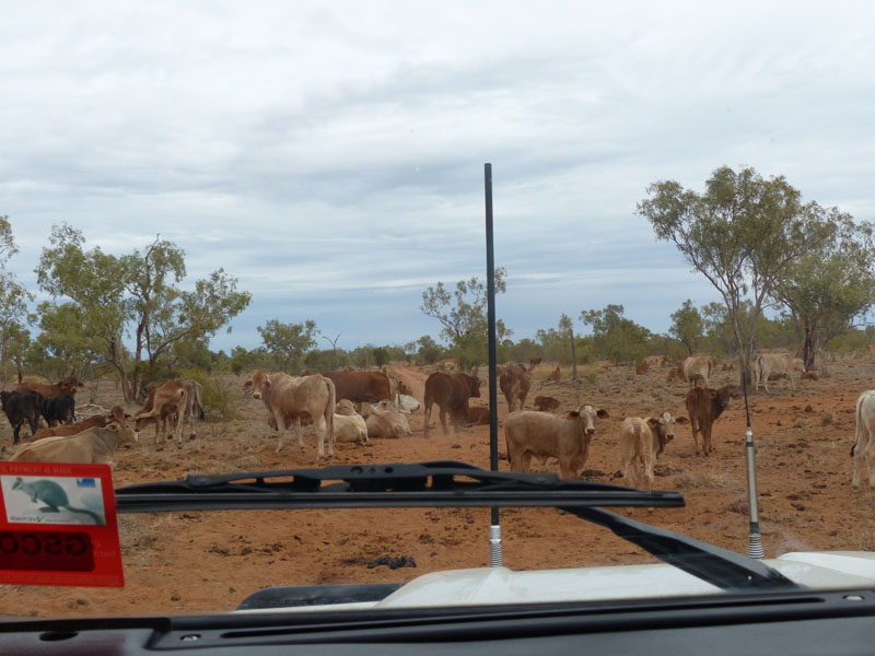 The owners have generously allowed access into their property so 'fossickers' can gain access to the Garnet fields that can be found
in this area. The fields themselves are bounded by rocky ridges of schist supporting the garnet crystals. The best chance of finding
any of these crystals is to climb to the top of the ridges. How exciting it would be to find just one!
The owners have generously allowed access into their property so 'fossickers' can gain access to the Garnet fields that can be found
in this area. The fields themselves are bounded by rocky ridges of schist supporting the garnet crystals. The best chance of finding
any of these crystals is to climb to the top of the ridges. How exciting it would be to find just one!
The track was quite good most of the way; small patches of bull dust and corrugations but these posed no problems for the van, nor the couple of dry creek beds we crossed. There were some beautiful ghost gums along this route; such a pity they don't seem to photograph nearly as striking as they are in reality. We passed a couple of herds of cattle, most of which were laying in the middle of the track, most likely because the sand was softer there. We proceeded very slowly through them and only those cows that needed to move, did so. Such beautiful, gentle creatures.
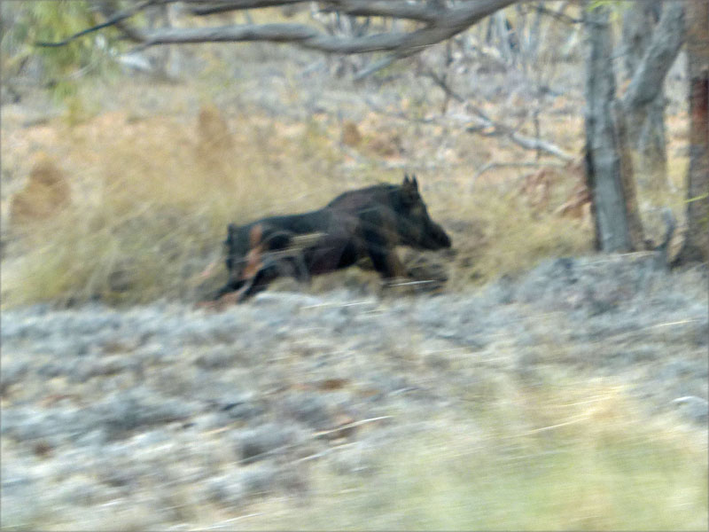
 We had just navigated out way through the second herd when something caught our eye in the distance. It looked like a small black
calf running. This didn't seem odd, as we had encountered so many cows along this track, but as we neared we realised it was a
feral pig. He was a large, fat, black pig, with no shortage of energy as he bounded along with ease at a striking pace. This was the
first wild pig we had seen, or first live one.
We had just navigated out way through the second herd when something caught our eye in the distance. It looked like a small black
calf running. This didn't seem odd, as we had encountered so many cows along this track, but as we neared we realised it was a
feral pig. He was a large, fat, black pig, with no shortage of energy as he bounded along with ease at a striking pace. This was the
first wild pig we had seen, or first live one.
 There were a few forks in the road but the small rudimentary signs gave us confidence we were on the right track. After 20kms, we
took a track that wound into a cleared area around the base of the rocky ridges. WoW!! Don wanted to get out of the 'cabin' and we
certainly did coming here. Not a sound!!
There were a few forks in the road but the small rudimentary signs gave us confidence we were on the right track. After 20kms, we
took a track that wound into a cleared area around the base of the rocky ridges. WoW!! Don wanted to get out of the 'cabin' and we
certainly did coming here. Not a sound!!  We found a nice spot to camp and had barely pulled up when we both jumped out and
began to fossick about the nearby rocks. How amazing, the whole ground sparkled with the mica in the rocky soil, even though it
was a bit over-cast. The one draw-back was flies but we can hardly complain, we've not been bothered by flies at all up until now.
Don did his usual 'King of the Castle' thing and climbed to the top of the ridge. "Very necessary" he told me, as he held the antenna
aloft to see if we could get a signal. Yes, we could, but I'm not sure how often he is going to climb up to the top of the ridge to make a
phone call, but he has worked out the location to set up the modem for uploading the blog.
We found a nice spot to camp and had barely pulled up when we both jumped out and
began to fossick about the nearby rocks. How amazing, the whole ground sparkled with the mica in the rocky soil, even though it
was a bit over-cast. The one draw-back was flies but we can hardly complain, we've not been bothered by flies at all up until now.
Don did his usual 'King of the Castle' thing and climbed to the top of the ridge. "Very necessary" he told me, as he held the antenna
aloft to see if we could get a signal. Yes, we could, but I'm not sure how often he is going to climb up to the top of the ridge to make a
phone call, but he has worked out the location to set up the modem for uploading the blog.
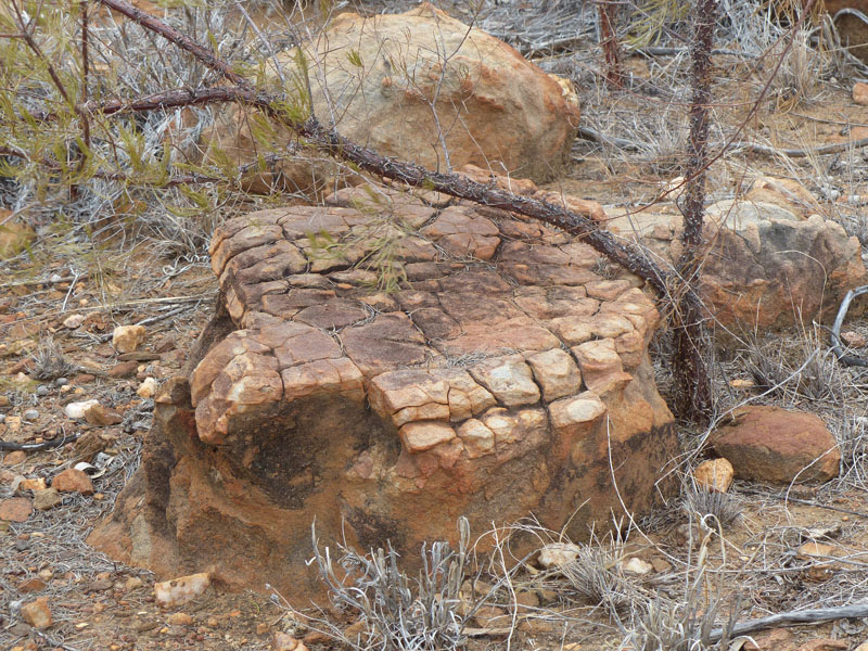
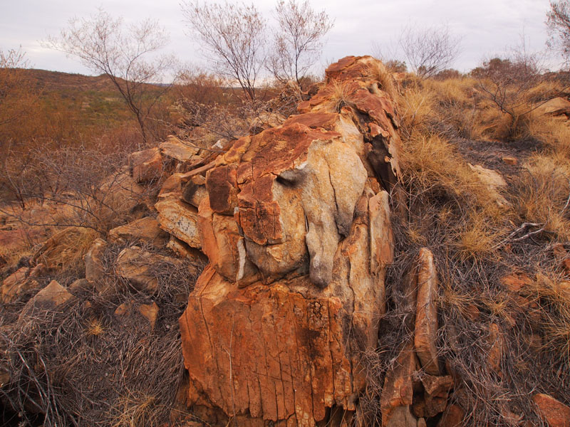
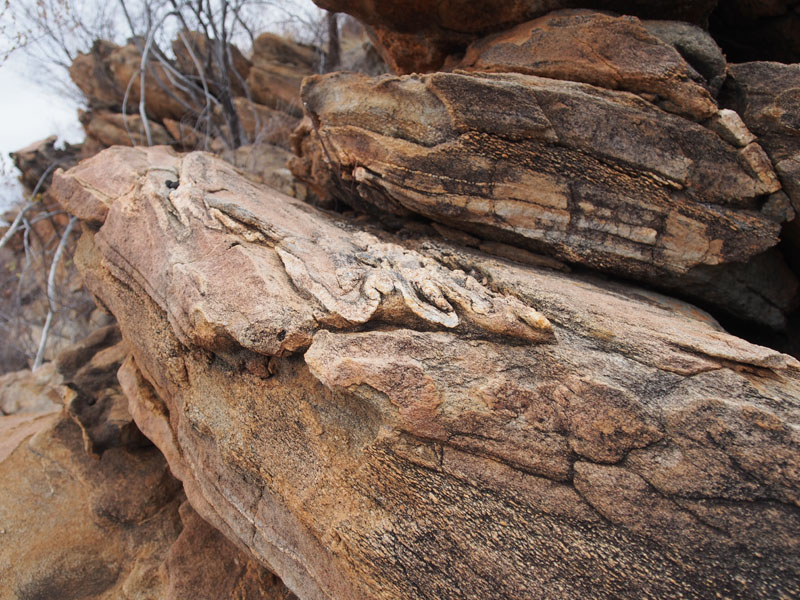
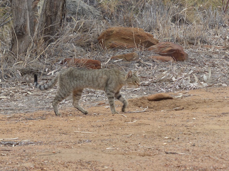 I'll have to get rid of it of course. I have a responsibility to". "Well, that sounds good Darling, but how are you going to manage that?
I can't see it standing still long enough for you to catch it and do away with it", I replied, a little bemused. I then went back inside to
continue getting the things out for dinner. It wasn't long before I heard scuffling and a few strange noises. I looked out the window and
couldn't believe my eyes. There was Don, with a long piece of conduit in his hand with which he had threaded a piece of rope and
made a loop through the end of it. He was down on his knees, poking the rod under the Landy. After a few exclamations and only
a very short time, he jumped up triumphantly, swinging the snare out from under the Landy with an extremely angry cat on the other
end of it, wriggling and writhing at the end of the rope. I was flabbergasted!!
I'll have to get rid of it of course. I have a responsibility to". "Well, that sounds good Darling, but how are you going to manage that?
I can't see it standing still long enough for you to catch it and do away with it", I replied, a little bemused. I then went back inside to
continue getting the things out for dinner. It wasn't long before I heard scuffling and a few strange noises. I looked out the window and
couldn't believe my eyes. There was Don, with a long piece of conduit in his hand with which he had threaded a piece of rope and
made a loop through the end of it. He was down on his knees, poking the rod under the Landy. After a few exclamations and only
a very short time, he jumped up triumphantly, swinging the snare out from under the Landy with an extremely angry cat on the other
end of it, wriggling and writhing at the end of the rope. I was flabbergasted!! I apologise if this previous paragraph offends anyone but with feral cats being a major menace to our native wildlife, the demise of this one helps the survival of native creatures. Neither of us enjoyed this part of the day, we are both ardent animal lovers but the Feral cat came to a very humane end.
(EDIT by Don, I was not going to include a picture of said cat but have to emphasise that Feral Cats can look just like your pet cat at home, the point being if you are a cat owner, then do your part to save the bush, the responsible thing is get it sterelized and keep it indoors or in a cat enclosure
Useful document = Feral Cat PDF )
Friday 21st June, Bush Camp, Maronan Station, QLD
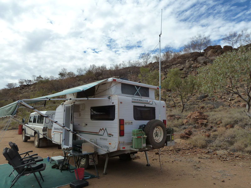 How blissful to wake up to the sun creeping over the ridges above us. The fingers of light working their way down the rocky
slope, the Mica coming to life as the sunlight bounces off it. The grey clouds from yesterday continued their journey North,
giving way to a beautiful blue sky today. We were in no hurry, there were no 'routines' to follow, nothing that couldn't wait
until we were ready to do it. It is very still here and very silent. There are very few birds about, maybe because there is no
water close by; the Fullarton River is dry at the moment.
How blissful to wake up to the sun creeping over the ridges above us. The fingers of light working their way down the rocky
slope, the Mica coming to life as the sunlight bounces off it. The grey clouds from yesterday continued their journey North,
giving way to a beautiful blue sky today. We were in no hurry, there were no 'routines' to follow, nothing that couldn't wait
until we were ready to do it. It is very still here and very silent. There are very few birds about, maybe because there is no
water close by; the Fullarton River is dry at the moment.
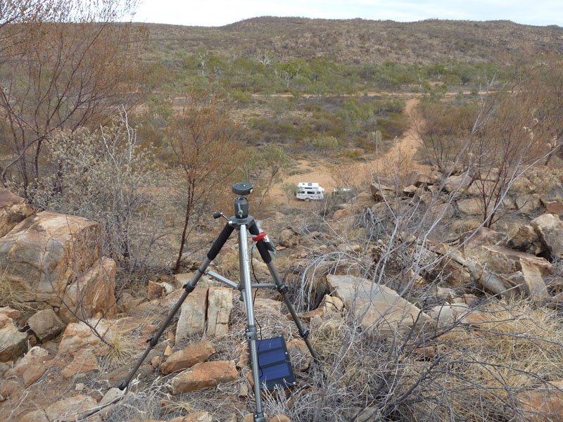 Don took a hike up to the top of the hill early and set the modem up on the tripod to see if we could get enough of a signal to
update the blog and check our messages. Clever Don, it worked. We spent the rest of the morning fossicking around the rocks
in the hope of finding one or two Garnets and checking out all the other interesting things in this area. Just taking a walk down
the track is a whole new experience.
Don took a hike up to the top of the hill early and set the modem up on the tripod to see if we could get enough of a signal to
update the blog and check our messages. Clever Don, it worked. We spent the rest of the morning fossicking around the rocks
in the hope of finding one or two Garnets and checking out all the other interesting things in this area. Just taking a walk down
the track is a whole new experience. 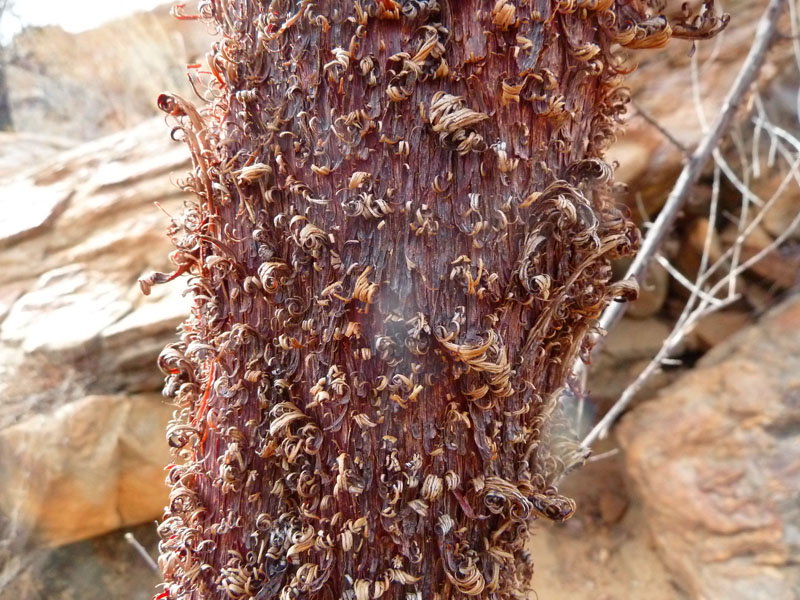
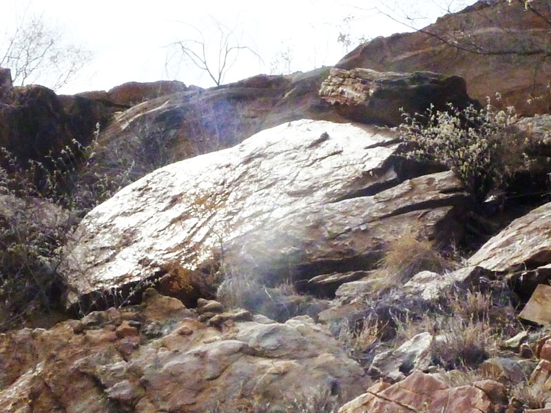 The whole area is covered in Mica, not only small pieces in or on the ground but large
rocks of it, that just come apart in your hands. Some are tinged silver, some yellow, some pink, some black.Your eyes dart here
and there as an extra bright glint catches your attention, only to be superseded by another and another. There was one particular
rock on the ridge above, it must have been 2m x 2m; the entire rock face just glistened no matter which way you viewed it from.
The bark on the thin shrubs was also fascinating; peeling off in tight curls.
The whole area is covered in Mica, not only small pieces in or on the ground but large
rocks of it, that just come apart in your hands. Some are tinged silver, some yellow, some pink, some black.Your eyes dart here
and there as an extra bright glint catches your attention, only to be superseded by another and another. There was one particular
rock on the ridge above, it must have been 2m x 2m; the entire rock face just glistened no matter which way you viewed it from.
The bark on the thin shrubs was also fascinating; peeling off in tight curls.
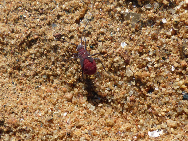 Walking across the rocks we came across a scattering of Emu chick feathers and a pile of small bones in a hollow with paw prints nearby.
At least there is now one less feral cat in the area. Also along the track we came across a very strange little beetle. He stood
out because he was so brightly coloured. Not one that we have seen before. We ambled back to camp and Don, noticing some
interesting pieces of Quartz near the Landy, decided to scratch around the dirt there. He was really excited when he came back
with a Garnet in his hand. With that, we took a bit more interest in the ground immediately around our camp and were amazed to
find Garnet after Garnet, albeit only small ones. So the next couple of hours were spent fossicking around and looking through the
loupe at all our 'treasures'. Having found some now, we don't need to look for more. It was just exciting to find them.
Walking across the rocks we came across a scattering of Emu chick feathers and a pile of small bones in a hollow with paw prints nearby.
At least there is now one less feral cat in the area. Also along the track we came across a very strange little beetle. He stood
out because he was so brightly coloured. Not one that we have seen before. We ambled back to camp and Don, noticing some
interesting pieces of Quartz near the Landy, decided to scratch around the dirt there. He was really excited when he came back
with a Garnet in his hand. With that, we took a bit more interest in the ground immediately around our camp and were amazed to
find Garnet after Garnet, albeit only small ones. So the next couple of hours were spent fossicking around and looking through the
loupe at all our 'treasures'. Having found some now, we don't need to look for more. It was just exciting to find them.
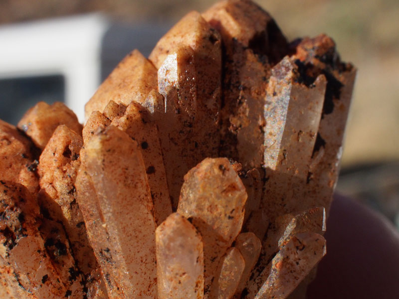
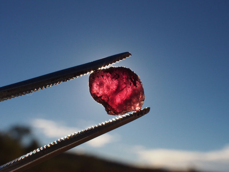
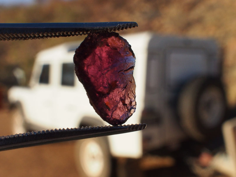
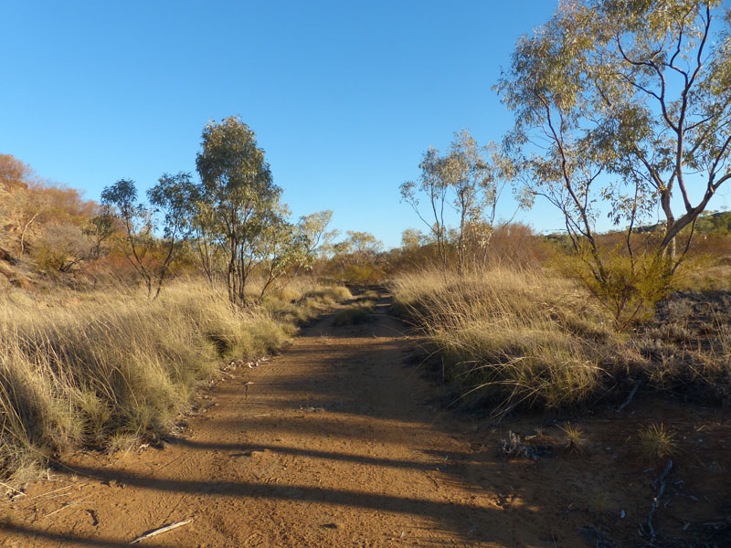
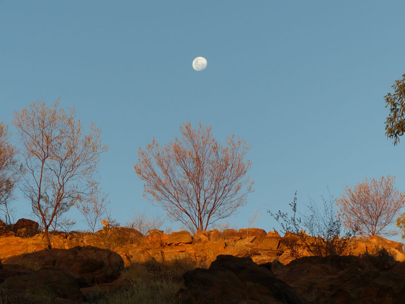 We went for another stroll along the track as the sun set but being below the ridges, we were unable to capture the beautiful sunset
but did get a couple of nice pics of the moon rising over the Eastern ridge. Back at camp and with the sun now out of sight, Don turned
on the torch and to our wonder the ground glistened and sparkled in the dark. Leaving Don outside to put a few things away, I went
inside to boil the billy.
With the billy well and truly boiled and almost gone cold again I wondered what was keeping him. I went outside
and around the front of the Landy to see Don down on all fours with the torch about 2cm from the ground. It was pitch black other than
the small circle of light emanating from the torch.
We went for another stroll along the track as the sun set but being below the ridges, we were unable to capture the beautiful sunset
but did get a couple of nice pics of the moon rising over the Eastern ridge. Back at camp and with the sun now out of sight, Don turned
on the torch and to our wonder the ground glistened and sparkled in the dark. Leaving Don outside to put a few things away, I went
inside to boil the billy.
With the billy well and truly boiled and almost gone cold again I wondered what was keeping him. I went outside
and around the front of the Landy to see Don down on all fours with the torch about 2cm from the ground. It was pitch black other than
the small circle of light emanating from the torch.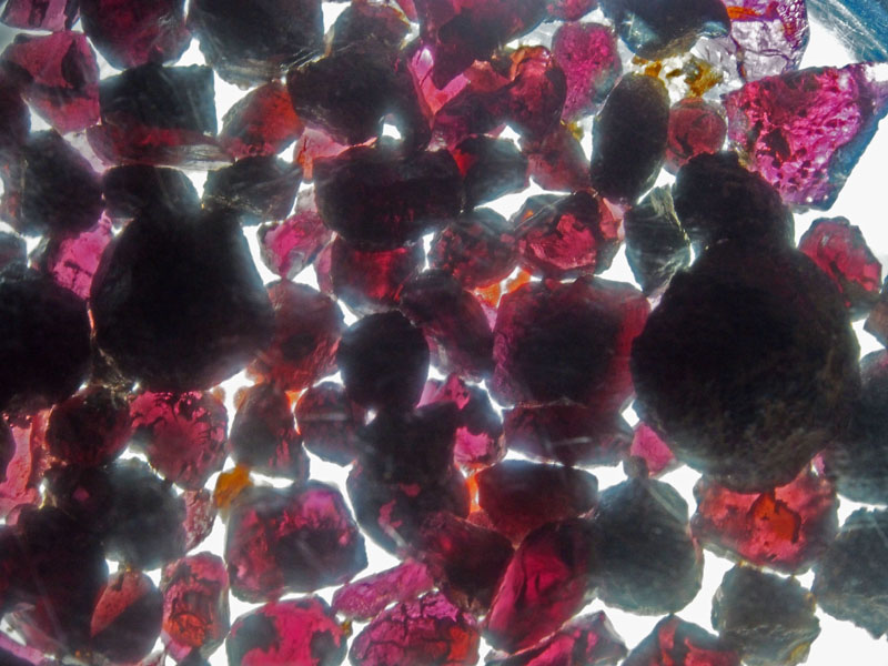
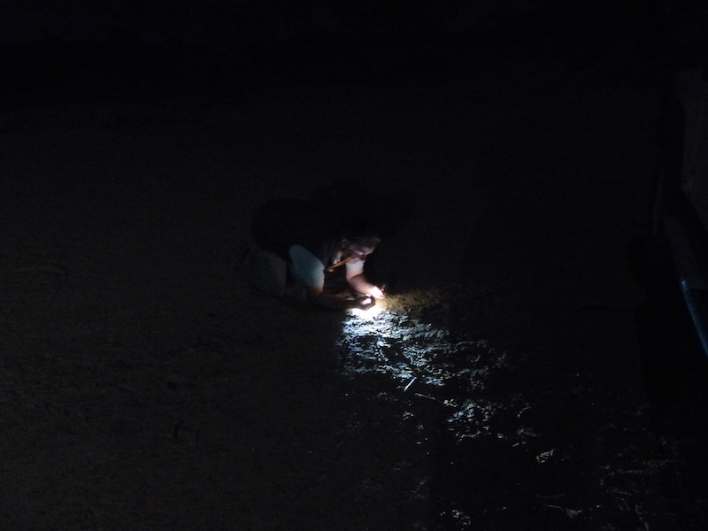 "What have you lost?" I asked. "Nothing……look at all the Garnets I've found" he
exclaimed excitedly, holding up a palm full of little stones. Now I'm keen…………but I think Don has far surpassed me in dedication to
'fossicking'. Back in the van we checked his little 'stash' and he had indeed found Garnets. He put them in a small plastic bag and held
this on top of the torch…..WoW! they looked spectacular, beautiful pink/purple Garnets. Well done Don.
"What have you lost?" I asked. "Nothing……look at all the Garnets I've found" he
exclaimed excitedly, holding up a palm full of little stones. Now I'm keen…………but I think Don has far surpassed me in dedication to
'fossicking'. Back in the van we checked his little 'stash' and he had indeed found Garnets. He put them in a small plastic bag and held
this on top of the torch…..WoW! they looked spectacular, beautiful pink/purple Garnets. Well done Don. Footnote: Yesterday I asked Don to check the buzzing sound at the back of the van and make sure it wasn't wasps. Don did so and said not to worry they were only bees after the water coming from the sullage bucket. I asked him if he could remove the bucket and just let the hose run on the ground so the bees wouldn't congregate there. 'Don't worry about them" he said, "they won't bite you." Today, Don had put the bucket back to catch some water to wash the Garnets and I told him I could hear the bees back again. He didn't confess until tonight, when he needed some 'nursing' that he had been stung by a bee when he went to get the bucket of water. He is now sporting a very irritating bite between his fingers. Life is never dull with Dear Donald.
Saturday 22nd June, Bush Camp, (Cow Paddock about 50km East of Cloncurry) QLD
A beautiful morning followed a beautiful evening. With not a cloud in the evening sky, the moonlight had lit up the area with a soft, warm glow and with the ground dancing and glittering with the Mica it was magical. Don had been keen to take some star photos but needing a dark night to do so, last night was not the night with the moon shining so brightly. There will be plenty more dark nights but not many as magical as this one, so no disappointment putting the star pics on hold.
Don hiked up the ridge early this morning and tied the modem to a tree so we could upload the blog
and check our emails, it worked just as well as the tripod…..(after we realised it wasn't working because
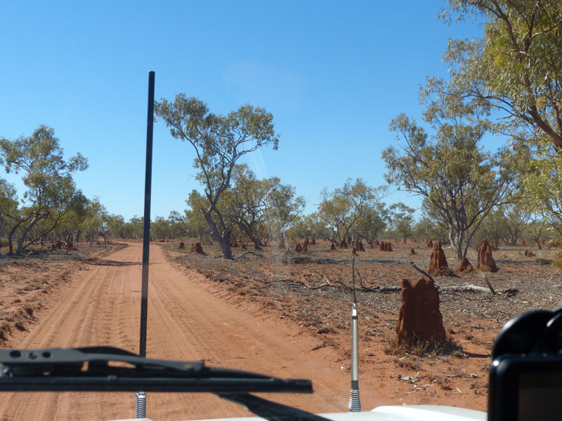 I was sitting in front of the window and blocking the signal). We packed up slowly reluctant to leave but
once again, it was time to move on. With no-one around, it was great to shower outside without the
constrictions of a tent, so I enjoyed a beautiful hot shower whilst Don hiked back up the ridge to get the
modem. With the temperature hitting 36.2° by this time, I felt a bit guilty watching him hike up the rocks
whilst I lathered up but with my ankle still a bit dodgy, it's better I feel guilty than to be on crutches again.
(Having a passion for climbing up and over rocks, I must admit I was envious as well). With Don back
down off the ridge and freshly showered we took one last fossick around before heading off up the track.
I was sitting in front of the window and blocking the signal). We packed up slowly reluctant to leave but
once again, it was time to move on. With no-one around, it was great to shower outside without the
constrictions of a tent, so I enjoyed a beautiful hot shower whilst Don hiked back up the ridge to get the
modem. With the temperature hitting 36.2° by this time, I felt a bit guilty watching him hike up the rocks
whilst I lathered up but with my ankle still a bit dodgy, it's better I feel guilty than to be on crutches again.
(Having a passion for climbing up and over rocks, I must admit I was envious as well). With Don back
down off the ridge and freshly showered we took one last fossick around before heading off up the track.
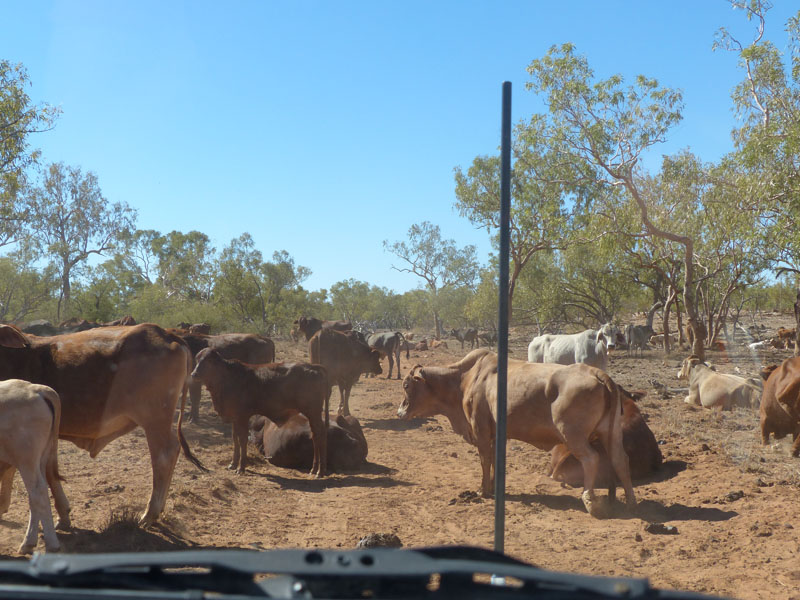
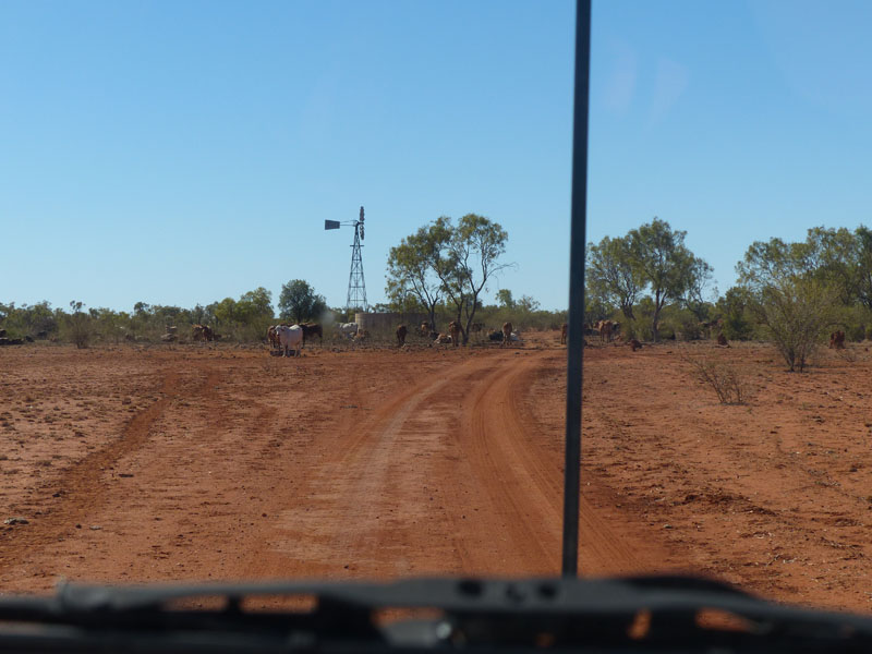 It was nice to see quite a few kangaroos on the way, they didn't seem too perturbed by us driving by and
were quite close to the track. We passed the two herds of cows we had passed on the way down, they
seemed a bit more reluctant to get off the track today, probably because it was much hotter. We waited
for them to get up and stretch before moving off slowly. It's funny, I've grown up around cows but I've never
actually been aware of them stretching before, just like a dog when it wakes and arises. We also observed
one of them scratching its ear with its hind foot. Silly little things that suddenly become noticeable when you
have time to observe them and yet I'm sure we've seen this happen many times before. We just haven't 'seen'
it before.
It was nice to see quite a few kangaroos on the way, they didn't seem too perturbed by us driving by and
were quite close to the track. We passed the two herds of cows we had passed on the way down, they
seemed a bit more reluctant to get off the track today, probably because it was much hotter. We waited
for them to get up and stretch before moving off slowly. It's funny, I've grown up around cows but I've never
actually been aware of them stretching before, just like a dog when it wakes and arises. We also observed
one of them scratching its ear with its hind foot. Silly little things that suddenly become noticeable when you
have time to observe them and yet I'm sure we've seen this happen many times before. We just haven't 'seen'
it before.
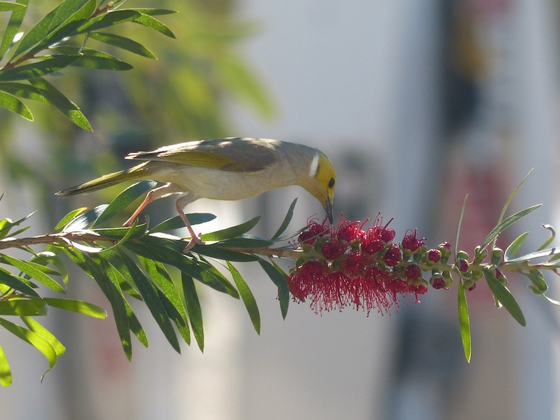 We hit the Landsborough Highway and turned East for McKinley about 50kms on, where we stopped at the
Roadhouse for a quick sandwich. McKinley is home to the Walkabout Creek Hotel which featured in the
Crocodile Dundee movies. Leaving McKinley, we took the Gidyea Bug Byway North, a dirt track in reasonable
condition except for a few corrugations. The landscape along this route was flat and treeless. Absolutely
nothing broke the line of the horizon for quite a few kilometres. This track was around 80km long taking us to
Gilliat where it joined us up with the Flinders Highway (Barkly Highway West of Cloncurry). We reached Gilliat,
and found nothing there but some remnants of a wooden building, an old tin shed and an old rusted 1956
International AS160 truck. Of course this proved a perfect photo opportunity before we crossed over the rail track and
a short distance to the Highway.
We hit the Landsborough Highway and turned East for McKinley about 50kms on, where we stopped at the
Roadhouse for a quick sandwich. McKinley is home to the Walkabout Creek Hotel which featured in the
Crocodile Dundee movies. Leaving McKinley, we took the Gidyea Bug Byway North, a dirt track in reasonable
condition except for a few corrugations. The landscape along this route was flat and treeless. Absolutely
nothing broke the line of the horizon for quite a few kilometres. This track was around 80km long taking us to
Gilliat where it joined us up with the Flinders Highway (Barkly Highway West of Cloncurry). We reached Gilliat,
and found nothing there but some remnants of a wooden building, an old tin shed and an old rusted 1956
International AS160 truck. Of course this proved a perfect photo opportunity before we crossed over the rail track and
a short distance to the Highway.
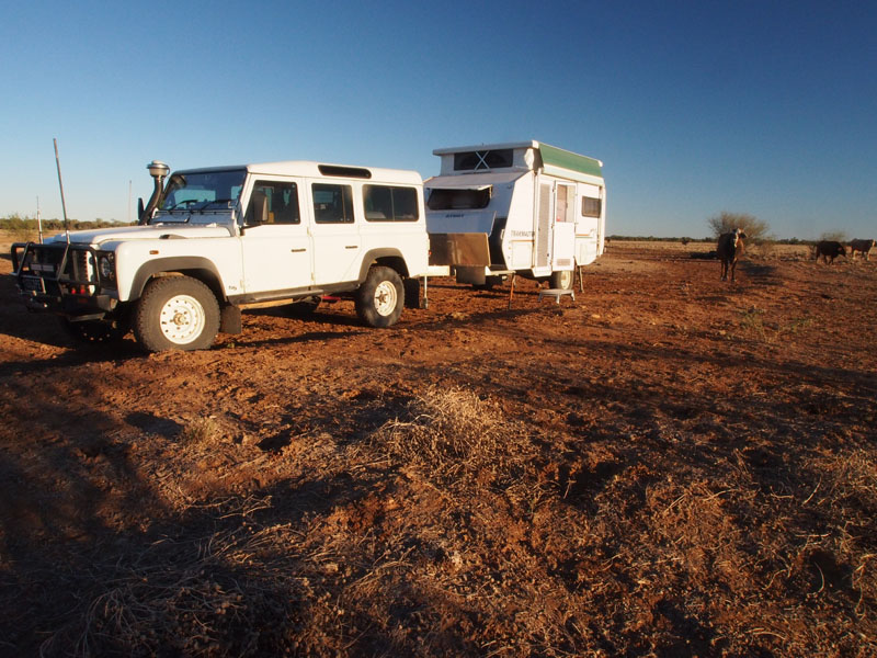
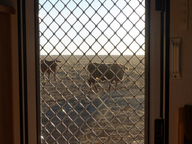
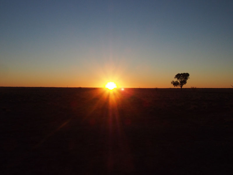
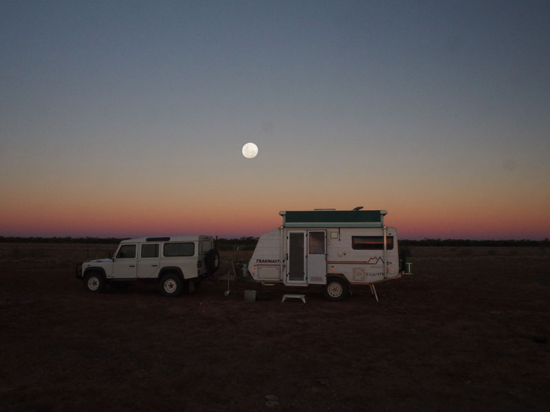
Sunday 23rd June, Cloncurry, QLD
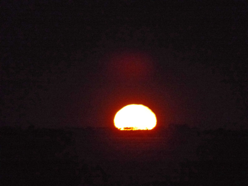 What a winter solstice this was…….I was up at 0630 and saw my first ever 'moonset' with the largest, brightest, orange moon slowly
descending below the horizon. When I first went outside, I saw this huge orange ball just above the horizon and having just woken
up I confusedly thought it was the sun rising, then realised it was 'rising' in the West. As I gazed at it, I realised it was descending, not
rising.
What a winter solstice this was…….I was up at 0630 and saw my first ever 'moonset' with the largest, brightest, orange moon slowly
descending below the horizon. When I first went outside, I saw this huge orange ball just above the horizon and having just woken
up I confusedly thought it was the sun rising, then realised it was 'rising' in the West. As I gazed at it, I realised it was descending, not
rising.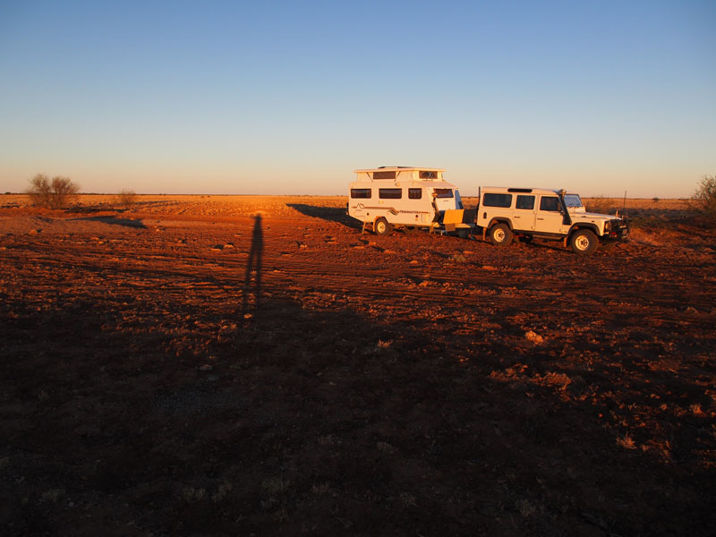 Grabbing my camera I managed to capture it as it slipped below the horizon. In the East, the horizon was just a big orange glow,
with the sun yet to rise in about half an hour.
Grabbing my camera I managed to capture it as it slipped below the horizon. In the East, the horizon was just a big orange glow,
with the sun yet to rise in about half an hour. As we were only about an hour from Cloncurry where we will stay for a couple of days, we continued South down the track where we had camped for 5kms to the Oorindi Railway Siding. Enroute we passed one little Bustard strolling casually across the road with his head held aloft, regally. They don't seem to frighten easily.
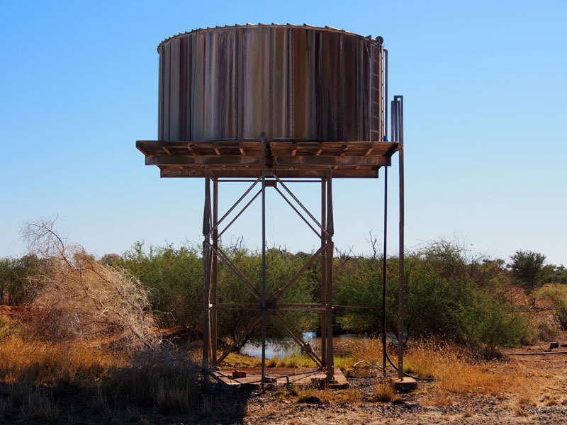 We arrived at Oorindi and found heaps of good stuff to keep us pottering around for about an hour. There was a small lagoon that
attracted a lot of small birdlife, which captured my attention for awhile as I watched them darting about. As usual, Don had headed
off in a different direction to fossick about all the old 'junk'.
We arrived at Oorindi and found heaps of good stuff to keep us pottering around for about an hour. There was a small lagoon that
attracted a lot of small birdlife, which captured my attention for awhile as I watched them darting about. As usual, Don had headed
off in a different direction to fossick about all the old 'junk'.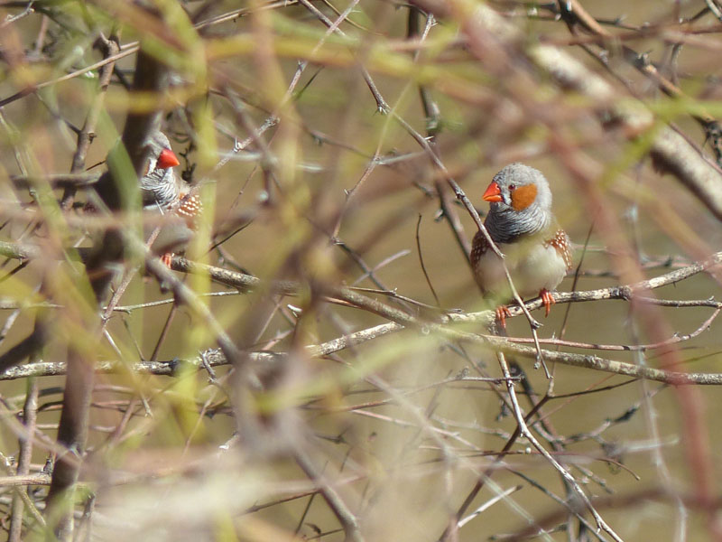 We are always anxious at the end of the day to view each other's photos.
Although we are both at the same place, we don't always 'see' the same things (quite often we do and photograph the same thing
in the same way, which is always amusing) but it is always a highlight to look at our photos at the end of the day and 'see' the things
each of us had missed. We are also anxious to impress each other with our 'finds' and at one time when we 'crossed paths', we both
had our fist clenched and smiles on our faces……..who was going to have the best treasure? I opened mine first to produce some
good heavy duty bolts and a really handy steel 'round thing'…..Don was impressed. Then he opened his fist and produced some
great rock specimens he had found in the ballast along the track……I was impressed. Score one for each of us.
We are always anxious at the end of the day to view each other's photos.
Although we are both at the same place, we don't always 'see' the same things (quite often we do and photograph the same thing
in the same way, which is always amusing) but it is always a highlight to look at our photos at the end of the day and 'see' the things
each of us had missed. We are also anxious to impress each other with our 'finds' and at one time when we 'crossed paths', we both
had our fist clenched and smiles on our faces……..who was going to have the best treasure? I opened mine first to produce some
good heavy duty bolts and a really handy steel 'round thing'…..Don was impressed. Then he opened his fist and produced some
great rock specimens he had found in the ballast along the track……I was impressed. Score one for each of us.
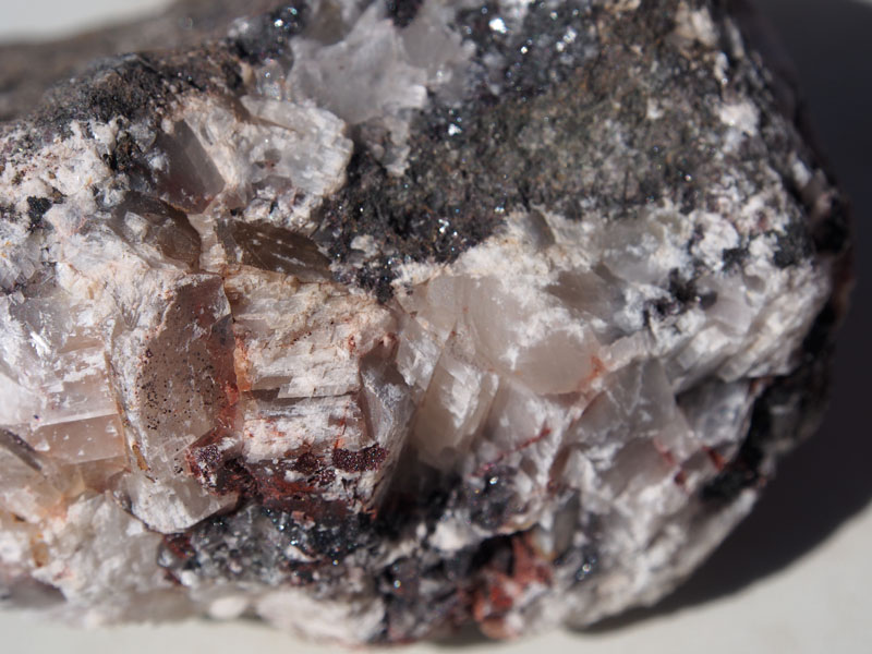
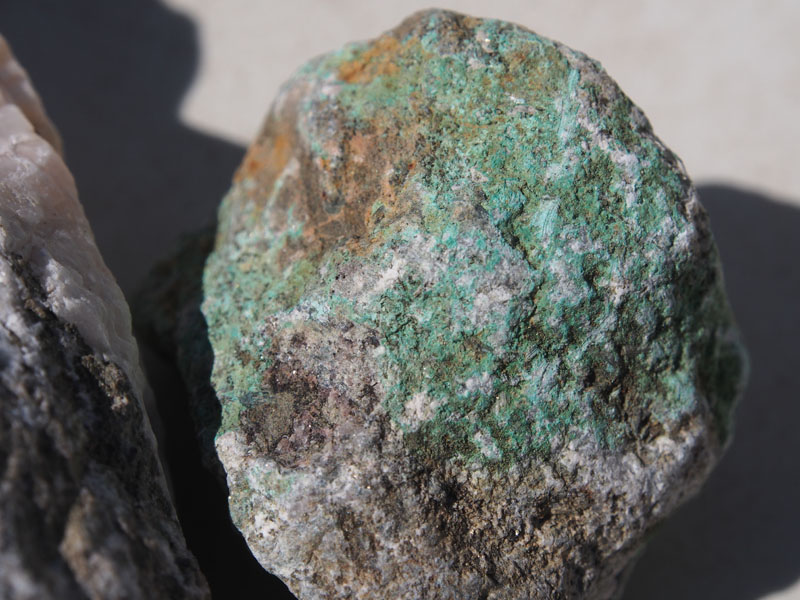
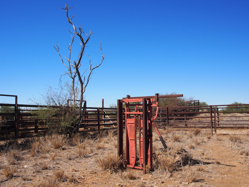 Fast forward to this morning………as we were driving out of Oorindi, I noticed a Cattle Crush that looked interesting and suggested
Don might like to take a quick photo. He arrived back at the Landy all smiles holding a very handy, but very heavy, small anvil in his
hand. "Look at this little beauty I found buried in the ground" he said, really pleased with himself. "I knew you'd like this" he continued. He was right, I did like it.
He already had the back door of the Landy opened and the anvil neatly stashed as he uttered….."Well, seeing you want this, you'll
have to find some more things of yours to toss out to make up for the extra weight". I must admit he caught me by surprise, I should
have seen that one coming. I have one pair of shoes left, two t/shirts and one pair of pants and I'm hanging on to them!!
Fast forward to this morning………as we were driving out of Oorindi, I noticed a Cattle Crush that looked interesting and suggested
Don might like to take a quick photo. He arrived back at the Landy all smiles holding a very handy, but very heavy, small anvil in his
hand. "Look at this little beauty I found buried in the ground" he said, really pleased with himself. "I knew you'd like this" he continued. He was right, I did like it.
He already had the back door of the Landy opened and the anvil neatly stashed as he uttered….."Well, seeing you want this, you'll
have to find some more things of yours to toss out to make up for the extra weight". I must admit he caught me by surprise, I should
have seen that one coming. I have one pair of shoes left, two t/shirts and one pair of pants and I'm hanging on to them!!
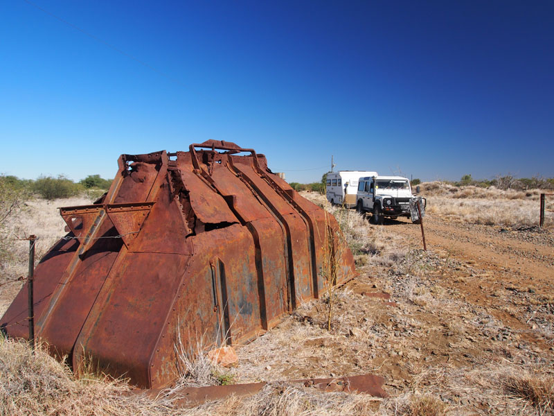
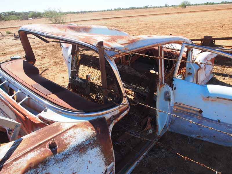
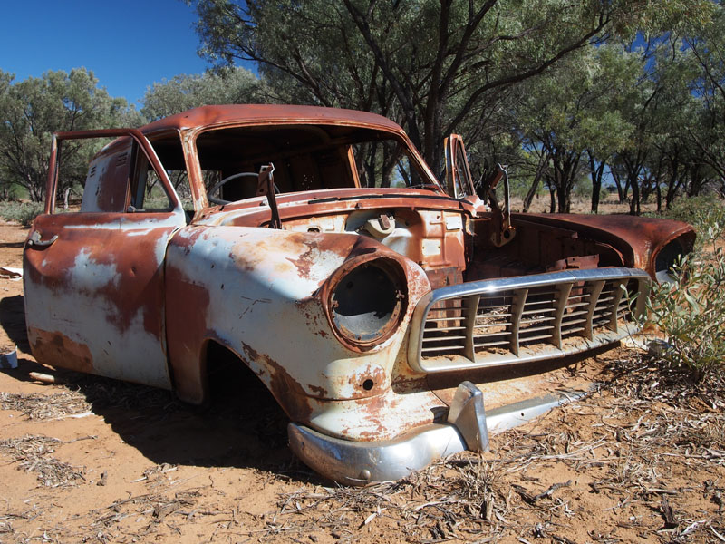
 As we drew closer and
the birds took flight we saw a large ginger feral cat rush from the carcass into the grass. Unusual sight to see cat and bird feasting together.
We arrived in Cloncurry, booked into a Park and set up quickly then headed down the street to get some lunch and have a quick look around
town. On the way back to camp we were lucky enough to reach the Rail Crossing just as a huge freight train was due to pull out. We pulled
over right near the track and got some great photos as it went past. There were two engines in front, followed by one passenger car then 92
Ore Wagons behind with an extra engine located in the middle of these. Oresome!! (Sorry, corny but I couldn't resist it) The train took 5 mins
to pass by. Great for us but not so great for those waiting to cross over.
As we drew closer and
the birds took flight we saw a large ginger feral cat rush from the carcass into the grass. Unusual sight to see cat and bird feasting together.
We arrived in Cloncurry, booked into a Park and set up quickly then headed down the street to get some lunch and have a quick look around
town. On the way back to camp we were lucky enough to reach the Rail Crossing just as a huge freight train was due to pull out. We pulled
over right near the track and got some great photos as it went past. There were two engines in front, followed by one passenger car then 92
Ore Wagons behind with an extra engine located in the middle of these. Oresome!! (Sorry, corny but I couldn't resist it) The train took 5 mins
to pass by. Great for us but not so great for those waiting to cross over.
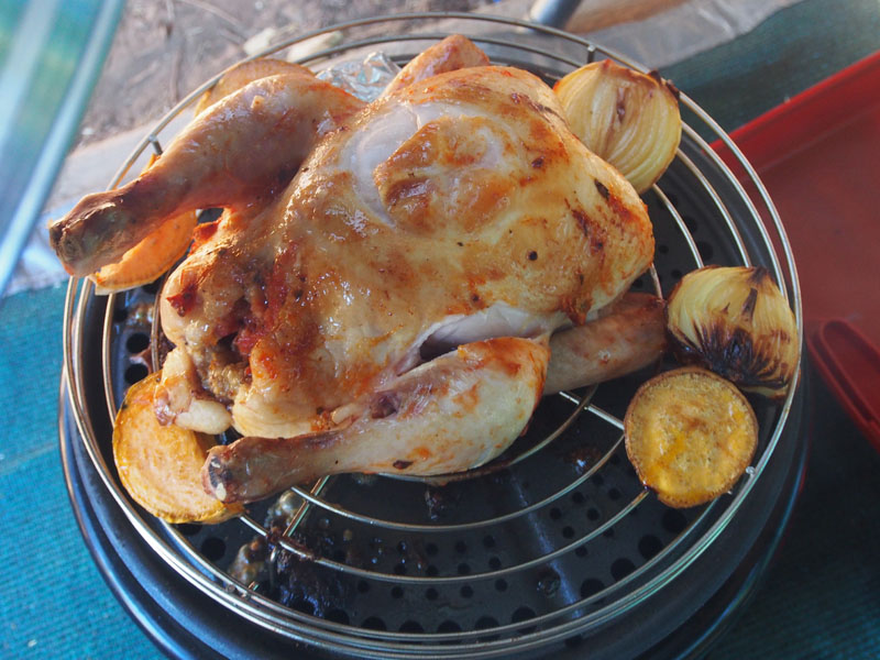
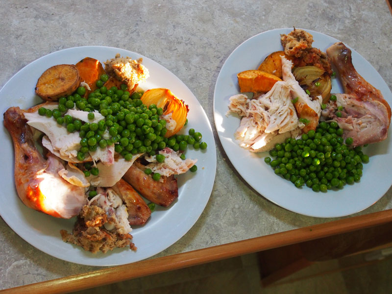 Back at camp we got our washing out of the way, filled up our water tanks then checked out what we would do over the next couple of days.
With chores done, Don set up the Cobb Cooker and I busied myself stuffing the chook. A big thanks to Don's family for this really handy gift.
Oh, and what did Don do whilst I was preparing the chicken?…………….straightened some tent pegs on 'my' new anvil.
Back at camp we got our washing out of the way, filled up our water tanks then checked out what we would do over the next couple of days.
With chores done, Don set up the Cobb Cooker and I busied myself stuffing the chook. A big thanks to Don's family for this really handy gift.
Oh, and what did Don do whilst I was preparing the chicken?…………….straightened some tent pegs on 'my' new anvil.
Monday 24th June, Cloncurry, QLD
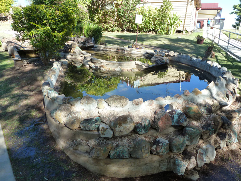
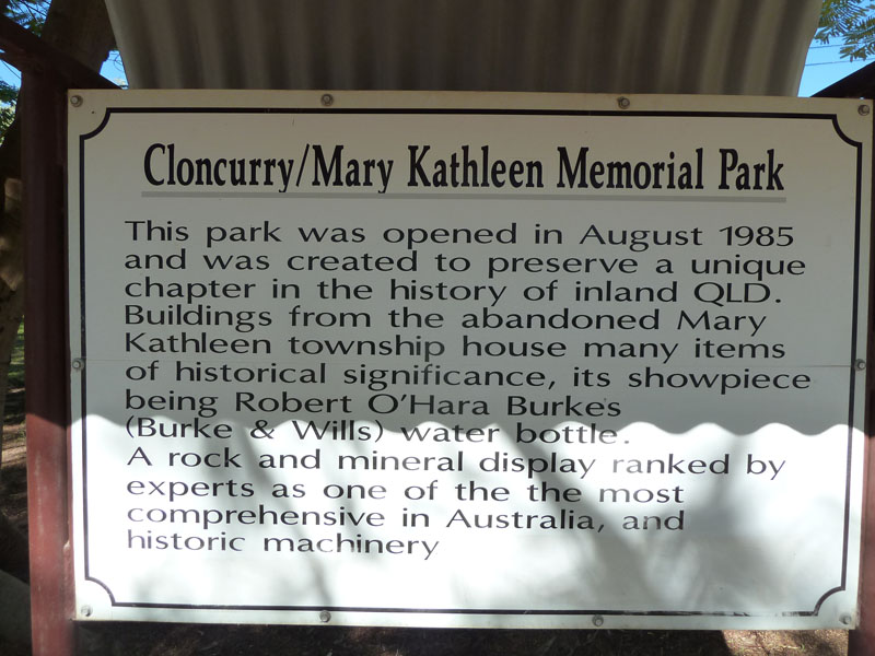 This morning we headed down to the Mary Kathleen Mine Museum which is attached to the Visitor's
Centre. The Mary Kathleen Museum was excellent as a Museum but a bit disappointing in the memorabilia
of the actual Mary Kathleen Township and Mining operations. The rock and mineral display was
extensive and well presented in large show cases. Displays in the outdoor area of the Park included
Steam Engines, a McLaren Traction Engine, farm and mining machinery and the unique 1941 Ford V8
Rail Ambulance which was used when roads were impassable, operating from 1956 until 1971.
This morning we headed down to the Mary Kathleen Mine Museum which is attached to the Visitor's
Centre. The Mary Kathleen Museum was excellent as a Museum but a bit disappointing in the memorabilia
of the actual Mary Kathleen Township and Mining operations. The rock and mineral display was
extensive and well presented in large show cases. Displays in the outdoor area of the Park included
Steam Engines, a McLaren Traction Engine, farm and mining machinery and the unique 1941 Ford V8
Rail Ambulance which was used when roads were impassable, operating from 1956 until 1971.
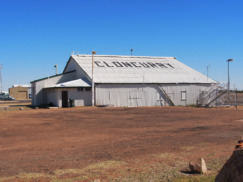 Cloncurry has a rich history of early pioneers forging their way in the Outback to build a township
based on Pastoral and Mining operations, with ups and downs of both. Burke & Wills with King & Gray,
were the first known Europeans to come into the area on their ill-fated expedition to the Gulf of Carpentaria.
Cloncurry is also the base for the establishment of the Royal Flying Doctor Service in 1928 with the original
Qantas hanger still in use at the Airport. The railway reached Cloncurry in 1907 and still remains an important
railway town today.
Cloncurry has a rich history of early pioneers forging their way in the Outback to build a township
based on Pastoral and Mining operations, with ups and downs of both. Burke & Wills with King & Gray,
were the first known Europeans to come into the area on their ill-fated expedition to the Gulf of Carpentaria.
Cloncurry is also the base for the establishment of the Royal Flying Doctor Service in 1928 with the original
Qantas hanger still in use at the Airport. The railway reached Cloncurry in 1907 and still remains an important
railway town today.
After lunch we drove out to the Airport to check out the Qantas Hanger but were disappointed to find it is 'still in use' but not as a hanger, more of a storage shed. Next we headed out to Chinaman Creek Dam, only a few kms from the township. The Dam was constructed in 1994 as a primary watercourse for Cloncurry. Prior to this, the town relied upon wells and bores in the Cloncurry River. The area was most interesting because of the variety of rocks on and around Mount Leviathan, the large 'hill' that stands impressively over the dam. We picked up one rock only, about palm-size, that weighed almost as much as Don's (I mean My) anvil, it being ironstone. We had a bit of fun driving over the mounds and tracks around the base of Mount Leviathan then headed back to town to stock up on our supplies.
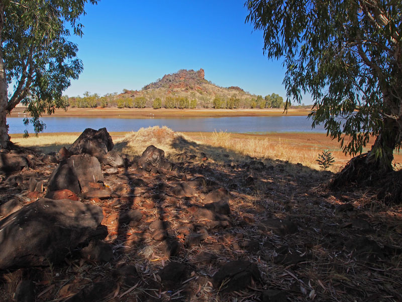
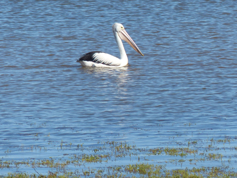
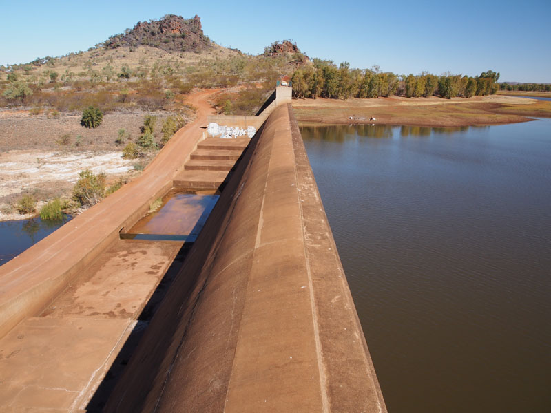
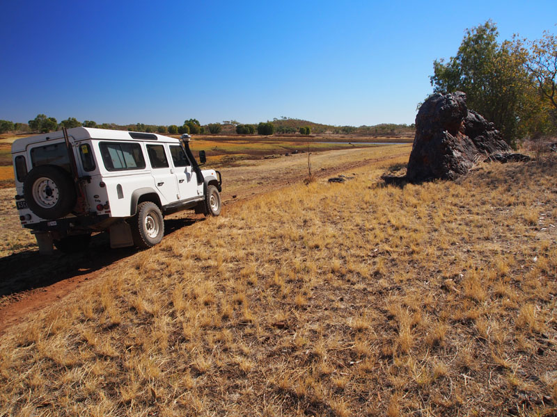
Tuesday 25th June, Bush Camp (Somewhere between Malbon & Toolebuc), QLD
 We fuelled up and headed West out of Cloncurry a couple of kms before turning South on the road
to Dajarra. We hadn't been on this road long before another feral cat darted across the road in front
of us. We continued South for 45kms before turning East to Malbon, a ramshackle couple of dwellings
and that's about it. We passed Malbon and took the track to the old Smelter and abandoned township
of Kuridala, established in 1906. The township was originally called 'Friezland' and at its height, was
the largest community in the district, with around 2000 residents. The town underwent a name change
during World War 1, replacing the German sounding name of Friezland with Kuridala. The smelter
eventually closed down in the 1920's and most of the equipment sold off to the early Mines that would
become the Mining province of Mount Isa.
We fuelled up and headed West out of Cloncurry a couple of kms before turning South on the road
to Dajarra. We hadn't been on this road long before another feral cat darted across the road in front
of us. We continued South for 45kms before turning East to Malbon, a ramshackle couple of dwellings
and that's about it. We passed Malbon and took the track to the old Smelter and abandoned township
of Kuridala, established in 1906. The township was originally called 'Friezland' and at its height, was
the largest community in the district, with around 2000 residents. The town underwent a name change
during World War 1, replacing the German sounding name of Friezland with Kuridala. The smelter
eventually closed down in the 1920's and most of the equipment sold off to the early Mines that would
become the Mining province of Mount Isa.
 We located the site of the old Cemetery, which is now classified as an historical site, this is one of the
largest pioneering cemeteries in the District. The gate to the Cemetery was locked with a small sign
stating No Entry. This may have been put there to preserve the site but it is over-grown and the fence
surrounding it would not keep people out if they wished to look at the graves. Better to leave the gate
open and allow people to walk through than to risk damage climbing over the fence. Also, the grass
would probably be kept down by the people tracking around the site. But, we obeyed the rule and
kept outside the fence. Pity, although we are not 'cemetery tourists', I'm sure it would be of interest to
others that are. As it is, it is over-grown and of significance only to a few who probably never visit it.
We located the site of the old Cemetery, which is now classified as an historical site, this is one of the
largest pioneering cemeteries in the District. The gate to the Cemetery was locked with a small sign
stating No Entry. This may have been put there to preserve the site but it is over-grown and the fence
surrounding it would not keep people out if they wished to look at the graves. Better to leave the gate
open and allow people to walk through than to risk damage climbing over the fence. Also, the grass
would probably be kept down by the people tracking around the site. But, we obeyed the rule and
kept outside the fence. Pity, although we are not 'cemetery tourists', I'm sure it would be of interest to
others that are. As it is, it is over-grown and of significance only to a few who probably never visit it.
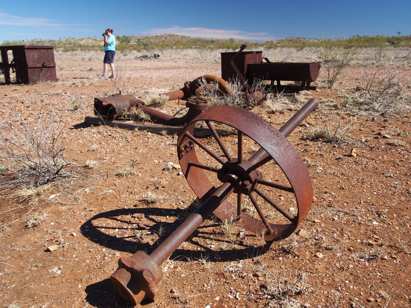
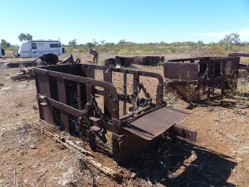
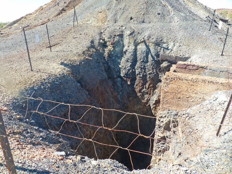
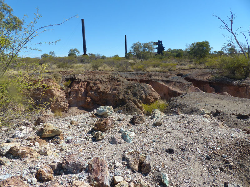
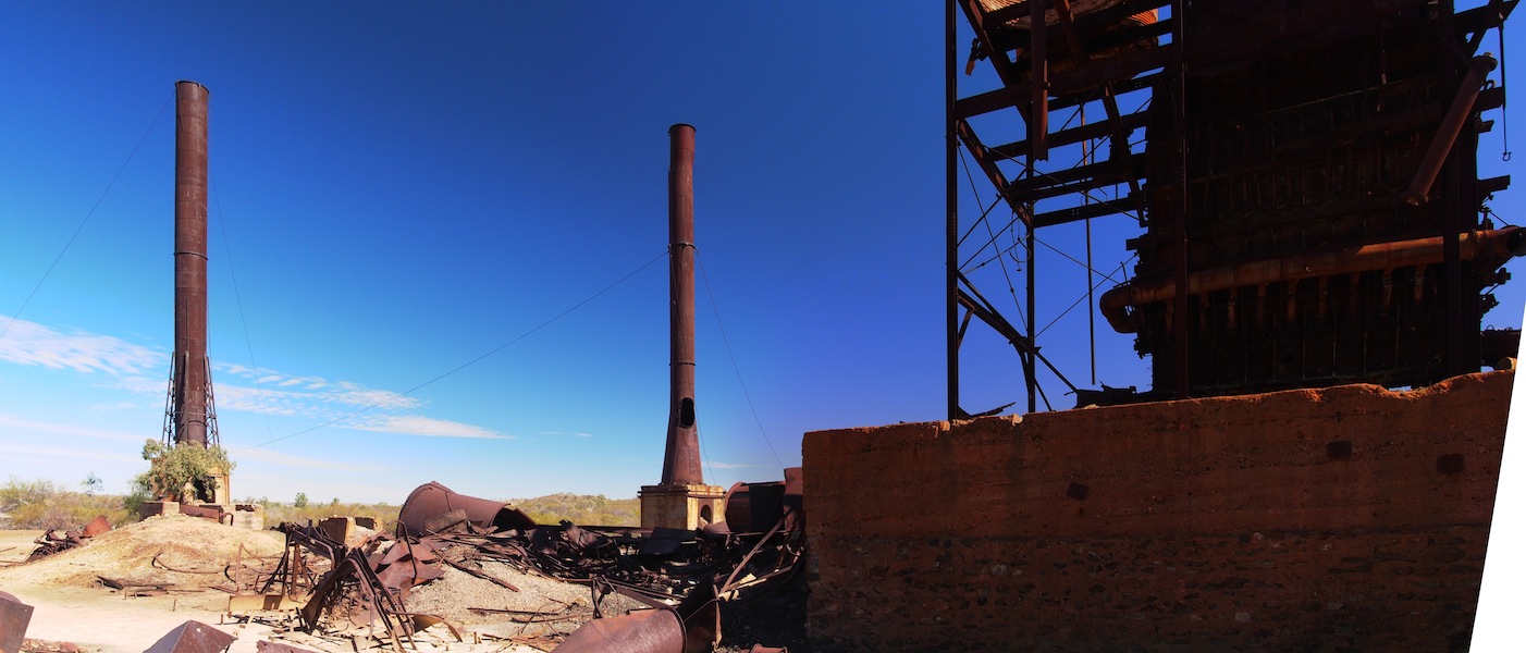
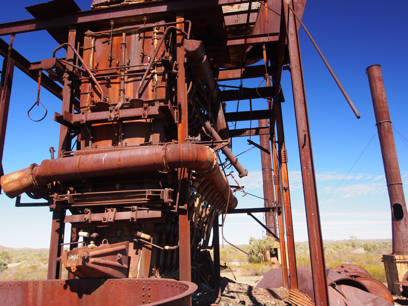
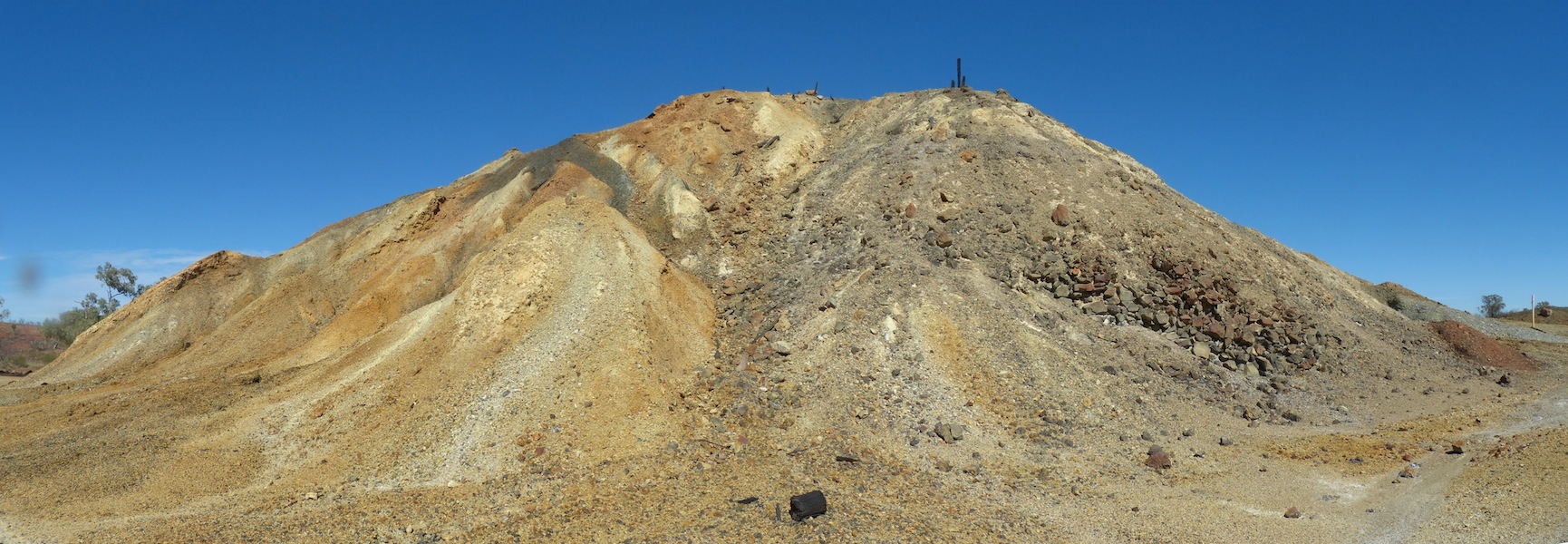
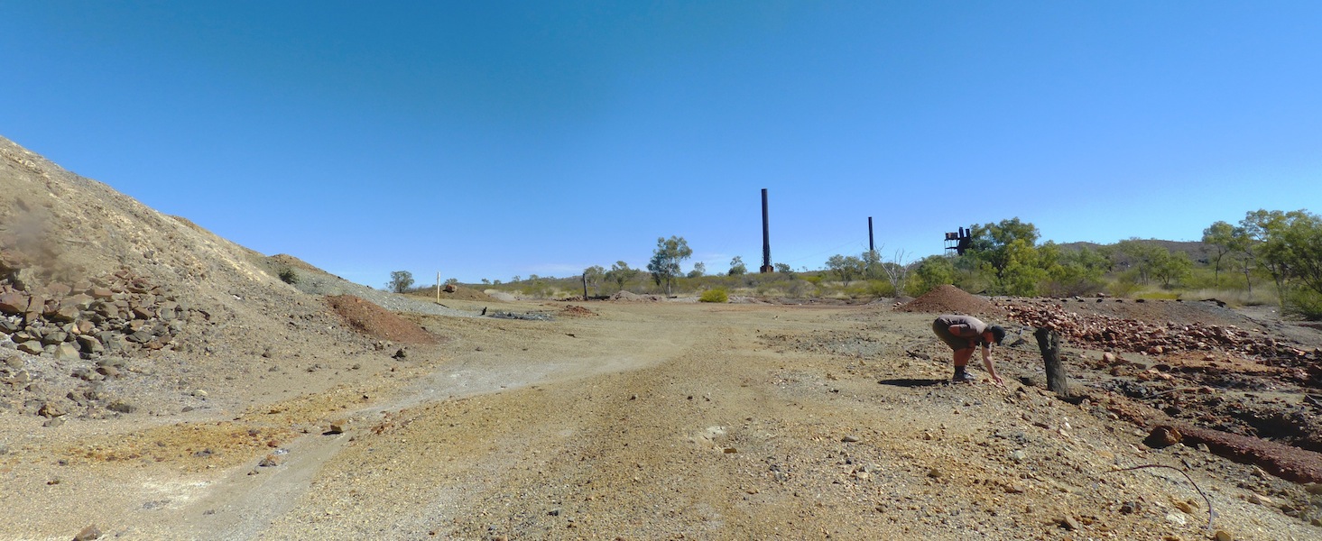
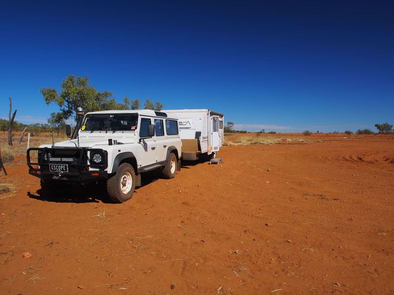
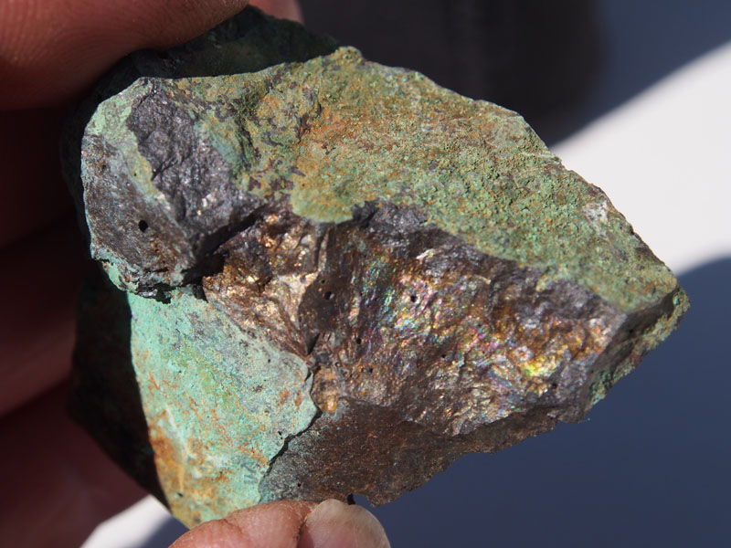
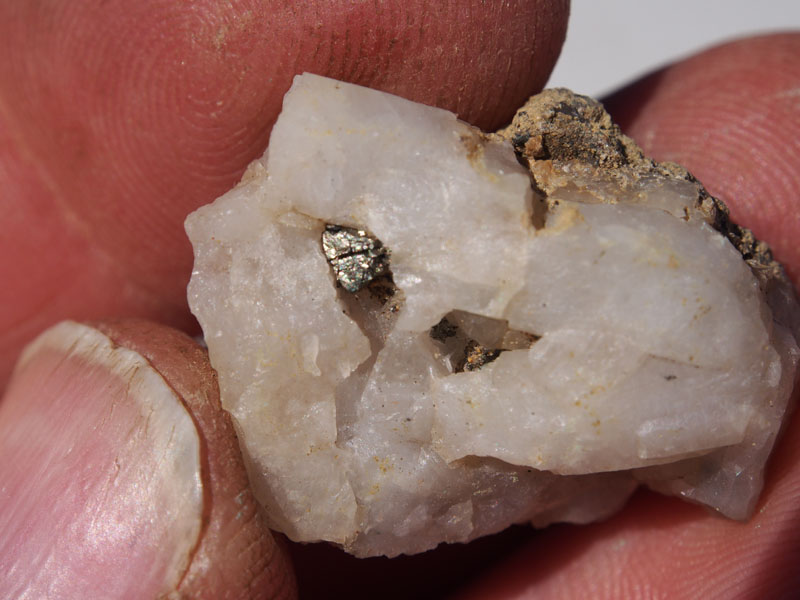
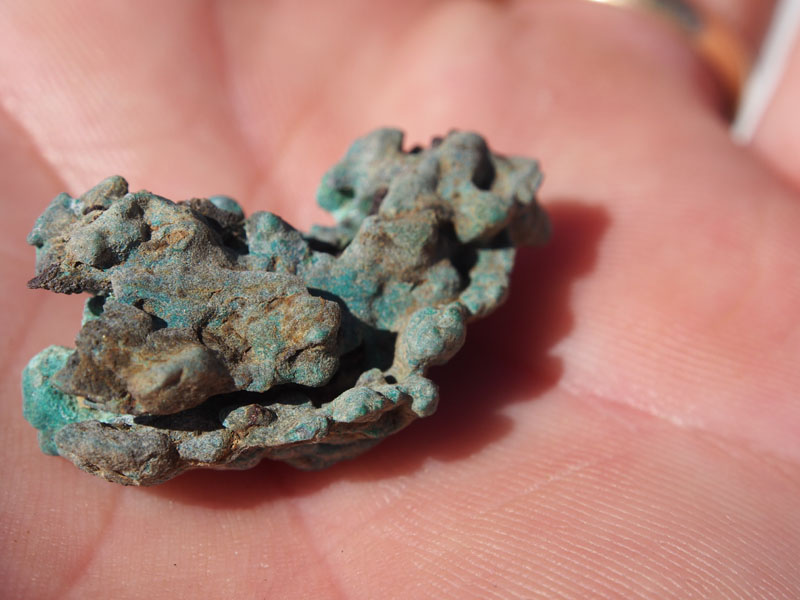
 When we approached the area with still quite a few Mines in operation, the tracks became a bit confusing.
There were no sign posts on most of the forks and one fork had a large regular sign board giving the totally
wrong directions. It pays to know which direction you need to be heading. Once again we went by our gut
and found we were on the right track. The 'Private Mining Roads' were always well maintained and most
times ran parallel with our 'bumpy, corrugated' track. Driving through this Mining area was a bit 'spooky'.
The atmosphere seemed different, quite a few ghost gums were dying and fire had swept through the hills
in various places.
When we approached the area with still quite a few Mines in operation, the tracks became a bit confusing.
There were no sign posts on most of the forks and one fork had a large regular sign board giving the totally
wrong directions. It pays to know which direction you need to be heading. Once again we went by our gut
and found we were on the right track. The 'Private Mining Roads' were always well maintained and most
times ran parallel with our 'bumpy, corrugated' track. Driving through this Mining area was a bit 'spooky'.
The atmosphere seemed different, quite a few ghost gums were dying and fire had swept through the hills
in various places.  We passed the Mines Office and Camp which was quite a big complex then further on
the Airstrip. Our map had stated that this Mine was abandoned but there are quite a few working Mines in
this area.
We passed the Mines Office and Camp which was quite a big complex then further on
the Airstrip. Our map had stated that this Mine was abandoned but there are quite a few working Mines in
this area.The only wildlife we spotted along this track were two Kangaroos, who hopped a short distance away but didn't seem to be too frightened of us. We had stopped quite a few times to potter around, so it was soon time to keep our eye out for a good spot to camp. Being so far away from anything here, Don is hoping he may get a chance to take some star pics tonight.
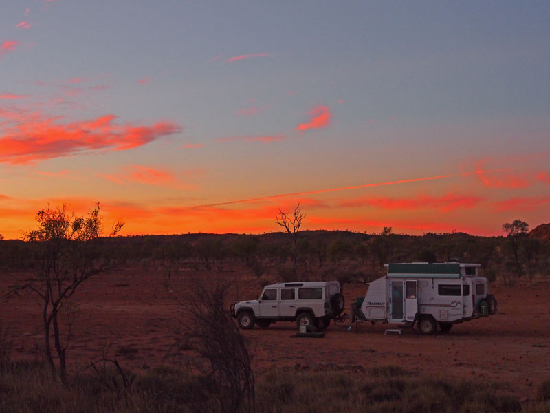
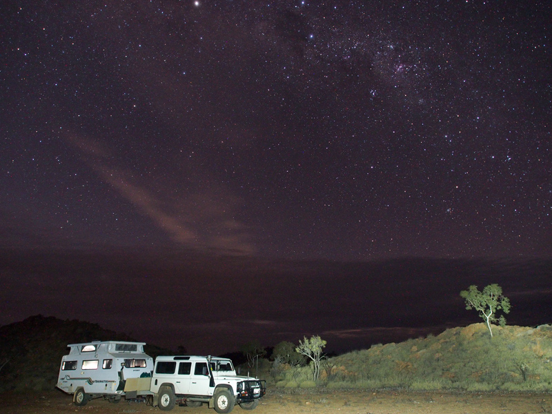
Wednesday 26th June, Bush Camp (Hamilton River), QLD
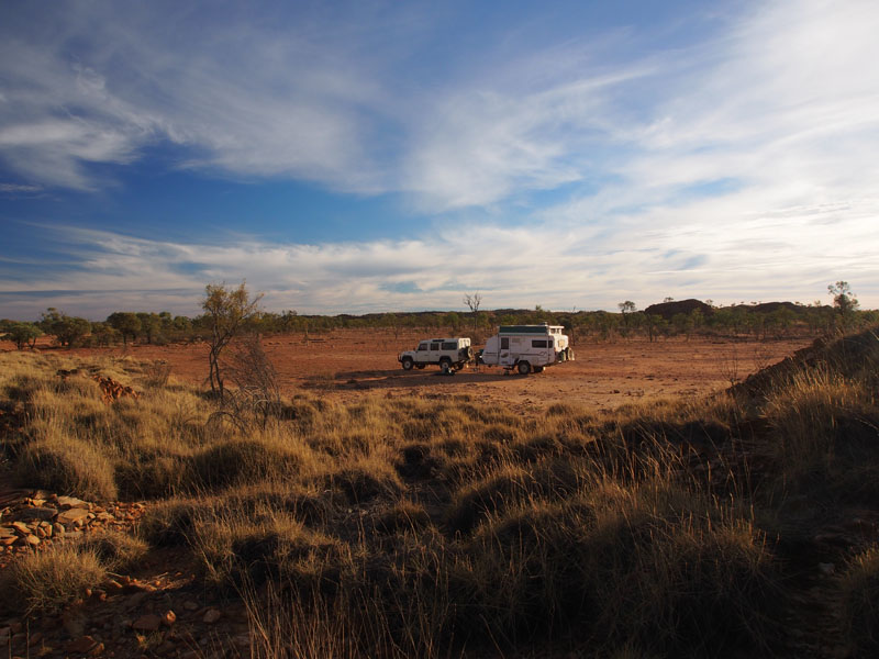
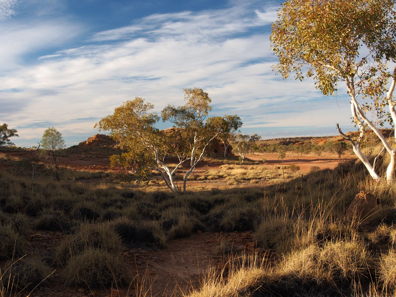 The camp last night was excellent, a nice open spot but well protected from the wind with a high ridge
running in a semi circle around it. The moon was large and full, bathing the campsite in bright moonlight
but Don managed to get a couple of star pics before it illuminated fully. We packed up and continued on
South East. Such interesting landscape with large rocky escarpments, weathered and cracked and forming
the most odd shapes. Large natural caves carved their way into the rock face just waiting to be explored.
There were plenty of healthy looking kangaroos about but not much other wildlife except a pair of large emus.
The camp last night was excellent, a nice open spot but well protected from the wind with a high ridge
running in a semi circle around it. The moon was large and full, bathing the campsite in bright moonlight
but Don managed to get a couple of star pics before it illuminated fully. We packed up and continued on
South East. Such interesting landscape with large rocky escarpments, weathered and cracked and forming
the most odd shapes. Large natural caves carved their way into the rock face just waiting to be explored.
There were plenty of healthy looking kangaroos about but not much other wildlife except a pair of large emus.
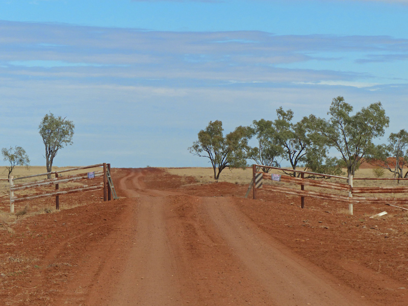
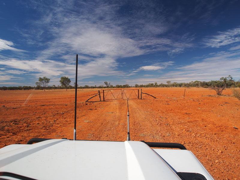 The track was a little bit ordinary in parts enroute to Toolebuc but once we turned South it improved immensely.
Toolebuc is not a community but a Station and provides a good reference point for the turn South. We found a
nice spot to have lunch, then did our usual fossick around before heading off again. We left the Selwyn Range
behind and came out into flat open plains. The horizon flat and treeless. There were many cattle gates along
this route, so Don got plenty of practice with his 'Royal' wave as he drove through. One gate was particularly
difficult to get unlocked as the wire was rusty and had been threaded through the gate incorrectly, I was so
engrossed in getting it shut correctly that once done, I looked up to find I was on the wrong side of the gate……
DUH !!! Of course this took twice as long to shut the gate. Did Don notice…….Nope! He was merrily chewing
on a lolly and gazing about the landscape when I finally got back into the Landy.
The track was a little bit ordinary in parts enroute to Toolebuc but once we turned South it improved immensely.
Toolebuc is not a community but a Station and provides a good reference point for the turn South. We found a
nice spot to have lunch, then did our usual fossick around before heading off again. We left the Selwyn Range
behind and came out into flat open plains. The horizon flat and treeless. There were many cattle gates along
this route, so Don got plenty of practice with his 'Royal' wave as he drove through. One gate was particularly
difficult to get unlocked as the wire was rusty and had been threaded through the gate incorrectly, I was so
engrossed in getting it shut correctly that once done, I looked up to find I was on the wrong side of the gate……
DUH !!! Of course this took twice as long to shut the gate. Did Don notice…….Nope! He was merrily chewing
on a lolly and gazing about the landscape when I finally got back into the Landy.
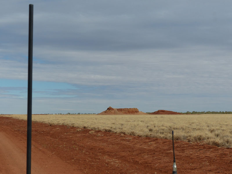
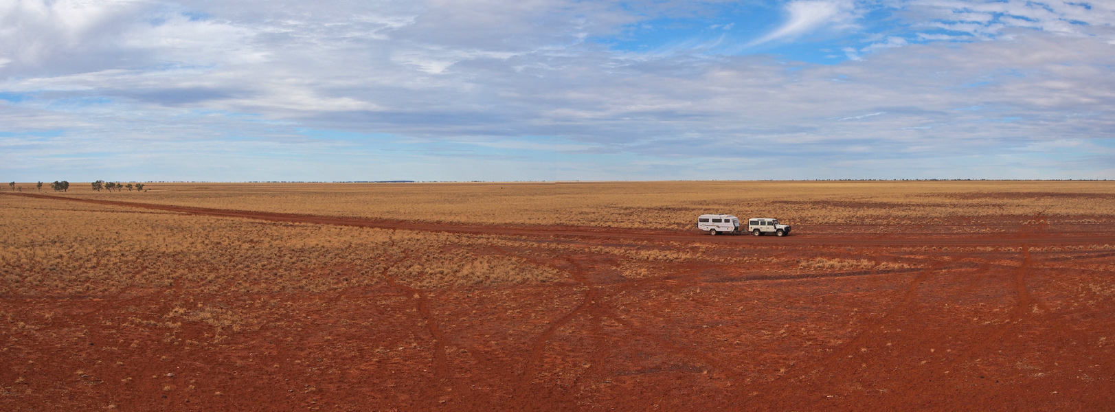
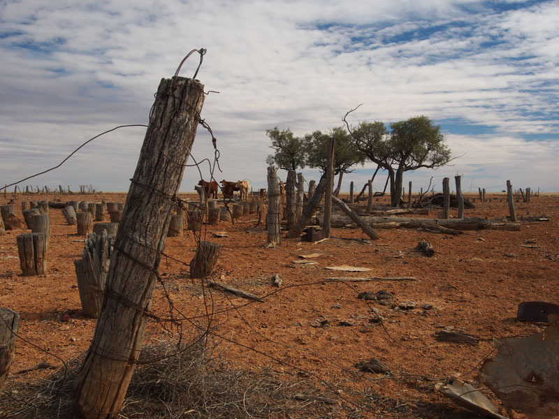
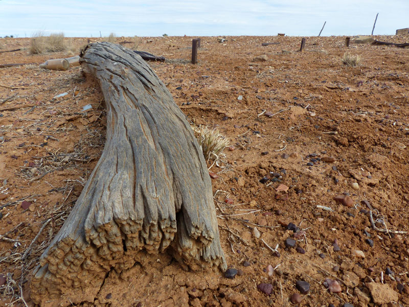
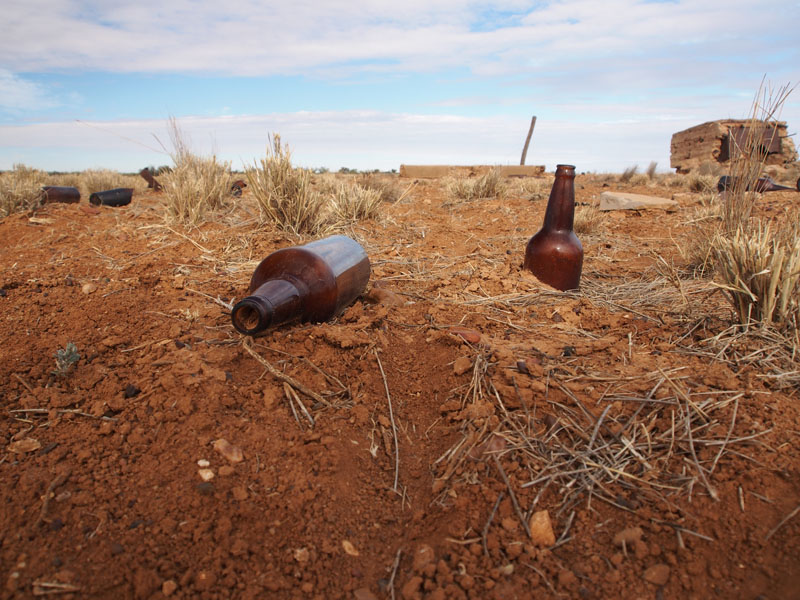
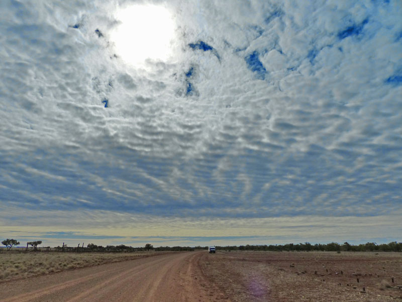
Hitting the road again, it wasn't long before we arrived at the Hamilton Hotel Ruins (famous for the area where
the MIn Min lights have been sighted). The ruins were a disappointment, just a small section of a stone fireplace,
albeit made from beautiful local stones and petrified wood. The disappointment was that it was necessary for this
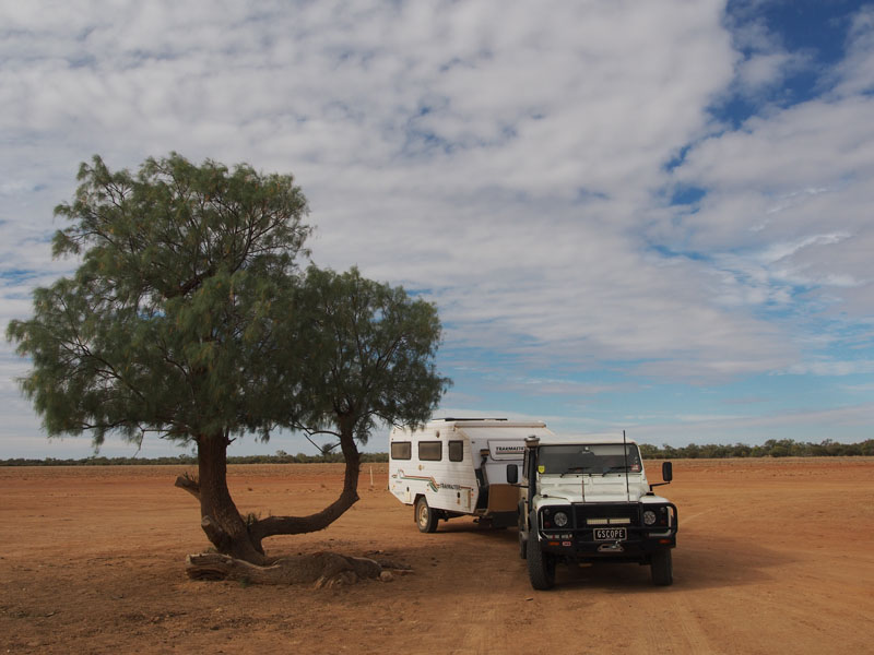
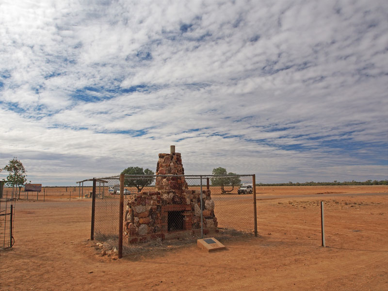
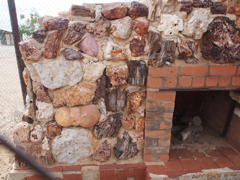 historical fireplace to be surrounded by a high wire mesh fence, obviously to protect it. Unlike the cemetery, in this
instance, we heartily agree. The plaque explaining the site had been stolen; without the fence, we're sure it wouldn't
be long before all the stones were stolen also. Why can't people enjoy these sites and leave them as they find them
so other people can also enjoy them? After seeing this, maybe we will change our mind about the fence surrounding
the cemetery. Even though Don and I have a Fossicker's Licence, it is usual for us to take only one or two specimens.
At the Mine site at Kuridala we could have filled a ten ton truck but chose instead to take just two small rocks, because
of their beauty, not their value. The value lies in being able to see these beautiful rocks and minerals in their natural
environment; seeing how and where they form is of most interest. (Soap box has now been packed away….sorry).
historical fireplace to be surrounded by a high wire mesh fence, obviously to protect it. Unlike the cemetery, in this
instance, we heartily agree. The plaque explaining the site had been stolen; without the fence, we're sure it wouldn't
be long before all the stones were stolen also. Why can't people enjoy these sites and leave them as they find them
so other people can also enjoy them? After seeing this, maybe we will change our mind about the fence surrounding
the cemetery. Even though Don and I have a Fossicker's Licence, it is usual for us to take only one or two specimens.
At the Mine site at Kuridala we could have filled a ten ton truck but chose instead to take just two small rocks, because
of their beauty, not their value. The value lies in being able to see these beautiful rocks and minerals in their natural
environment; seeing how and where they form is of most interest. (Soap box has now been packed away….sorry).
Whilst we were looking at the ruins, the stillness was broken by a guy in one of the vans, using
a chainsaw to cut up some wood…….YES!!!! A CHAINSAW!!! There is so much dead wood laying about you could
camp out here for five years and have the fire burning 24hrs a day and still not run out. Twigs for little fires, logs for
big ones, take your pick, they are all around.
There were already three vans at the ruins so we headed East for a few kms to the Hamilton River where we found
a nice spot to camp.
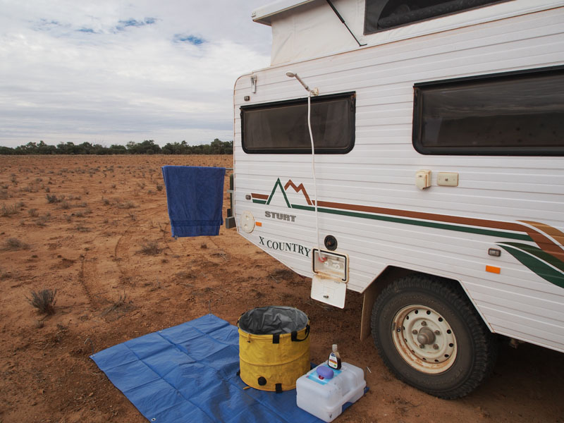 With the noise of the chainsaw far gone from our minds we settled into
the solitude of our camp. Don set up the shower and………..what bliss!! Standing in the open under the shower with
the sun warming you as the clean, hot water washes the dust away. I never realised how good it was to shower in
bare feet until we began staying in Caravan Parks. Showering in 'crocs' is not quite the same.
With the noise of the chainsaw far gone from our minds we settled into
the solitude of our camp. Don set up the shower and………..what bliss!! Standing in the open under the shower with
the sun warming you as the clean, hot water washes the dust away. I never realised how good it was to shower in
bare feet until we began staying in Caravan Parks. Showering in 'crocs' is not quite the same.
We have no signal again tonight but hopefully we can upload the blog when we get to Boulia tomorrow. We've been out of range for most of the last few days but have managed to upload the blog as we traversed the ridges and found we had signal for a short time……sometimes this amounted to a few meters either way. It is still daylight as I'm sitting here typing this and Don has been 'gone' for about half an hour, so I better go look for him. When he has his head down and his bum up he can walk for miles. ( Update……just looked out and there he is wandering around in the distance….yep, head down and bum up).
Note: I had to mention this……….In reference to the caves I mentioned in today's blog, when I had looked inside one of the large ones, I had told Don there was no 'cave art' in there. Don was checking the photos and suddenly said…:"Hey! Look at this". I looked at the photo and there on the back wall was some 'cave art'……two snakes, and a hand. I was flabbergasted. "Wow! I can't believe that. I had a really good look and didn't see anything" I replied astounded. Don couldn't help himself, he burst out laughing. I immediately knew what 'Don the photoshop comedian' had been busy doing whilst I was preparing the tea. I can't believe he still manages to 'suck me in' so easily after all these years …………or that he still gets so much enjoyment out of doing so.
Thursday 27th June, Boulia, QLD
Slightly over-cast today and 21°. We heard a light sprinkling of rain on the roof early morning but could see no evidence of it on the ground this morning. It wasn't long before the sun was shining through the clouds and we were on our way again, heading for Boulia, 77kms further West. It had been a great place to camp, well off the road and out of sight behind a protective clump of trees, yet with a lot of space around us.
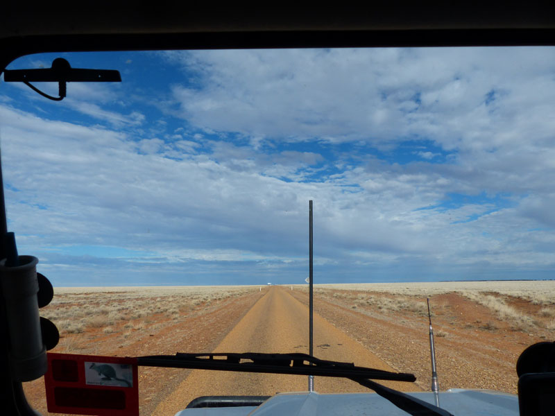 The Kennedy Developmental Road to Boulia was sealed but single lane only most of the way.
This was of no inconvenience as it's to the mutual benefit of both vehicles to move half off the
roadway when passing and to slow down. It's only when meeting the large road-trains, that
moving completely off the road is well advised. This route is unfenced and grazing land for
cattle on both sides of the road; with this route being sealed vehicles travel along a lot faster
with the sad inevitability that cows will be included in the road-kill. Today we saw three in a
very short distance. We have seen a lot of cows along our journey, we have photographed
them and we have shared a couple of camp-sites with them, we have grown to appreciate
that their life in the Outback is not an easy one. The cattle we have seen recently have been
very thin, their bones prominent and their skin dull. It is hard to pass by empty-handed.
The Kennedy Developmental Road to Boulia was sealed but single lane only most of the way.
This was of no inconvenience as it's to the mutual benefit of both vehicles to move half off the
roadway when passing and to slow down. It's only when meeting the large road-trains, that
moving completely off the road is well advised. This route is unfenced and grazing land for
cattle on both sides of the road; with this route being sealed vehicles travel along a lot faster
with the sad inevitability that cows will be included in the road-kill. Today we saw three in a
very short distance. We have seen a lot of cows along our journey, we have photographed
them and we have shared a couple of camp-sites with them, we have grown to appreciate
that their life in the Outback is not an easy one. The cattle we have seen recently have been
very thin, their bones prominent and their skin dull. It is hard to pass by empty-handed.
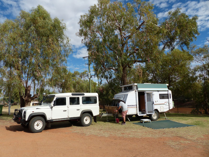
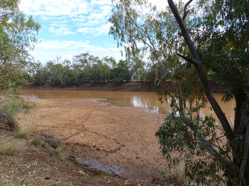
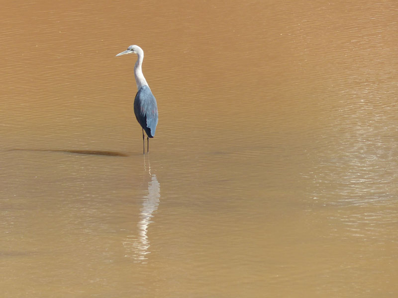
We arrived in Boulia and dropped the van off at a really nice Park situated on the banks of the Burke River. Our van backs onto the river so it's not too bad. We then headed down the street to have a look a the town. It is only a small community, with only the minimum of shops; a Tourist Information Centre which has a Coffee Shop attached, Stone House Museum, Hardware Store, Hotel, Post Office, Road-House and a large, very modern Sports & Aquatic Centre (this is a $4million sporting facility). This complex is situated in the block behind the main street and looked quite out of place in this small community of just over 200 population. It must be a boon with its indoor basketball, netball, badminton and volleyball courts as well as a snack bar, 25 metre swimming pool, children's splash pool, playground and BBQ area. It is situated next to the existing sports oval and adjoining tennis courts.
After camping out for a couple of nights and washing needing to be done, we decided to leave the exploring until tomorrow. We had lunch in the Coffee Shop attached to the Information Centre then intending to have a quick look in there only, we ended up going through the self-guided 'Min Min' tour, (Don reluctantly joining me). But once inside we were both pleasantly surprised; it's hard to describe but as you went from 'room to room' you were placed in a different 'scene'…….the Pub, outside a country house, beside a camp fire and 'in the bush'. The anamatronic 'figures' in the scene spoke the dialogue; their mouths moving and their heads or arms moving…….it was really quite amazing. We were both really impressed with the quality of this interpretation in such a small town.
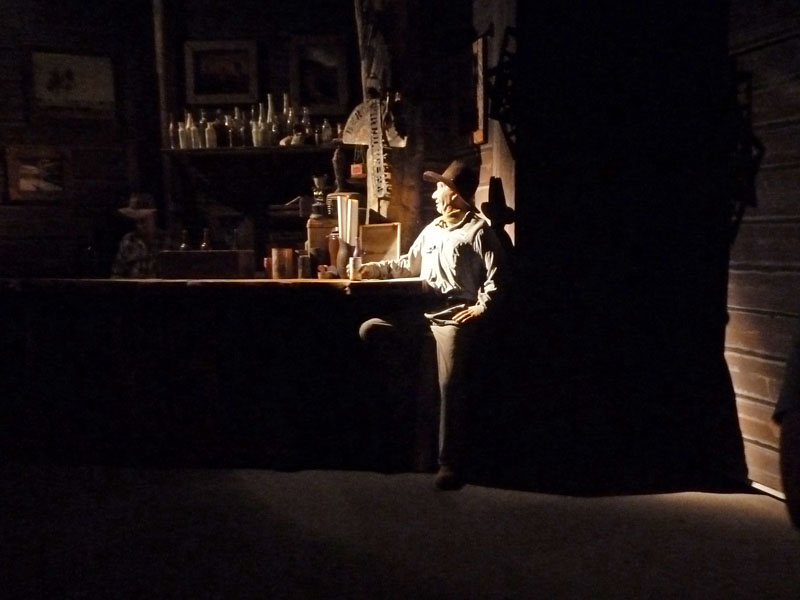
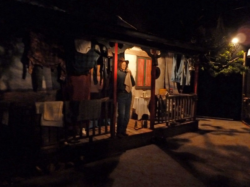
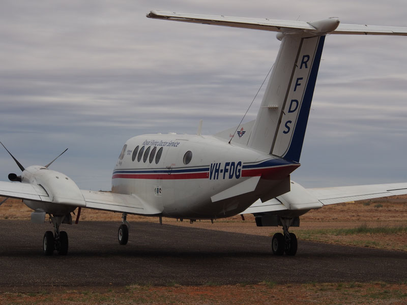 We took a quick drive to the Airport (at the end of the Main Street) and were lucky to find an aircraft there
from the Royal Flying Doctor Service (Beechcraft B200 Super King Air). There was a small weatherboard building, and a Grandstand about
30ft long and about 5 tiers high; hopefully not the Waiting Lounge for the passengers.
We took a quick drive to the Airport (at the end of the Main Street) and were lucky to find an aircraft there
from the Royal Flying Doctor Service (Beechcraft B200 Super King Air). There was a small weatherboard building, and a Grandstand about
30ft long and about 5 tiers high; hopefully not the Waiting Lounge for the passengers.
Friday 28th June, Boulia, QLD
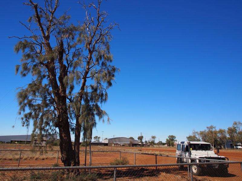 Heading East out of Boulia for a few kms, we then turned onto the Coorabulka track and
headed South for about 10kms hoping to find some Waddi trees. A very old one situated
in Boulia is now an historic site known as the Kooree Yuppiree tree. This lone Waddi Tree
is held sacred by Aborigines of the Boulia area; it marked a corroboree ground for the Pitta
Pitta tribe and neighbouring Aborigines in the district. We were hoping to find a few more
younger ones down the track.
Heading East out of Boulia for a few kms, we then turned onto the Coorabulka track and
headed South for about 10kms hoping to find some Waddi trees. A very old one situated
in Boulia is now an historic site known as the Kooree Yuppiree tree. This lone Waddi Tree
is held sacred by Aborigines of the Boulia area; it marked a corroboree ground for the Pitta
Pitta tribe and neighbouring Aborigines in the district. We were hoping to find a few more
younger ones down the track.
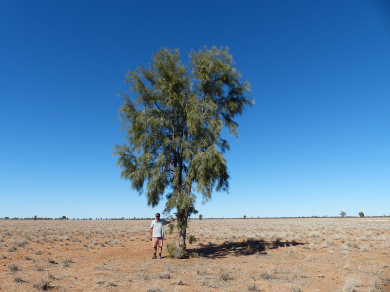
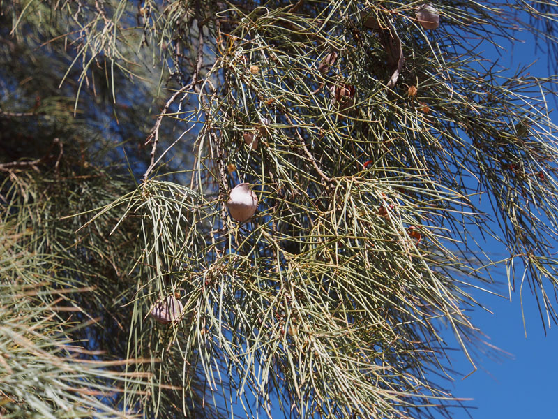 Waddi wood was highly regarded by the Aborigines. It was extremely hard and was used to
make weapons and digging sticks and often traded with other tribes. These trees grow in small
patches in the Boulia and Birdsville areas. The wood is known as one of the hardest timbers in
the world and believed to be found in only Australia and South America. Eagle eyes Don was
the first to spot one growing not far off the track. The tree is easily identified by its very spiky flat
leaves. It was not in flower but we could see the seed pods hanging amongst the leaves.
Waddi wood was highly regarded by the Aborigines. It was extremely hard and was used to
make weapons and digging sticks and often traded with other tribes. These trees grow in small
patches in the Boulia and Birdsville areas. The wood is known as one of the hardest timbers in
the world and believed to be found in only Australia and South America. Eagle eyes Don was
the first to spot one growing not far off the track. The tree is easily identified by its very spiky flat
leaves. It was not in flower but we could see the seed pods hanging amongst the leaves.
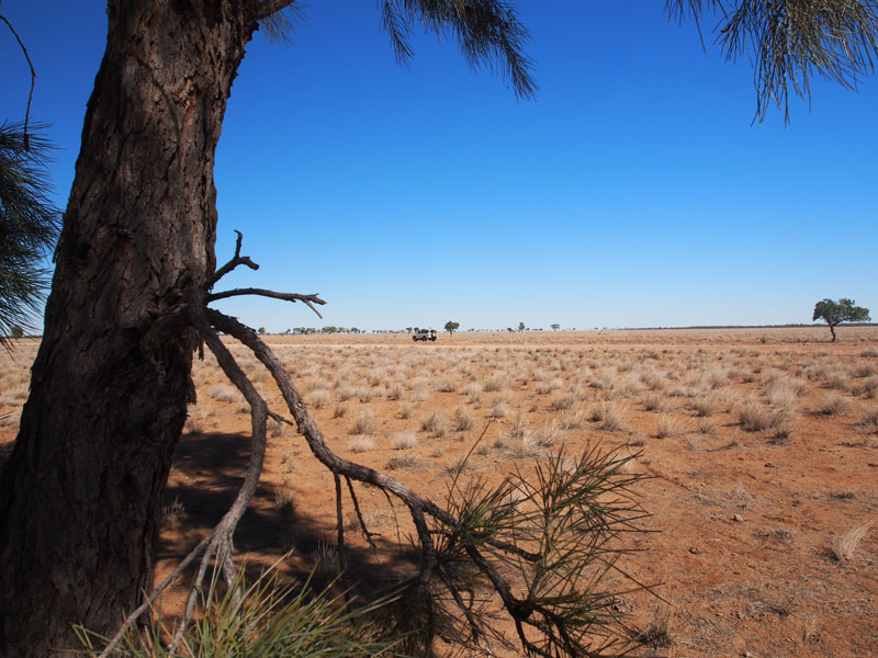 As we walked back to the car, Don remarked again (as he had many times before) about how
useless my lens cap was. It was cracked and didn't fit properly he kept telling me. "You don't need it"
he said, screwing an ugly black thing to the front of my camera. "This will be much better, it will keep
the sun reflections off your shots". "O.K." I said and finally agreed to him removing my 'annoying'
lens cap. As Don had lost his earlier in the trip I figured I could do without mine as well. Well!!!!
Sucked in again. In one swift movement, my lens cap was off my camera and……….Voila!! ……fitted
neatly on the end of Don's camera!! "Well, look at that" he crowed smiling. "It fits perfectly", and walked
off leaving me still not quite sure what had just happened. I have a lot of catching up to do.
As we walked back to the car, Don remarked again (as he had many times before) about how
useless my lens cap was. It was cracked and didn't fit properly he kept telling me. "You don't need it"
he said, screwing an ugly black thing to the front of my camera. "This will be much better, it will keep
the sun reflections off your shots". "O.K." I said and finally agreed to him removing my 'annoying'
lens cap. As Don had lost his earlier in the trip I figured I could do without mine as well. Well!!!!
Sucked in again. In one swift movement, my lens cap was off my camera and……….Voila!! ……fitted
neatly on the end of Don's camera!! "Well, look at that" he crowed smiling. "It fits perfectly", and walked
off leaving me still not quite sure what had just happened. I have a lot of catching up to do.
We headed back to Boulia for lunch at the Min Min Cafe, which is attached to the Info Centre where we had taken the 'Min Min Tour' yesterday. The 'Min MinLights' are well-entrenched in the Australian Outback folklore; I have witnessed them myself many years ago when I travelled in the Outback with my Father but it was not so much the story that was so enthralling on this tour, it was the cleverness with which is was put together. I couldn't help myself and had to go through the tour again.
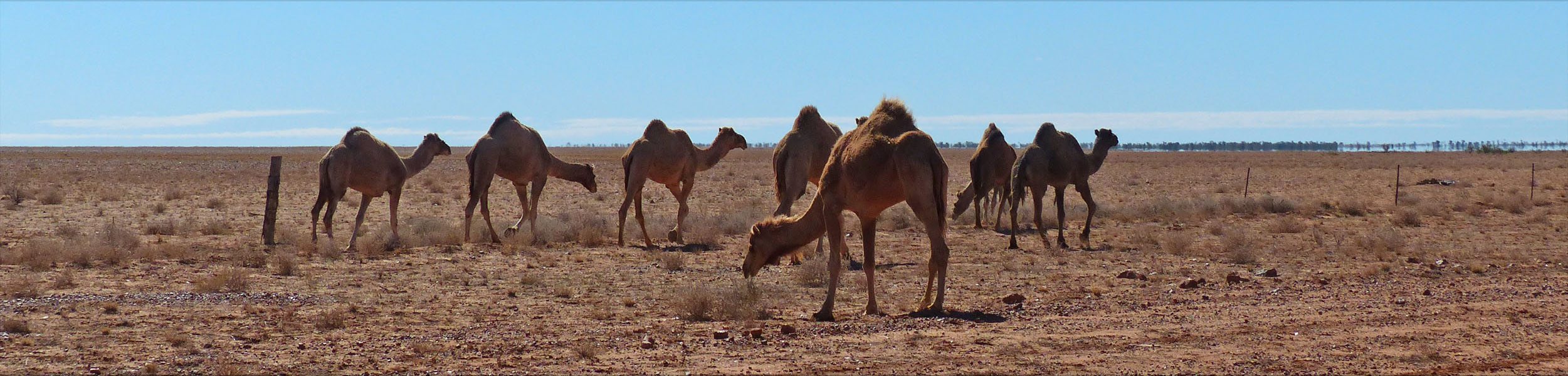
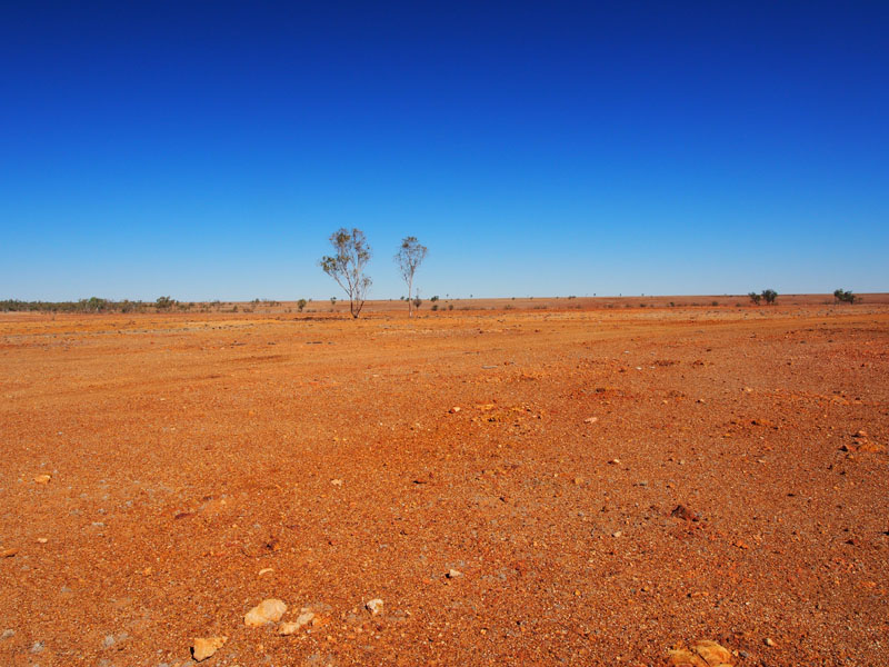
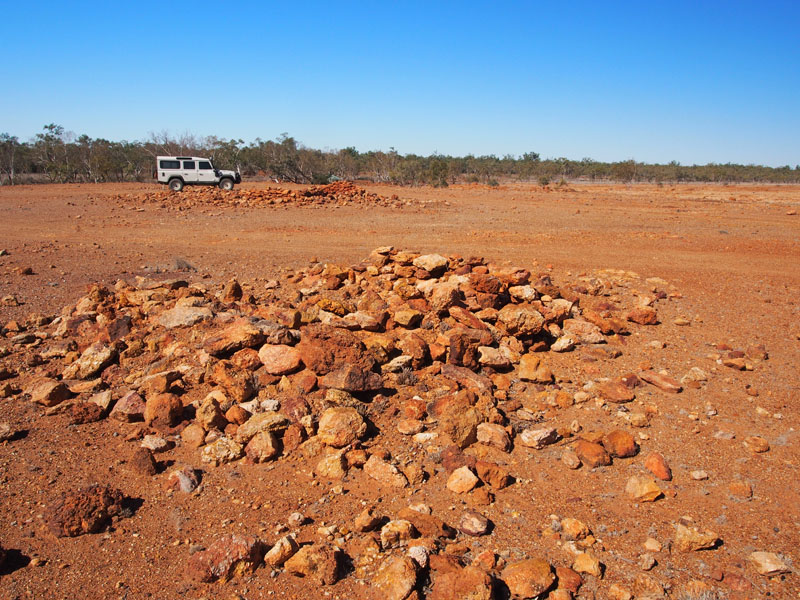
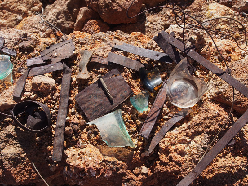
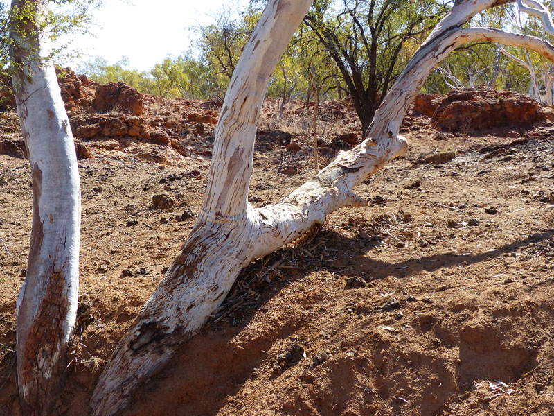
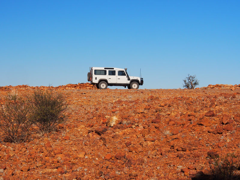
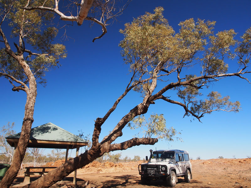
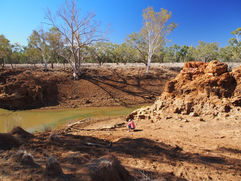
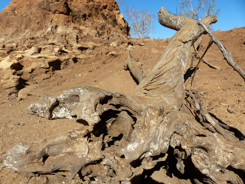
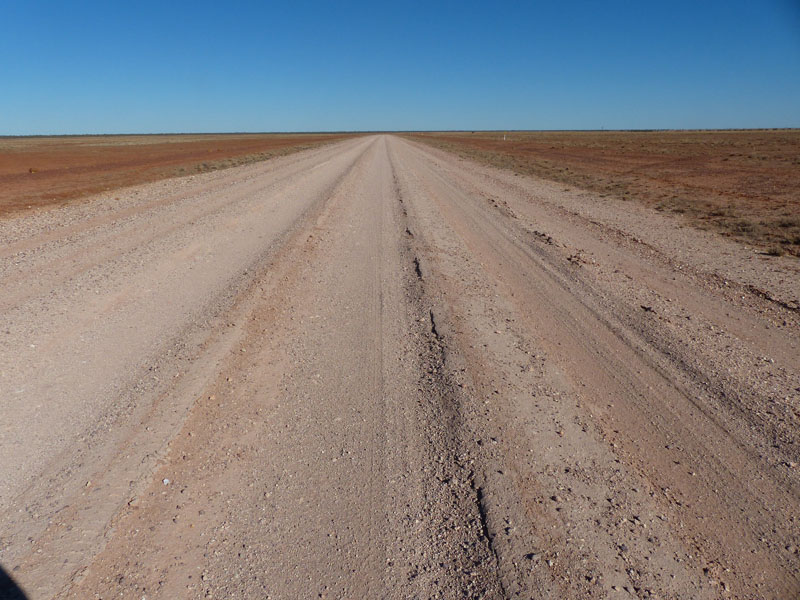

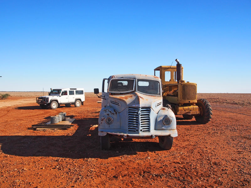
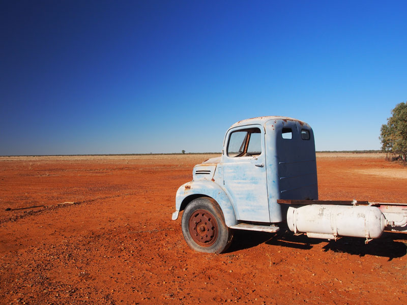
(Extra bit by Don)
Today I did the first necessary repair on the Landy (other than tinkering), I noticed the PCV hose from the Provent had sagged and was resting on the Turbo Wastegate, the hose itself was still sound but the heat shielding was a little sad, when I put the hose in last year it was sitting up no problems but I guess the high ambient temps & corrugations have helped it settle, I've been watching the EGT guage carefully (Exhause Gas Temp pyrometer) , the gas inside the manifold is usually sitting about 450-520°C pre turbo (aluminium melts at 660°C)
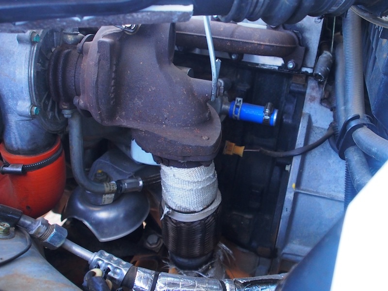
On the trip, we have done 11,468 klm so far, The Dewfender is going like a charm, apart from todays small job and the occasional dust out I have only had to change one blown park light globe, and fix a star chip on the windscreen with some of that stuff from Super Cheap Auto that you inject into the hole - worked a treat.
The rear tyres are getting chewed up a bit. They are BFG 235/85r16LT All Terrains. The Front tyres & the Van tyres are still fine, BFG's explanation to this is that I'm driving over Rocks in 2WD, … DUH, Dont they know that Landrover have all been Constant (full time) 4WD since 1980 ??? The damage is not caused by rocks being thrown up from the front tyres because the rear shockers would be full of rock pit marks but they are only sandblasted !
(speedo 185419 klm)
Saturday 29th June, Bedourie, QLD
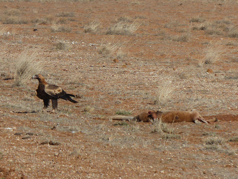
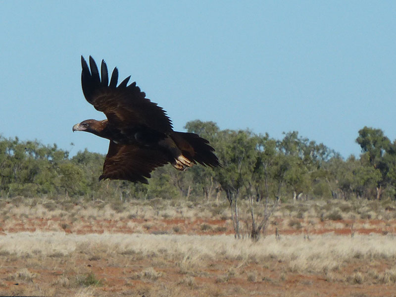 Leaving Boulia around 0930 we headed South down the Diamantina Developmental Road headed for
Bedourie about 220kms away. This road was excellent, narrow in places but an excellent surface. We
were pleased with the road but were yet to see the amazing countryside that awaited us. We saw a fair
bit of wildlife enroute,
Leaving Boulia around 0930 we headed South down the Diamantina Developmental Road headed for
Bedourie about 220kms away. This road was excellent, narrow in places but an excellent surface. We
were pleased with the road but were yet to see the amazing countryside that awaited us. We saw a fair
bit of wildlife enroute,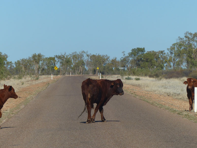 Wedged-tail Eagles, Kangaroos, Emus, Wild Horses and a Wild Pig (road-kill).
Care had to be taken as this road was also unfenced and cattle were grazing on both sides of the road,
as well as ambling across it.
Wedged-tail Eagles, Kangaroos, Emus, Wild Horses and a Wild Pig (road-kill).
Care had to be taken as this road was also unfenced and cattle were grazing on both sides of the road,
as well as ambling across it.
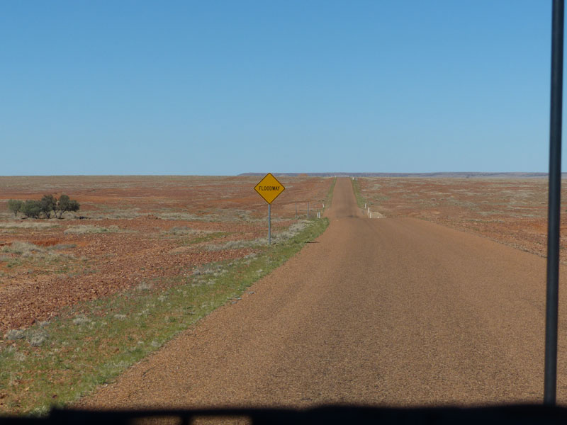
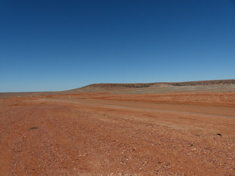 The low scrubby trees made way to open gibber plains, flat and endless. I've never taken so many photos
of 'nothing'. The colours, the ambience the vastness, it was just beautiful. The 'nothing' engulfed you and
the more you gazed the more opened up before your eyes. Each rise, each turn, each bend provided a
different scene just as interesting as the last. We saw a large Mesa on the horizon and as we drew near,
could see what looked like a picnic table way up on top. That was definitely where we were headed, the
view from the top was sure to be amazing…………and it was!
The low scrubby trees made way to open gibber plains, flat and endless. I've never taken so many photos
of 'nothing'. The colours, the ambience the vastness, it was just beautiful. The 'nothing' engulfed you and
the more you gazed the more opened up before your eyes. Each rise, each turn, each bend provided a
different scene just as interesting as the last. We saw a large Mesa on the horizon and as we drew near,
could see what looked like a picnic table way up on top. That was definitely where we were headed, the
view from the top was sure to be amazing…………and it was!
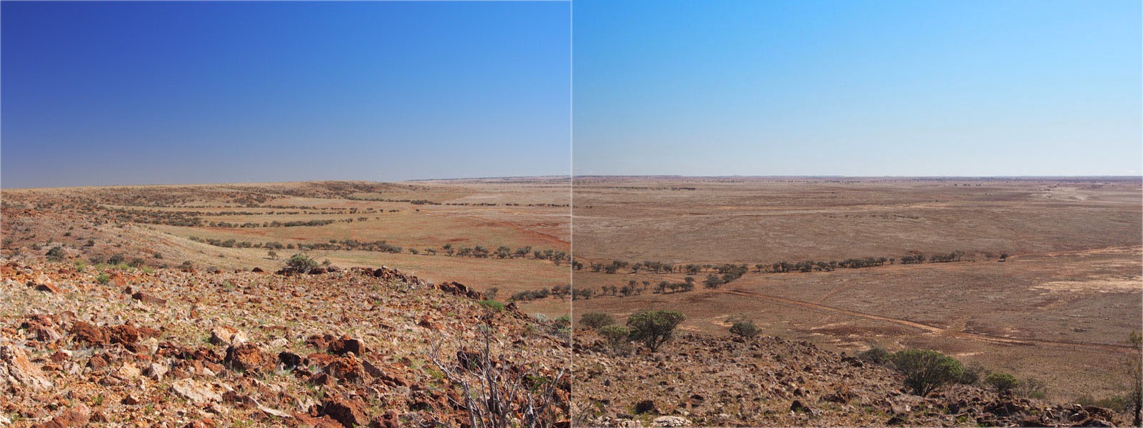
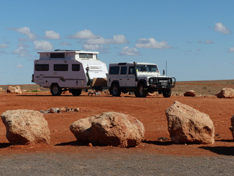
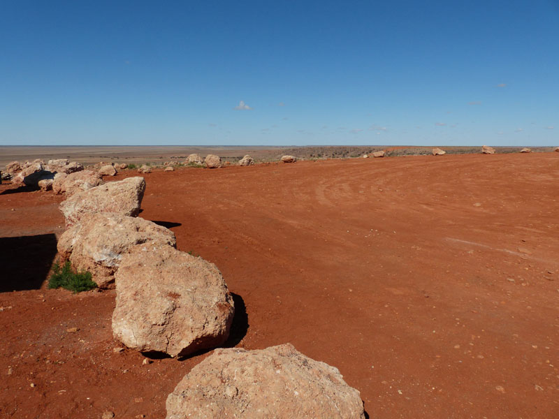
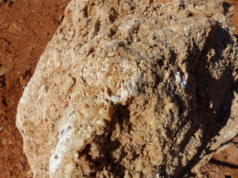
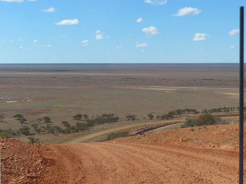
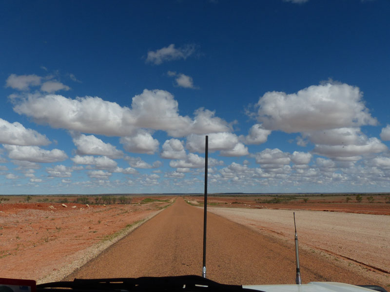 This is the amazing nature of this region known as the 'treeless plains'. The Mitchell Grass Downs covers
an area of 23 million hectares, almost 14% of Queensland. These open, treeless, rolling Downs are considered to provide
some of the best natural native pastures in the world. The extremely rapid growth of the Mitchell Grass transforms the bare earth
and dry tussock within a month.
This is the amazing nature of this region known as the 'treeless plains'. The Mitchell Grass Downs covers
an area of 23 million hectares, almost 14% of Queensland. These open, treeless, rolling Downs are considered to provide
some of the best natural native pastures in the world. The extremely rapid growth of the Mitchell Grass transforms the bare earth
and dry tussock within a month. Closer to Bedourie the landscape changed again as the road crossed through sand dunes, hardly recognisable as they were dotted with small shrubs but distinguishable by the red rolling dunes beneath. We arrived in Bedourie early afternoon and quickly set up camp in the Caravan Park. This Park looks like a large parking lot at the side of the road with a couple of small Dongas with toilet and shower. This is one Park we know won't get crowded. The Road-House/Pub/Motel/Caravan Park/Service Station and Grocery Store (all in the one) was just across the road so we took advantage of this and enjoyed dinner out for a change.
Sunday 30th June, Bush Camp (Diamantina National Park) QLD
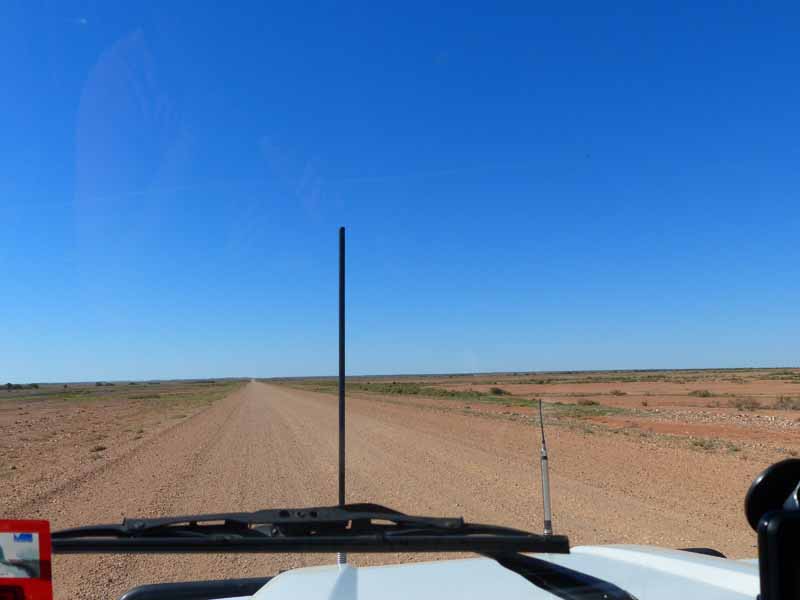
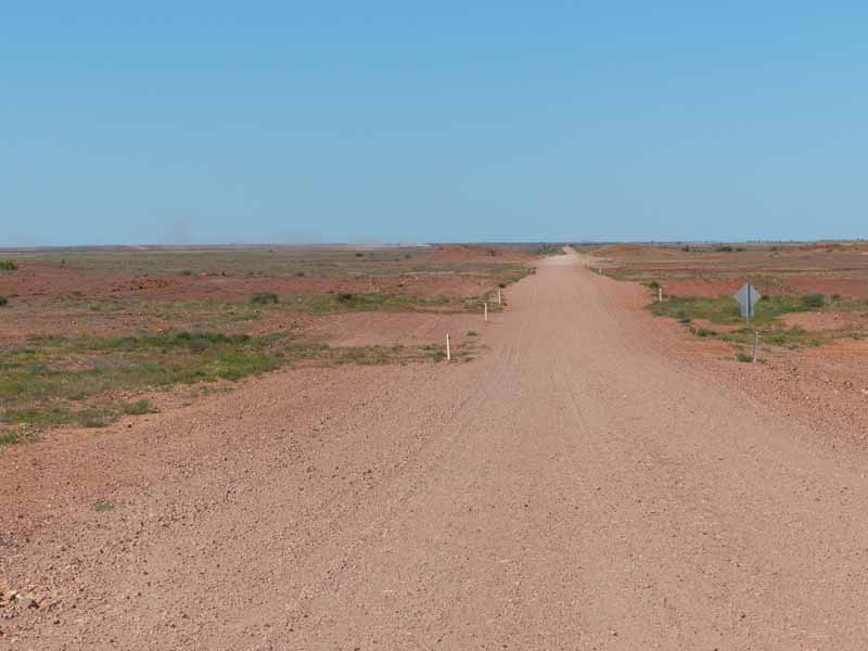 We fuelled up and departed Bedourie around 1000, heading East on the Diamantina Developmental
Road. The road was sealed for the first 40kms then turned to gravel. This was quite good to drive on
if you were the only vehicle on the road, but not too good if you were either following someone or being
passed by a road-train. Luckily we had no-one in front of us and only encountered one road-train along
the way. The gravel being very dry, powdery and loose left an enormous dust trail that hung in the air and
could be seen for miles. You were well warned if another vehicle was approaching, as we were with the
road-train. It's to your own peril if you don't move off the road and stop with total visibility obscured for quite
a few minutes after it has passed.
We fuelled up and departed Bedourie around 1000, heading East on the Diamantina Developmental
Road. The road was sealed for the first 40kms then turned to gravel. This was quite good to drive on
if you were the only vehicle on the road, but not too good if you were either following someone or being
passed by a road-train. Luckily we had no-one in front of us and only encountered one road-train along
the way. The gravel being very dry, powdery and loose left an enormous dust trail that hung in the air and
could be seen for miles. You were well warned if another vehicle was approaching, as we were with the
road-train. It's to your own peril if you don't move off the road and stop with total visibility obscured for quite
a few minutes after it has passed.
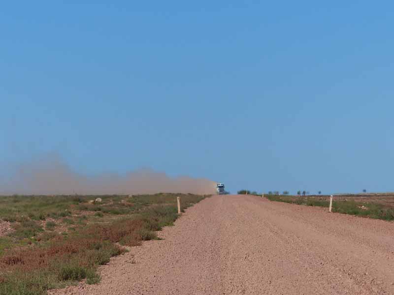
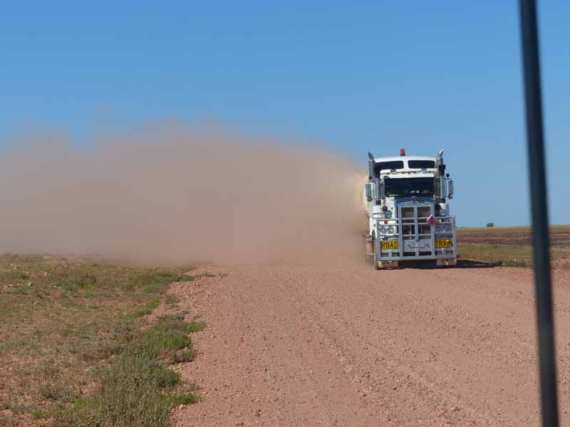
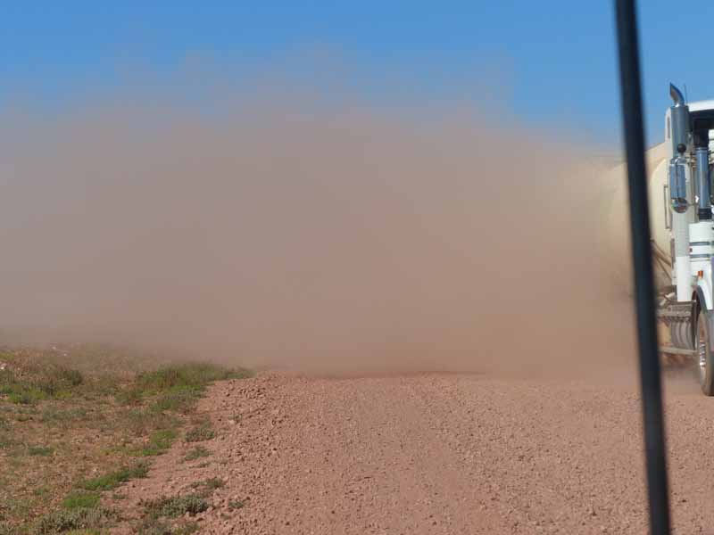
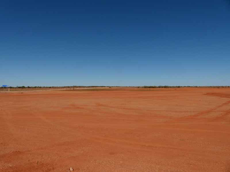
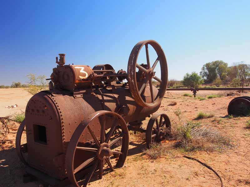
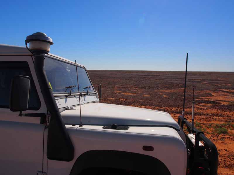
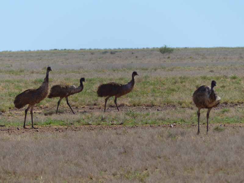 We were surprised and delighted to see many Emus enroute. They were either in pairs or in flocks. It got to
be more surprising if we didn't see any Emus as we travelled as they were so numerous. The bright green of
the grasses from the recent spurt of growth looked strangely odd against the hard, shiny gibber stones. One
turn of the road could change a lush green grassy landscape into a sparse shining, brown gibber plain. We
stopped in at No. 3 Bore not much further on. Road-works equipment lay nearby which indicated the water
source from which the water tanks fill up. This was a lovely little Water-hole and one of a few along this route.
We were surprised and delighted to see many Emus enroute. They were either in pairs or in flocks. It got to
be more surprising if we didn't see any Emus as we travelled as they were so numerous. The bright green of
the grasses from the recent spurt of growth looked strangely odd against the hard, shiny gibber stones. One
turn of the road could change a lush green grassy landscape into a sparse shining, brown gibber plain. We
stopped in at No. 3 Bore not much further on. Road-works equipment lay nearby which indicated the water
source from which the water tanks fill up. This was a lovely little Water-hole and one of a few along this route.
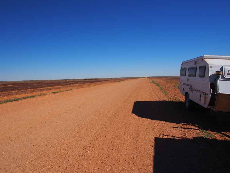
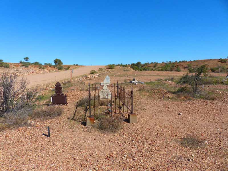 We arrived at Monkira Station turn-off around lunch-time and turned NE on a dirt track heading for Diamantina
National Park. Not far after turning up this track we came across a Graveyard located just beside the road. The
Head-stones were of Stockmen who had died on the Monkira Station in the late 1890's. There was a nice open
area not far from the Graves where we stopped for lunch before continuing on.
We arrived at Monkira Station turn-off around lunch-time and turned NE on a dirt track heading for Diamantina
National Park. Not far after turning up this track we came across a Graveyard located just beside the road. The
Head-stones were of Stockmen who had died on the Monkira Station in the late 1890's. There was a nice open
area not far from the Graves where we stopped for lunch before continuing on.
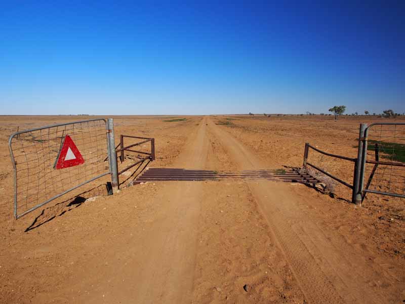
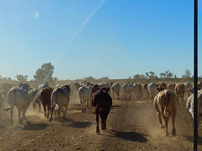
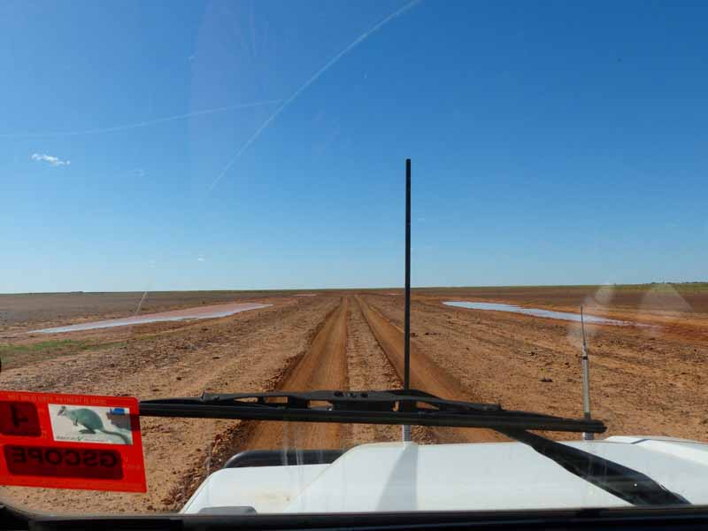
The track deteriorated as we travelled through Diamantina Downs Station; deep ruts had been etched into the surface, criss-crossing over each other obscuring a defined path. As we were travelling through Channel Country this was understandable. We encountered the usual herds of cattle but one herd of Bulls we came across, didn't want to give up the road. Sorry fellas, but there is a huge behavioural difference in a herd of Cows and a herd of Bulls. The Cows normally look at you resignedly, then patiently get up, or move off the road slowly. The Bulls on the other hand, stare at you until you are almost upon them, then buck their legs in the air, give a snort, trot a few paces then turn and stare and repeat the procedure. They are really cute to watch. We hadn't encountered a large herd of Bulls before so it took quite a while to actually get past them. When they did turn and run a few paces it was up the track, not off it, but with patience we finally edged our way past without upsetting them too much. We could almost hear them saying….'there, we chased them off'. (Boys will be boys)
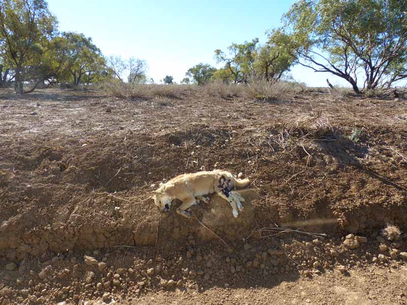 As we came down through the Diamantina Channels, deep, dry creeks at the moment, we came across a Dingo, not
long dead. He had probably died from 1080 poison bait as he didn't have any obvious injuries. He looked quite a healthy dog
other than the fact that he was no longer living. There were quite a few cattle gates along the track as we crossed
from Diamantina Station into Davenport Station. We had travelled around 150kms through these Stations before
reaching the Diamantina National Park. These Stations are vast. The landscape is varying and beautiful.
As we came down through the Diamantina Channels, deep, dry creeks at the moment, we came across a Dingo, not
long dead. He had probably died from 1080 poison bait as he didn't have any obvious injuries. He looked quite a healthy dog
other than the fact that he was no longer living. There were quite a few cattle gates along the track as we crossed
from Diamantina Station into Davenport Station. We had travelled around 150kms through these Stations before
reaching the Diamantina National Park. These Stations are vast. The landscape is varying and beautiful.
The Gibber Plains are quite something to see, consisting of small stones polished by wind blown sand, forming millions of years ago when Australia had a humid, tropical climate. The fluctuating watertables caused particles of iron to accumulate in a layer under the surface; erosion of the vegetation and topsoil exposed this layer, oxidising it and turning it hard (ironstone). This is one reason that ancient dinosaurs and other fossils have been so preserved, being protected under a layer of ironstone. Claypans also feature in this landscape and can create the illusion of shimmering lakes during hot weather. The Grasslands consist of many species including the reddish Flinders Grass and four species of Mitchell grass. (Named after the explorer). So with Gibber Plains, Claypans, Grasslands, Sand Dunes and Plateaus there is plenty to absorb and appreciate.